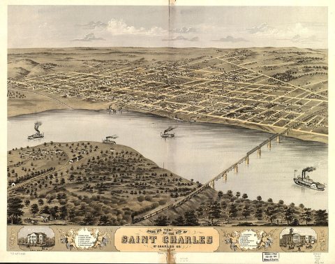
St. Charles dates to 1765, and 15 of its places are on the National Register
More historic than 89% of U.S. towns · #14 of 247 in Missouri. What drives it
Most of St. Charles was built recently: 7% of its homes predate 1940 and the median home dates from 1986. 15 places in town are on the National Register, among them five historic districts with 1,201 buildings between them. Below: 5 old photos and papers, maps from 1954 on, and the census since 1850.
Founding year: Wikidata. First post office: 1806.The full story ↓
History grade
What drives St. Charles’ History grade
On its age, its old homes and the National Register, St. Charles is more historic than 89% of U.S. towns, #14 of 247 in Missouri. Its National Register listings hold the grade up; its share of homes from before 1940 pulls it down.
A
HistoryA character grade: shown, never part of St. Charles’ overall grade.
Missouri towns list about as much on the Register as the country (a typical Missouri town has 2.4 per 10,000 residents, the U.S. 2.4), so St. Charles’ 170 sits above most of its state (94% of Missouri towns have fewer) while its 1,218 historic buildings outnumber those of 99% of U.S. towns.
How sure. Graded on any two of the three inputs instead, the letter would range from B+ to A+. The pre-1940 share (±1.0 points) is firm at this size. Two sources give 1765.
Founding year: Wikidata (other dates in Quick answers). Homes: Census ACS 2020–24. National Register: National Park Service, May 2026 list; each listing counted once (boundary changes and added documentation belong to their listing), and a historic district counts its contributing buildings. How TownRatings grades history →
What stands out about St. Charles’ past
Read from the archive, the National Register and the record. The page puts what stands out first.
Native American peoples inhabited the area at least as early as 11,000 B.C. When European colonists arrived, the area was inhabited by the historic Ilini, Osage and Missouri tribes.
According to Hopewell's Legends of the Missouri and Mississippi, Blanchette met another French Canadian (Bernard Guillet) at this site in 1765. Blanchette, determined to settle there, asked if Guillet, who had become an honorary chief of a Dakota band, had chosen a name for it.
"I called the place 'Les Petites Côtes' " replied Bernard, "from the sides of the hills that you see."
"By that name shall it be called", said Blanchette Chasseur, "for it is the echo of nature—beautiful from its simplicity."
Passages that mention St. Charles, cut from the printed page as they were published.
History of St. Charles, Montgomery, and Warren counties, Missouri, written and comp. from the most authentic official and private sources, including a history of their townships, towns and villages, together with a condensed history of Missouri ..1885 · page 463Read the page →
Read the text
The town of Hamburg is located about two miles from the Mis¬ souri river in this township, and is 16 miles from St. Charles. The town was laid out and platted in 1840, by Henry Schneider, who, assisted by Jacob Smith and William Koenig, built the first house in the town. Like all country villages Hamburg has had to depend upon the country about it for all its business, and in every respect it has held an enviable position with its sister towns. The usual number of churches, and the best educational privileges are enjoyed by its
Text read by machine from the scan; it may contain errors.
History of St. Charles, Montgomery, and Warren counties, Missouri, written and comp. from the most authentic official and private sources, including a history of their townships, towns and villages, together with a condensed history of Missouri ..1885 · page 94Read the page →
Read the text
All authorities, however, agree to the main fact, that Blanchette made the first settlement in the county, and that he located on the present town site of the city of St. Charles, coming here about the year 1769, and dying about the year 1793. He was commissioned by the Governor of Upper Louisiana to establish a post here under the Spanish government, and was, until the date, of his death, its-
Text read by machine from the scan; it may contain errors.
Scans and text from the Internet Archive. Books published in 1930 or earlier, which are in the public domain.
Timeline
St. Charles, 1765 to 2001
Woven from the archive, old maps, post office records, the National Register and the people born here.
Nothing in the archives for these yearsWeddings on Main Street, storms, parades, school pictures, the old store. If it’s in your family album, it belongs here.
In 1765, according to Wikidata. St. Charles’ post office opened in 1806, and the census of 1850 counted 1,498 people here.
How does St. Charles rank for history?
St. Charles is more historic than 89% of U.S. towns, #14 of 247 in Missouri. The History grade combines the town’s founding era, the share of homes built before 1940 and its National Register listings. It’s a character grade, so it isn’t part of the overall grade. How it works.
What is on the National Register in St. Charles?
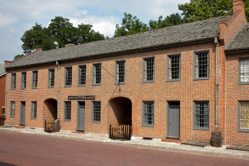
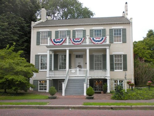
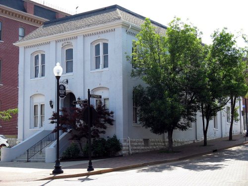
15 listings: 10 buildings, among them the First Missouri State Capitol Buildings (listed 1969, the first), and 5 historic districts with 1,201 contributing buildings. 1,218 historic buildings in all.
How old are the homes in St. Charles?
7% of St. Charles’ homes were built before 1940 (Census estimate, ±1.0 points), against a typical 8.4% for a Missouri town; the median home was built in 1986.
Founding dates: Wikidata, Wikipedia, the U.S. post office records of Blevins & Helbock (CC0) and the Census. Homes by year built: Census ACS 2020–24. National Register of Historic Places: National Park Service (list of May 22, 2026). Old photos, postcards and papers: Wikimedia Commons, the Library of Congress and other public archives, credited on each item’s page. Maps: U.S. Geological Survey historical topographic maps (via Esri) and Sanborn fire-insurance maps (Library of Congress). History text and census tables: Wikipedia (CC BY-SA 4.0). Places that used to be: USGS Geographic Names Information System (2021).
From Wikimedia Commons (5), Wikidata (1), the National Register of Historic Places (15), Wikipedia, Wikidata and Wikipedia for famous people, U.S. Geological Survey historical maps, U.S. Census counts (via Wikipedia), the US Post Offices dataset (Blevins & Helbock), the USGS Geographic Names Information System and old county and town histories (Internet Archive). Archive images are copied here with their credits and licenses, shown on each photo’s page. Refreshed monthly.