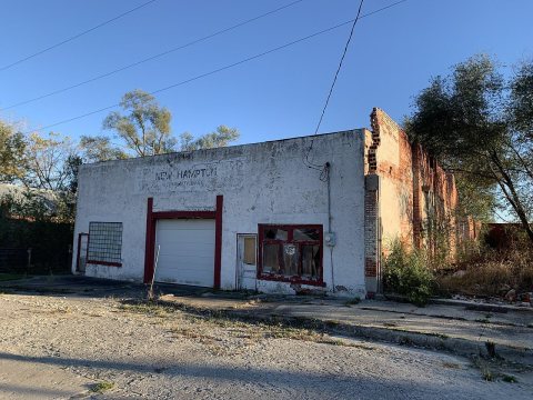
New Hampton was originally called Hamptonville, and under the latter name was platted in 1869 by Hampton Cox, and named for him. A post office called New Hampton has been in operation since 1881.
Passages that mention New Hampton, cut from the printed page as they were published.
History of Harrison County, Missouri1921 · page 359Read the page →
Read the text
to manhood there, coming to America in 1885 and locating near New Hampton, where he engaged in farming until he was appointed postmaster. In 1900, he bought thirty-six acres of land adjoining the town site of New Hampton, and successfully engaged in horticulture, specializing in the raising of apples, cherries, pears and grapes. Mr. Smyth closely follows bulletins and agricultural papers and adopts the latest ideas and methods in raising fruit. He sells to shippers at his orchard.
Text read by machine from the scan; it may contain errors.
History of Harrison County, Missouri1921 · page 165Read the page →
Read the text
New Hampton, which is located on the Burlington Railroad on sections 7 and 8 in White Oak Township, is a live business center and an important shipping point. There are two banks, two elevators and a number of progressive merchants here. New Hampton has a population of 519 and its schools are among the best in Harrison County.
Text read by machine from the scan; it may contain errors.
Scans and text from the Internet Archive. Books published in 1930 or earlier, which are in the public domain.
Timeline
New Hampton, 1881 to 1948
Woven from the archive, old maps, post office records, the National Register and the people born here.
Founding dates: Wikidata, Wikipedia, the U.S. post office records of Blevins & Helbock (CC0) and the Census. Homes by year built: Census ACS 2020–24. National Register of Historic Places: National Park Service (list of May 22, 2026). Old photos, postcards and papers: Wikimedia Commons, the Library of Congress and other public archives, credited on each item’s page. Maps: U.S. Geological Survey historical topographic maps (via Esri) and Sanborn fire-insurance maps (Library of Congress). History text and census tables: Wikipedia (CC BY-SA 4.0). Places that used to be: USGS Geographic Names Information System (2021). How TownRatings grades history →
From Wikimedia Commons (3), Wikipedia, Wikidata and Wikipedia for famous people, U.S. Geological Survey historical maps, U.S. Census counts (via Wikipedia), the US Post Offices dataset (Blevins & Helbock), the USGS Geographic Names Information System and old county and town histories (Internet Archive). Archive images are copied here with their credits and licenses, shown on each photo’s page. Refreshed monthly.


 2025
 2025
 2004

