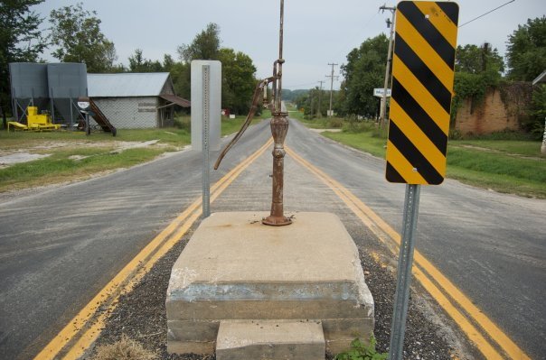
The village of La Russell, Missouri was platted and laid out for public use August 18, 1903. La Russell was named in honor of Russell Harding, vice president and general manager of the Missouri-Pacific Railroad at that time and of importance to the town's creation. The French La was added to the original proposed name of Russell in order to prevent confusion with another Missouri town named Russellville. Because of this word change, the name La Russell appears to be unique in the United States.
Passages that mention La Russell, cut from the printed page as they were published.
A history of Jasper County, Missouri, and its people1912 · page 442Read the page →
Read the text
La Russell La Russell is another one of the new towns which has been put on the map of Jasper county during the last decade. It is in the central portion of the county and sprang up after the building of the White River line. At first it drew largely from Bower's Mill, one of tiie oldest towns in the southwest but some three or four miles off from the railroad.
Text read by machine from the scan; it may contain errors.
Scans and text from the Internet Archive. Books published in 1930 or earlier, which are in the public domain.
By decade
No old photos in the archives yet
Weddings on Main Street, storms, parades, school pictures, the old store. If it’s in your family album, it belongs here.
Be the first to add onePhotograph a print flat, in daylight, no flash.
Founding dates: Wikidata, Wikipedia, the U.S. post office records of Blevins & Helbock (CC0) and the Census. Homes by year built: Census ACS 2020–24. National Register of Historic Places: National Park Service (list of May 22, 2026). Old photos, postcards and papers: Wikimedia Commons, the Library of Congress and other public archives, credited on each item’s page. Maps: U.S. Geological Survey historical topographic maps (via Esri) and Sanborn fire-insurance maps (Library of Congress). History text and census tables: Wikipedia (CC BY-SA 4.0). Places that used to be: USGS Geographic Names Information System (2021). How TownRatings grades history →
From Wikipedia, U.S. Geological Survey historical maps, U.S. Census counts (via Wikipedia), the US Post Offices dataset (Blevins & Helbock), the USGS Geographic Names Information System and old county and town histories (Internet Archive). Archive images are copied here with their credits and licenses, shown on each photo’s page. Refreshed monthly.