Lost post offices, old corners, places now gone and burying grounds
Four other post offices opened and closed inside today’s town.
Ellenorah
1865–1898
Lone Star
1873–1906
Free Water
1881–1893
Gara
1883–1906
18601940today
Hamlets and corners on the map
EllenorahLone StarPinhookSiloam Springs
Gone or out of use
Adam SchoolschoolColvin SchoolschoolGlendenning SchoolschoolHill ChapelchurchLone Star SchoolschoolNeedels SchoolschoolPleasant Grove SchoolschoolSiloam SchoolschoolWayman Schoolschool
6cemeteries and burying grounds inside Howard Township
CarterLone StarMageeMillerMizeWilson
US Post Offices dataset (Blevins & Helbock, CC0). Places and cemeteries from the USGS Geographic Names Information System (2021).
Help out
Start Howard Township’s collection
The first neighbors to add old photos shape how Howard Township’s history is told.
Decades since 1900 with photos
00s10s20s30s40s50s60s70s80s90s
0 of 10 decades. The empty ones are waiting for someone’s album.
Wikipedia doesn’t have a history of Howard Township yet. The photos, dates and memories neighbors add here are how it gets written.
Howard Township is a township in Gentry County, Missouri, United States. At the 2020 census, its population was 120. Howard Township bears the name of local pioneers Asa and Samuel Howard.
Between the 2010 and 2020 censuses its population grew from 100 to 120 (+20%).
Intro from Wikipedia. Population: U.S. Census Bureau.
Timeline
Howard Township, 1865 to 1943
Woven from the archive, old maps, post office records, the National Register and the people born here.
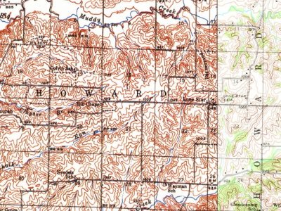
Every edition of the U.S. Geological Survey’s map of Howard Township. Tap a year, or press play to watch the town change.
1943Grant City sheet · 1:62,500
U.S. Geological Survey historical topographic maps (public domain), via Esri’s collection of the scans. The red ring marks the center of Howard Township.
Stories next door
History across the town line
Each neighbor’s History grade, on the same three inputs.
Founding dates: Wikidata, Wikipedia, the U.S. post office records of Blevins & Helbock (CC0) and the Census. Homes by year built: Census ACS 2020–24. National Register of Historic Places: National Park Service (list of May 22, 2026). Old photos, postcards and papers: Wikimedia Commons, the Library of Congress and other public archives, credited on each item’s page. Maps: U.S. Geological Survey historical topographic maps (via Esri) and Sanborn fire-insurance maps (Library of Congress). History text and census tables: Wikipedia (CC BY-SA 4.0). Places that used to be: USGS Geographic Names Information System (2021). How TownRatings grades history →
From U.S. Geological Survey historical maps, the US Post Offices dataset (Blevins & Helbock) and the USGS Geographic Names Information System. Archive images are copied here with their credits and licenses, shown on each photo’s page. Refreshed monthly.