Peaked at 698 in 1890; 392 people lived here in 2020.
15 censuses, 1880–2020.
U.S. Census Bureau decennial counts, from the census table on Calhoun’s Wikipedia page.
Every building
Calhoun, building by building, 1893–1909
Fire insurance maps drew every building, what it was made of and what it was used for, so insurers could price the risk of fire. Pick a year, then a sheet.
1893Sheet 1 of 1
Edition
Sheets
BrickWoodStone
Sanborn Map Company, via the Library of Congress. Editions published in 1930 or earlier, which are in the public domain.
Calhoun was platted in 1837. The town was named after John C. Calhoun, seventh Vice President of the United States. A post office called Calhoun has been in operation since 1844.
Passages that mention Calhoun, cut from the printed page as they were published.
History of Henry County, Missouri1919 · page 126Read the page →
Read the text
ing upon the records of the County Court under date of the 10th of February, is as follows: "Whereas, a petition was this day presented to the court signed by sundry citizens of the town of Calhoun, in the County of Henry, praying to have the said town incorporated and setting forth the metes and bounds thereof, and it appearing to the satisfaction of the court that two-thirds of the taxable inhabitants of said town have signed said petition, and also that the prayer in said petition is reasonable, it is there-
Text read by machine from the scan; it may contain errors.
History of Henry County, Missouri1919 · page 120Read the page →
Read the text
tlement activity. As was also stated in another chapter, the town of Calhoun was laid out by Mr. Nash, in 1835. The first tavern license was granted in November, 1845, to John Taylor, who paid twenty dollars for the privilege. Mathew Arbuckle, in February, 1846, received a license to open a saloon in Calhoun; in August, 1844, was held the first election in the town of Calhoun.
Text read by machine from the scan; it may contain errors.
Life history of George A. Shepherd of Calhoun, Missouri1930 · page 47Read the page →
Read the text
the .Methodist Ep. Church at Lewis and from that time on to the the present I have tried, to the best of my ability, to do my part to help someone to a better life and to advance the Kingdom of God in the world. After moving to Calhoun in 1902, I joined the Presbyterian church. I will stop my narrative just long enough to give you my reasons for changing my church relationship when I moved to Calhoun. I made it a point to attend all the churches :n town for a year or more. It appeared to me that the Presby¬
Text read by machine from the scan; it may contain errors.
Scans and text from the Internet Archive. Books published in 1930 or earlier, which are in the public domain.
Timeline
Calhoun, 1837 to 1953
Woven from the archive, old maps, post office records, the National Register and the people born here.
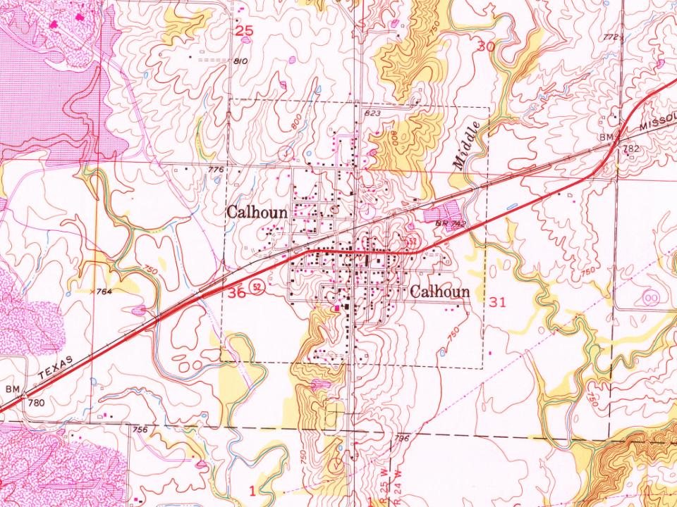
Founding dates: Wikidata, Wikipedia, the U.S. post office records of Blevins & Helbock (CC0) and the Census. Homes by year built: Census ACS 2020–24. National Register of Historic Places: National Park Service (list of May 22, 2026). Old photos, postcards and papers: Wikimedia Commons, the Library of Congress and other public archives, credited on each item’s page. Maps: U.S. Geological Survey historical topographic maps (via Esri) and Sanborn fire-insurance maps (Library of Congress). History text and census tables: Wikipedia (CC BY-SA 4.0). Places that used to be: USGS Geographic Names Information System (2021). How TownRatings grades history →
From Wikimedia Commons (1), the Library of Congress (1), Wikipedia, U.S. Geological Survey historical maps, U.S. Census counts (via Wikipedia), the US Post Offices dataset (Blevins & Helbock), the USGS Geographic Names Information System, Sanborn fire insurance maps (Library of Congress) and old county and town histories (Internet Archive). Archive images are copied here with their credits and licenses, shown on each photo’s page. Refreshed monthly.


 Date?
 2004