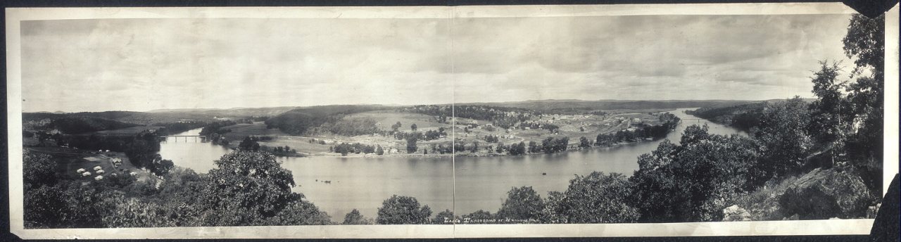
144 years in pictures
Census counts: 598 in 1920, 12,638 in 2020. The archive holds 12 old photos and papers going back to 1914 and 2 maps from 1956 on.
3 places on the National Register of Historic Places.
- 1882Branson is settled
Each edition grades its towns against each other only.

Branson grades D overall, ranked 219th of 247 in Missouri, mostly because of safety and incomes. It reports more crime per resident than 96% of U.S. towns, including 51 violent crimes reported to the FBI in 2025. The median household income is $52K, and 20% of residents live below the poverty line. What it does well: its schools outperform 80% of the state's. 45% of working residents work locally in Branson, above both Missouri’s towns (13%) and U.S. towns (8%). Only 40 of Missouri’s 419 towns score lower on cost of living. Ruth and Paul Henning Conservation Area, at 1,477 acres with 3.4 miles of trail, is the biggest park or preserve.
Where Branson beats most towns, and one thing worth knowing.
10,520 counted in 2010 and 12,638 in 2020; an estimated 12,921 in 2025.
U.S. Census 2010 & 2020 counts · Census Bureau estimate, July 1, 2025
Each subject compared with towns across the country (schools within Missouri), ordered by how far Branson is from typical.
How TownRatings grades towns →
Census counts: 598 in 1920, 12,638 in 2020. The archive holds 12 old photos and papers going back to 1914 and 2 maps from 1956 on.
3 places on the National Register of Historic Places.
Who provides power, water and the rest in Branson, and how to reach them.
EPA SDWIS (Oct 9, 2026) · HIFLD + EIA-861 2025 · Census 2020 ZCTAs · NCES 2024–25 · registration: vote.gov, updated Nov 18, 2024.
Ordered by what stands out in Branson.
Branson draws workers from Hollister and beyond and is healthier than towns with similar incomes, but it reports property crime at about twice the Missouri rate.
The trail network density for Branson comes to 1.3 miles per square mile. Across 17 parks and preserves: 29 miles of trail.
| Biggest places to walk | Trails | Acres |
|---|---|---|
| 1. Lakeside Forest Wilderness Area | 4 mi | 139 |
| 2. Ruth and Paul Henning Conservation Area | 3.4 mi | 1,477 |
| 3. White River Balds Natural Area | 2.2 mi | 336 |
Trails & parks © OpenStreetMap contributors · Conserved land: USGS PAD-US
Public schools: Branson R-IV. Three of the 11 schools are below, and why each made the list.
| School | Level | Students | Letter |
|---|---|---|---|
| Branson JR. HighLargest public middle schoolGrades 7–8 | Grades 7–8 | 694 | B+ |
| Branson HighLargest public high schoolGrades 9–12 | Grades 9–12 | 1,469 | B+ |
| Buchanan ElementaryTop results in townGrades K–3 | Grades K–3 | 578 | A |
NCES · EDFacts · graded within MO on state tests and graduation
Property crime runs at 35.3 per 1,000 residents, about twice the Missouri rate, most of it theft. Reported crimes fell from 764 to 507 over the last three FBI years, a drop beyond ordinary year-to-year swings.
Branson’s rate of reported violence is 3.9 per 1,000 residents. The property offense rate in the town is 35.3 per 1,000 residents.
| Branson | Missouri towns | U.S. towns | |
|---|---|---|---|
| Property crimes per 1,000 (2025) | 35.3 per 1,000 residents | 12.4 | 9.9 |
| Violent crimes per 1,000 (2025) | 3.9 per 1,000 residents | 2.2 | 1.6 |
FBI crime data, 2025 · crimes reported to police
16,069 jobs are based in Branson, 2.7 for every working resident, so most of the people who work here commute in. The average commute takes 17.5 minutes, against 23.5 across Missouri.
For Branson, the mean commuting time is 18 minutes. Half of commuters travel less than 5 miles. The top destinations are Springfield (11%), Hollister (3%) and Joplin (2%).
| Branson | Missouri towns | U.S. towns | |
|---|---|---|---|
| Average trip to work | 18 minutes | 22 minutes | 25 minutes |
| Median household income | $52,000 | $62,000 | $80,000 |
Census LEHD 2023 · ACS
Against the 6,451 U.S. towns with household incomes like Branson’s, it is healthier than 57%, so its C isn’t only a matter of income.
In Branson, 30% of adults feel lonely. Two in five adults in the town have high blood pressure; 16% report frequent physical distress.
| Branson | Missouri towns | U.S. towns | |
|---|---|---|---|
| Binge drink (CDC PLACES) | 14% | 16% | 16% |
| High blood pressure (CDC PLACES) | 40% | 37% | 35% |
| Frequent physical distress (CDC PLACES) | 16% | 15% | 14% |
| Get no exercise (CDC PLACES) | 32% | 30% | 25% |
| What stands out | Branson | MO |
|---|---|---|
| More adults with heart disease | 8.6% | 6.8% |
| More adults with COPD | 9.8% | 8% |
| More adults who have had a stroke | 4.4% | 3.6% |
CDC PLACES 2025 · modeled estimates for adults · CMS · HRSA
80 flood insurance claims have been filed here, and 18 properties have flooded more than once.
Branson’s natural-hazard score from FEMA stands at 72 of 100. 80 flood insurance claims have been paid in the town since 1982. Expected losses in Branson break down as 72% from inland flooding and 6% from tornadoes. Households here have drawn federal disaster aid in 8 declared disasters, most recently in 2017.
FEMA disaster declarations and aid · FEMA National Risk Index · OpenFEMA
Here, 28% of adults 25 and older have a bachelor’s degree, against 32% in Missouri as a whole. Adults 35 to 64 are 29% of residents (37% statewide); people 65 and older are 25% of residents (18% statewide). Since 2020, Branson has grown 2.2%, to 12,921 residents in the Census Bureau’s 2025 estimate. Among residents here, 21% are under 18.
| Branson | Missouri towns | U.S. towns | |
|---|---|---|---|
| Aged 65 or older | 25% | 17% | 18% |
| Under 18 | 21% | 23% | 22% |
| Bachelor’s degree or more, 25+ | 28% | 22% | 29% |
55% women, 45% men
About 83 men for every 100 women (the survey’s margin: ±2.7 points). Across Missouri, 50.7% of residents are women.
| Branson | MO | U.S. | |
|---|---|---|---|
| Under 10 | 10.9% | 11.9% | 11.6% |
| 10 to 17 | 9.8% | 10.4% | 10.3% |
| 18 to 24 | 10.8% | 9.1% | 9.1% |
| 25 to 34 | 14.7% | 13.2% | 13.7% |
| 35 to 44 | 7.8% | 12.8% | 13.2% |
| 45 to 54 | 7.8% | 11.6% | 12.2% |
| 55 to 64 | 13.4% | 13% | 12.7% |
| 65 to 74 | 12.7% | 10.6% | 10.2% |
| 75 and older | 12.2% | 7.3% | 7% |
| No diploma | 9% | 8.1% | 10.4% |
| High school | 30.8% | 30.2% | 26% |
| Some college | 26.7% | 20.8% | 19.1% |
| Associate’s | 5.8% | 8.4% | 8.8% |
| Bachelor’s | 17.3% | 19.8% | 21.6% |
| Graduate | 10.4% | 12.6% | 14.1% |
Census population estimates, 2025 · U.S. Census Bureau · ACS 2020-2024 5-year estimates
NOAA U.S. Climate Normals, 1991–2020
For households in Branson, the share who live in a home they own is 48%. On the market in the town: a median 64 days to sell. In the year to September 2026, typical home values slipped 1%.
| Branson | Missouri towns | U.S. towns | |
|---|---|---|---|
| Households that own their home | 48% | 64% | 73% |
| Median rent | $961 a month | $972 a month | $1,185 a month |
Census ACS, 2020–24 · Zillow Home Value Index · Redfin Data Center
Museums, parks, gardens and other places to visit around Branson. Close and well known come first.
4 mi Theme parkSilver Dollar City
4 mi LakeTable Rock Lake
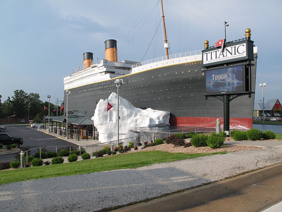
in town MuseumTitanic Museum4 mi CaveMarvel Cave
28 mi LandmarkChrist of the Ozarks
36 mi National RiverBuffalo National River1.4M visitors a yearSilver Dollar City: Nan Fry, CC BY 2.0 · Table Rock Lake: KTrimble (talk), CC BY-SA 3.0 · Titanic Museum: Brad A. Totman, Public domain · Christ of the Ozarks: Bobak Ha'Eri, Public domain · Buffalo National River: Mattsrealm, CC BY-SA 4.0
1 within 15 miles of the center of Branson
About 4 of every 100 Branson residents are enrolled in college, against 6 across Missouri.
Where Branson’s working residents go each day. Line width shows the share.
Census LEHD 2023
City in Missouri, United States
Branson is a resort city in the U.S. state of Missouri. Most of the city is situated in Taney County, with a small portion in the west extending into Stone County. Branson is in the Ozark Mountains. The community was named after Reuben Branson, postmaster and operator of a general store in the area in the 1880s. The population was 12,638 at the 2020 census, which constitutes nearly one fourth of the Taney County population. Branson has long been a popular destination for vacationers from Missouri and around the country. The collection of entertainment theaters along 76 Country Boulevard (and to a lesser extent along Shepherd of the Hills Expressway), including Dolly Parton's Stampede, has i…
From Wikipedia, licensed CC BY-SA 4.0 · facts via Wikidata (CC0)
One town shares a border with Branson.
Hollister reports no FBI crime data of its own. Compare Branson with a neighbor →
Short answers, built from the data on this page.
Branson grades D overall, better than 10% of U.S. towns and #219 of 247 in Missouri. It grades C for health, D− for safety and A− for schools. Safety is its weak spot, with a D−.
That is 4.3 years of the area's median household income ($56,497 across the Branson, MO area). Cost of living, which also weighs rents, property taxes and how many households pay 30% or more of their income for housing, grades C.
2 notable people were born here, including Dalton Risner and Lyle Rowland.