Zumbrota dates to 1856, and 19% of its homes were built before 1940
More historic than 59% of U.S. towns · #78 of 273 in Minnesota. What drives it
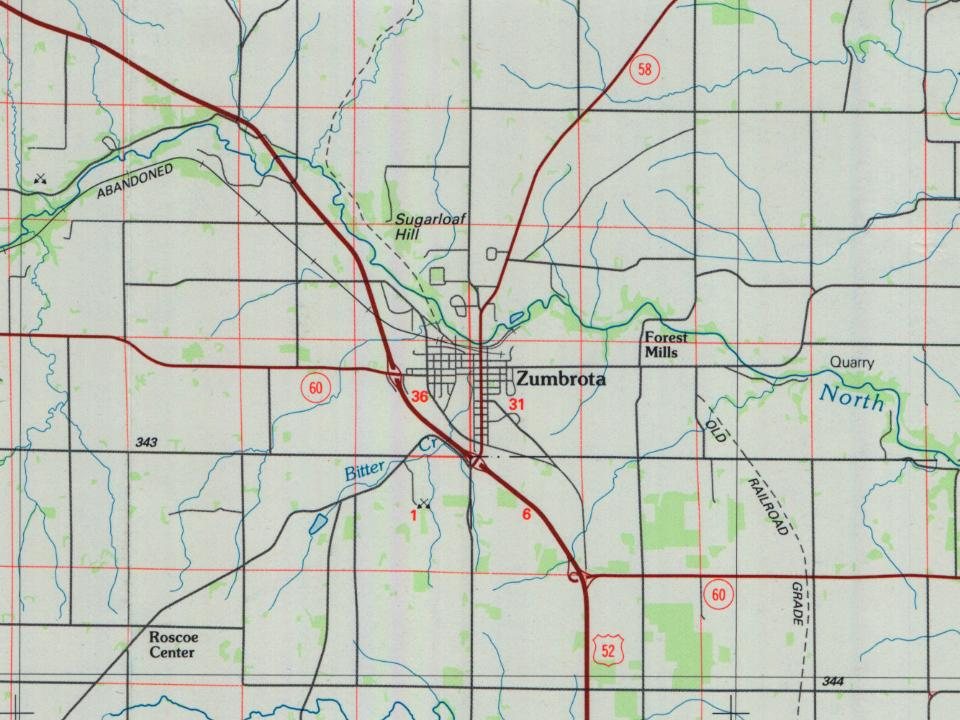
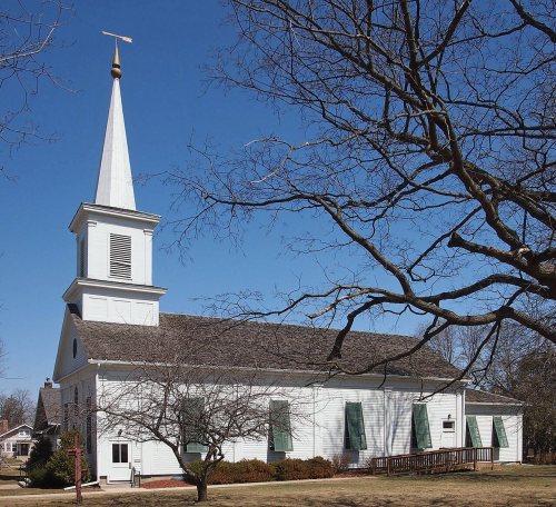
Its Register listings are the Zumbrota Covered Bridge and the First Congregational Church of Zumbrota. Below: 2 old photos and papers, maps from 1885 on, and the census since 1880.
Founding year: Wikidata. First post office: 1857.The full story ↓
History grade
What drives Zumbrota’s History grade
On its age, its old homes and the National Register, Zumbrota is more historic than 59% of U.S. towns, #78 of 273 in Minnesota. Its share of homes from before 1940 holds the grade up; its age pulls it down.
B
HistoryA character grade: shown, never part of Zumbrota’s overall grade.
Minnesota towns list about as much on the Register as the country (a typical Minnesota town has 2.1 per 10,000 residents, the U.S. 2.4), so Zumbrota’s 5.1 sits near the middle of its state (63% of Minnesota towns have fewer) while its 2 listings outnumber those of 60% of U.S. towns.
How sure. Graded on any two of the three inputs instead, the letter would range from C+ to B+. The pre-1940 share is a Census survey estimate (±7.9 points). Two sources give 1856.
Founding year: Wikidata (other dates in Quick answers). Homes: Census ACS 2020–24. National Register: National Park Service, May 2026 list; each listing counted once (boundary changes and added documentation belong to their listing), and a historic district counts its contributing buildings. How TownRatings grades history →
What stands out about Zumbrota’s past
Read from the archive, the National Register and the record. The page puts what stands out first.
Fire insurance maps drew every building, what it was made of and what it was used for, so insurers could price the risk of fire. Pick a year, then a sheet.
Zumbrota was claimed as a town in 1856 by Joseph Bailey and D.B. Goddard. The name Zumbrota appears to have resulted from a corruption of the French name for the local Zumbro River, Rivière des Embarras (Obstruction River), coupled with the Dakota toŋ (village).
Zumbrota is home to the Zumbrota Covered Bridge, the last functioning covered bridge in the state of Minnesota. It was originally installed in 1869, one year before the arrival of railroads to the area. The bridge is listed on the National Register of Historic Places.
The Zumbrota Public Library was the first tax-supported library in Minnesota.
The city of Zumbrota celebrated its sesquicentennial in 2006.
family joined him. remaining until the spring of 1866, and where was born to them another daughter, Laura. The summer and winter of 1866-7, they lived on the farm of T. D. Rowell, east of the village of Zumbrota, moving thence to the farm lying soiithwesterly from Zumbrota village, in the town of Roscoe, which Mr. Matchan had purchased in the fall of 1865 of Josiah Thompson, then living at Zumbrota. This farm consisted of 160 acres, for which he agreed to pay $800, paying $100 cash and
Text read by machine from the scan; it may contain errors.
History of Goodhue County, Minnesota1909 · page 205Read the page →
Read the text
nearest markets were Red Wing and Lake City on the river. In 1902 the Great Western Railroad Company, having purchased the Duluth, Red Wing and Southern railroad from Red Wing to Zumbrota, extended the line through this place to Rochester, connecting with their line at that place, so that at present the railroad service enjoyed by the people of this vicinity is nearly all that could be desired. In the spring of 1878 the village of Pine Island was incorporated and separated from the township. The
Text read by machine from the scan; it may contain errors.
Scans and text from the Internet Archive. Books published in 1930 or earlier, which are in the public domain.
Timeline
Zumbrota, 1856 to 1968
Woven from the archive, old maps, post office records, the National Register and the people born here.
Nothing in the archives for these yearsWeddings on Main Street, storms, parades, school pictures, the old store. If it’s in your family album, it belongs here.
In 1856, according to Wikidata. Zumbrota’s post office opened in 1857, and the census of 1880 counted 797 people here.
How does Zumbrota rank for history?
Zumbrota is more historic than 59% of U.S. towns, #78 of 273 in Minnesota. The History grade combines the town’s founding era, the share of homes built before 1940 and its National Register listings. It’s a character grade, so it isn’t part of the overall grade. How it works.
What is on the National Register in Zumbrota?
Two places: the Zumbrota Covered Bridge (listed 1975) and the First Congregational Church of Zumbrota (1980).
How old are the homes in Zumbrota?
19% of Zumbrota’s homes were built before 1940 (Census estimate, ±7.9 points), against a typical 8.1% for a Minnesota town; the median home was built in 1978.
Founding dates: Wikidata, Wikipedia, the U.S. post office records of Blevins & Helbock (CC0) and the Census. Homes by year built: Census ACS 2020–24. National Register of Historic Places: National Park Service (list of May 22, 2026). Old photos, postcards and papers: Wikimedia Commons, the Library of Congress and other public archives, credited on each item’s page. Maps: U.S. Geological Survey historical topographic maps (via Esri) and Sanborn fire-insurance maps (Library of Congress). History text and census tables: Wikipedia (CC BY-SA 4.0). Places that used to be: USGS Geographic Names Information System (2021).
From Wikimedia Commons (4), the Library of Congress (1), Wikidata (1), the National Register of Historic Places (2), Wikipedia, Wikidata and Wikipedia for famous people, U.S. Geological Survey historical maps, U.S. Census counts (via Wikipedia), the US Post Offices dataset (Blevins & Helbock), the USGS Geographic Names Information System, Sanborn fire insurance maps (Library of Congress) and old county and town histories (Internet Archive). Archive images are copied here with their credits and licenses, shown on each photo’s page. Refreshed monthly.


 2005
 2005
 2003