On its age, its old homes and the National Register, Stillwater is more historic than 93% of U.S. towns, #4 of 273 in Minnesota. All 3 inputs are above most U.S. towns; its National Register listings ranks highest and its age lowest.
A
HistoryA character grade: shown, never part of Stillwater’s overall grade.
Minnesota towns list about as much on the Register as the country (a typical Minnesota town has 2.1 per 10,000 residents, the U.S. 2.4), so Stillwater’s 35.6 sits above most of its state (91% of Minnesota towns have fewer) while its 69 historic buildings outnumber those of 87% of U.S. towns.
How sure. Graded on any two of the three inputs instead, the letter would range from A− to A. The pre-1940 share is a Census survey estimate (±3.3 points). Two sources give 1843.
Founding year: Wikipedia (other dates in Quick answers). Homes: Census ACS 2020–24. National Register: National Park Service, May 2026 list; each listing counted once (boundary changes and added documentation belong to their listing), and a historic district counts its contributing buildings. How TownRatings grades history →
What stands out about Stillwater’s past
Read from the archive, the National Register and the record. The page puts what stands out first.
In the 1830s, European Americans were pressing west into this territory. The U.S. government tried to arrange for their settlement in Native American lands, and on July 29 and September 29, 1837, it signed treaties with the local Ojibwe and Dakota nations to allow such settlement in the St. Croix Valley.
The settlement was founded on October 26, 1843, when four partners formed the Stillwater Lumber Company. Settlers were drawn by the area's abundant lumber and river traffic resulting from the industry. This was one of Minnesota's oldest towns, preceding Minneapolis by several years. Stillwater was officially incorporated as a city on March 4, 1854 (the same day as Saint Paul).
Passages that mention Stillwater, cut from the printed page as they were published.
History of Washington County and the St. Croix Valley1881 · page 331Read the page →
Read the text
In the summer of 1849, Miss Judd, now the wife of A. Eldridge of the city of Stillwater, began a school in the village of Stillwater ; soon after this in the summer of 1848, Miss Hosford, now the wife of H. L. Moss of St. Paul, taught a select school in Stillwater. J. B. Craig opened a school at Point Douglas early in January, 1850, and had about thirty scholars. By referring to the town
Text read by machine from the scan; it may contain errors.
History of Washington County and the St. Croix Valley Including the Explorers and Pioneers of Minnesota1881 · page 331Read the page →
Read the text
In the summerof 1849, Miss Judd, now the wife of A. Eldridge of the city of Stillwater, began a school in the village of Stillwater ; soon after this in the summer of 1848, Miss Ilosford, now the wife of H. L. Moss of St. Paul, taught a select school in Stillwater. J. 11. Craig opened a school at Point Douglas early in January, 1860, and had about thirty scholars. By referring to the town
Text read by machine from the scan; it may contain errors.
History of Washington County and the St. Croix Valley1881 · page 508Read the page →
Read the text
The government survey had been made and soon after Harvey Wilson surveyed and platted the village of Stillwater. Previously and at this time no title to land had been given legally, nor could such title be secured until the original claims were proved up and the entries made. In the meantime claims had been divided and subdivided by various transfers and transactions in an-
Text read by machine from the scan; it may contain errors.
History of Washington County and the St. Croix Valley Including the Explorers and Pioneers of Minnesota1881 · page 608Read the page →
Read the text
The government survey had been made and soon after Ilarvey Wilson surveyed and platted the village of Stillwater. Previously and at this time no title to land had been given legally, nor could such title be secured until the original claims were proved up and the entries made. In the meantime claims had been divided and subdi¬ vided by various transfers and transactions in an¬
Text read by machine from the scan; it may contain errors.
Scans and text from the Internet Archive. Books published in 1930 or earlier, which are in the public domain.
Timeline
Stillwater, 1843 to 2020
Woven from the archive, old maps, post office records, the National Register and the people born here.
Every edition of the U.S. Geological Survey’s map of Stillwater. Tap a year, or press play to watch the town change.
1948Stillwater sheet · 1:62,500
U.S. Geological Survey historical topographic maps (public domain), via Esri’s collection of the scans. The red ring marks the center of Stillwater.
Every building
Stillwater, building by building, 1884–1910
Fire insurance maps drew every building, what it was made of and what it was used for, so insurers could price the risk of fire. Pick a year, then a sheet.
In 1843, according to Wikipedia’s history of the town. Stillwater’s post office opened in 1846, and the census of 1860 counted 2,380 people here.
How does Stillwater rank for history?
Stillwater is more historic than 93% of U.S. towns, #4 of 273 in Minnesota. The History grade combines the town’s founding era, the share of homes built before 1940 and its National Register listings. It’s a character grade, so it isn’t part of the overall grade. How it works.
What is on the National Register in Stillwater?
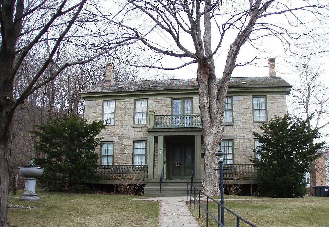
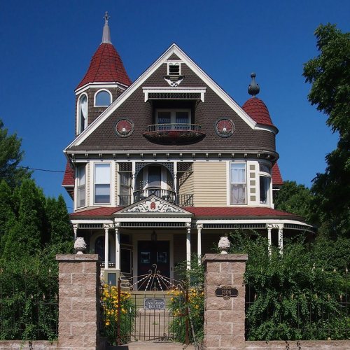
13 listings: 11 buildings, among them the Washington County Courthouse (listed 1971, the first), 1 historic district, the Stillwater Commercial Historic District, with 56 contributing buildings, and 1 structure. 69 historic buildings in all.
How old are the homes in Stillwater?
25% of Stillwater’s homes were built before 1940 (Census estimate, ±3.3 points), against a typical 8.1% for a Minnesota town; the median home was built in 1980.
Founding dates: Wikidata, Wikipedia, the U.S. post office records of Blevins & Helbock (CC0) and the Census. Homes by year built: Census ACS 2020–24. National Register of Historic Places: National Park Service (list of May 22, 2026). Old photos, postcards and papers: Wikimedia Commons, the Library of Congress and other public archives, credited on each item’s page. Maps: U.S. Geological Survey historical topographic maps (via Esri) and Sanborn fire-insurance maps (Library of Congress). History text and census tables: Wikipedia (CC BY-SA 4.0). Places that used to be: USGS Geographic Names Information System (2021).
From the Library of Congress (7), Wikidata (5), the National Register of Historic Places (13), Wikipedia, Wikidata and Wikipedia for famous people, U.S. Geological Survey historical maps, U.S. Census counts (via Wikipedia), the US Post Offices dataset (Blevins & Helbock), the USGS Geographic Names Information System, Sanborn fire insurance maps (Library of Congress) and old county and town histories (Internet Archive). Archive images are copied here with their credits and licenses, shown on each photo’s page. Refreshed monthly.







 2019
 2019
 2019
 2019
 2019
 2019
 2019


