Richfield was first counted by the census in 1860, and 1 of its places is on the National Register
More historic than 34% of U.S. towns · #158 of 273 in Minnesota. What drives it
Most of Richfield was built recently: 6% of its homes predate 1940 and the median home dates from 1959. Its Register listing is the Riley Lucas Bartholomew House. Below: 12 old photos and papers, maps from 1896 on, and the census since 1860.
Richfield first appears in the census in 1860. Two smaller post offices, Harmony (1856) and Richfield Center (1892), opened inside today’s city and later closed.
First census: 866 in 18602020 census: 36,994166 years
How historic is Richfield?
C
More historic than 34% of U.S. towns, on its age, its old homes and the National Register.
On its age, its old homes and the National Register, Richfield is more historic than 34% of U.S. towns, #158 of 273 in Minnesota. Its National Register listings hold the grade up; its share of homes from before 1940 pulls it down.
C
HistoryA character grade: shown, never part of Richfield’s overall grade.
Minnesota towns list about as much on the Register as the country (a typical Minnesota town has 2.1 per 10,000 residents, the U.S. 2.4), so Richfield’s 0.3 sits near the middle of its state (48% of Minnesota towns have fewer) while its 1 listings outnumber those of 51% of U.S. towns.
How sure. Graded on any two of the three inputs instead, the letter would range from C to C+. The pre-1940 share (±1.5 points) is firm at this size.
Founding year: the first census (other dates in Quick answers). Homes: Census ACS 2020–24. National Register: National Park Service, May 2026 list; each listing counted once (boundary changes and added documentation belong to their listing), and a historic district counts its contributing buildings. How TownRatings grades history →
What stands out about Richfield’s past
Read from the archive, the National Register and the record. The page puts what stands out first.
In the 1820s, some small settlements developed around Fort Snelling. By the late 1830s, the fortress served as a destination for newcomers—lumbermen, missionaries, farmers, traders and travelers—migrating to the borderlands people were now calling "Minisota". Minnesotan Franklin Steele reached the area in 1837 and worked as a sutler, selling goods to soldiers.
Fort Snelling's garrison made up the bulk of the area's population, along with Henry Sibley and Alexander Faribault's 75-person American Fur Company operation. Other small settlements of traders, farmers, missionaries and refugees began to develop outside the fort, some with permission, some without. These residents built communities on land that became known as Richfield.
Passages that mention Richfield, cut from the printed page as they were published.
History of Hennepin county and the city of Minneapolis, including the Explorers and pioneers of Minnesota1881 · page 225Read the page →
Read the text
by Miss Harrison, in 1855, since which time public schools have l)een regularly kept. The town is divided in four scliool districts, and has two joint districts with Richfield; the school house of the latter located in Richfield. That of District No. 13, known as the Gibson school house, on Section 20, finished in 18.59, wastlie first school house built. That of district No. 10, long known
Text read by machine from the scan; it may contain errors.
History of Hennepin county and the city of Minneapolis, including the Explorers and pioneers of Minnesota1881 · page 217Read the page →
Read the text
16th, 1844. Resided in his native State until 1874, when he came to Hennepin county, purceased twenty acres of land on section 15, town of Richfield, where he conducts a market garden. Mr. Chase is a practical gardener, and has been quite successful in the business.
Text read by machine from the scan; it may contain errors.
meadows of the town of Richfield. C. W. Harris, who, in 1868, died in Minneapolis, settled this year in that town, taking a claim and making a home for himself and his family.
Text read by machine from the scan; it may contain errors.
Grass Lake, form the notable water expanses of the town of Richfield. They are prairie lakes, charming in their quiet beauty, but chiefly notable for the fine farms located upon their banks.
Text read by machine from the scan; it may contain errors.
Scans and text from the Internet Archive. Books published in 1930 or earlier, which are in the public domain.
Timeline
Richfield, 1856 to 1970
Woven from the archive, old maps, post office records, the National Register and the people born here.
Nothing in the archives for these yearsWeddings on Main Street, storms, parades, school pictures, the old store. If it’s in your family album, it belongs here.
Nothing in the archives for these yearsWeddings on Main Street, storms, parades, school pictures, the old store. If it’s in your family album, it belongs here.
The Richfield post office opened in 1860, the earliest record of the town by name (U.S. post office records). Wikidata gives 1908.
How does Richfield rank for history?
Richfield is more historic than 34% of U.S. towns, #158 of 273 in Minnesota. The History grade combines the town’s founding era, the share of homes built before 1940 and its National Register listings. It’s a character grade, so it isn’t part of the overall grade. How it works.
What is on the National Register in Richfield?
One place: the Riley Lucas Bartholomew House (listed 1978).
How old are the homes in Richfield?
6% of Richfield’s homes were built before 1940 (Census estimate, ±1.5 points), against a typical 8.1% for a Minnesota town; the median home was built in 1959.
Founding dates: Wikidata, Wikipedia, the U.S. post office records of Blevins & Helbock (CC0) and the Census. Homes by year built: Census ACS 2020–24. National Register of Historic Places: National Park Service (list of May 22, 2026). Old photos, postcards and papers: Wikimedia Commons, the Library of Congress and other public archives, credited on each item’s page. Maps: U.S. Geological Survey historical topographic maps (via Esri) and Sanborn fire-insurance maps (Library of Congress). History text and census tables: Wikipedia (CC BY-SA 4.0). Places that used to be: USGS Geographic Names Information System (2021).
From Wikimedia Commons (18), the National Register of Historic Places (1), Wikipedia, U.S. Geological Survey historical maps, U.S. Census counts (via Wikipedia), the US Post Offices dataset (Blevins & Helbock), the USGS Geographic Names Information System and old county and town histories (Internet Archive). Archive images are copied here with their credits and licenses, shown on each photo’s page. Refreshed monthly.




 1880
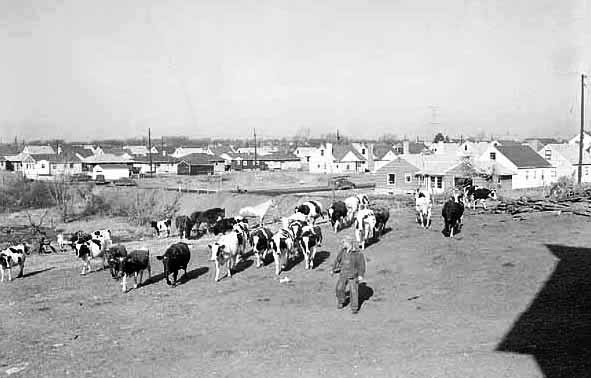
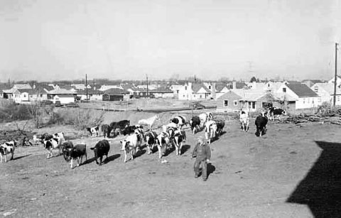 1954
 1955
 1955
 1955
 1955
 1964
 2008
 2008
 2007
 2006
 2006
 2005
