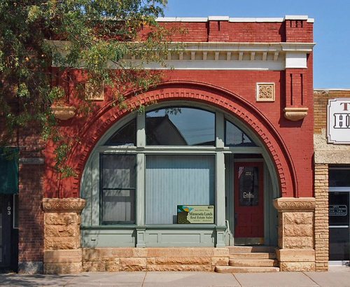
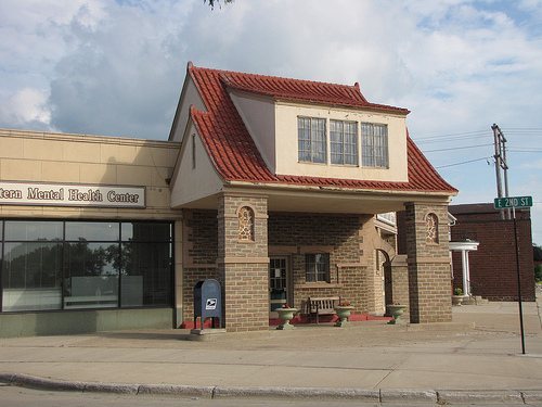
The Redwood Falls post office opened in 1864, the earliest record of the town by name. Two smaller post offices, North Redwood (1865) and Riverside (1875), opened inside today’s city and later closed.
First census: 981 in 18802020 census: 5,102162 years
How historic is Redwood Falls?
B+
More historic than 66% of U.S. towns, on its age, its old homes and the National Register.
Founding year: the first Redwood Falls post office (Blevins & Helbock, CC0).The full story ↓
History grade
What drives Redwood Falls’ History grade
On its age, its old homes and the National Register, Redwood Falls is more historic than 66% of U.S. towns, #52 of 273 in Minnesota. Its National Register listings hold the grade up; its age pulls it down.
B+
HistoryA character grade: shown, never part of Redwood Falls’ overall grade.
Minnesota towns list about as much on the Register as the country (a typical Minnesota town has 2.1 per 10,000 residents, the U.S. 2.4), so Redwood Falls’ 13.8 sits above most of its state (80% of Minnesota towns have fewer) while its 7 listings outnumber those of 73% of U.S. towns.
How sure. Graded on any two of the three inputs instead, the letter would range from B− to A−. The pre-1940 share is a Census survey estimate (±4.2 points). The founding year is the first post office, not a stated founding date.
Founding year: the first post office (other dates in Quick answers). Homes: Census ACS 2020–24. National Register: National Park Service, May 2026 list; each listing counted once (boundary changes and added documentation belong to their listing), and a historic district counts its contributing buildings. How TownRatings grades history →
What stands out about Redwood Falls’ past
Read from the archive, the National Register and the record. The page puts what stands out first.
US Post Offices dataset (Blevins & Helbock, CC0). Places and cemeteries from the USGS Geographic Names Information System (2021).
Every building
Redwood Falls, building by building, 1893–1915
Fire insurance maps drew every building, what it was made of and what it was used for, so insurers could price the risk of fire. Pick a year, then a sheet.
As the immigrant and the Euro-American population of the North American east coast region grew, population pressures affected people far inland. People moved west to find new homes as more and more land was used by farmers. The Minnesota area is the ancestral homeland of the several Dakota peoples, who consisted of the loosely confederated Oceti sakowin (Seven Council Fires). By 1700, Ojibwe, who spoke an Anishinaabe language, had also come to what is now Minnesota from the further east around the Great Lakes. At times they came into conflict with the Dakota over land and resources and began to push them to the west.
Passages that mention Redwood Falls, cut from the printed page as they were published.
The history of Redwood County, Minnesota1916 · page 584Read the page →
Read the text
box on a kitchen table, in the cabin of a pioneer. At Riverside, on the banks of the Minnesota, not far from what is now North Redwood, was established in 1876 the Riverside postoffice, later called Honner. It was on the stage route between Redwood Falls and Beaver Falls. The Minnesota Valley branch of the Winona & St. Peter railroad was built from New Ulm to Redwood Falls in 1878, and
Text read by machine from the scan; it may contain errors.
The history of Redwood County, Minnesota1916 · page 472Read the page →
Read the text
The story of the crime is quickly told. At about 7 o'clock in the evening of Friday, November 23, 1888, the defendant and the deceased, Frank Dodge, left the village of Morton, to drive in a buggy to the village of Redwood Falls, a distance of seven miles. At a later hour of the same evening the defendant came, with the team, to a hotel in Redwood Falls, where he remained that night.
Text read by machine from the scan; it may contain errors.
Scans and text from the Internet Archive. Books published in 1930 or earlier, which are in the public domain.
Timeline
Redwood Falls, 1858 to 1979
Woven from the archive, old maps, post office records, the National Register and the people born here.
Every edition of the U.S. Geological Survey’s map of Redwood Falls. Tap a year, or press play to watch the town change.
1952Redwood Falls sheet · 1:62,500
U.S. Geological Survey historical topographic maps (public domain), via Esri’s collection of the scans. The red ring marks the center of Redwood Falls.
On the National Register
7 historic places in Redwood Falls
The country’s official list of buildings and places worth saving.
The Redwood Falls post office opened in 1864, the earliest record of the town by name (U.S. post office records).
How does Redwood Falls rank for history?
Redwood Falls is more historic than 66% of U.S. towns, #52 of 273 in Minnesota. The History grade combines the town’s founding era, the share of homes built before 1940 and its National Register listings. It’s a character grade, so it isn’t part of the overall grade. How it works.
What is on the National Register in Redwood Falls?
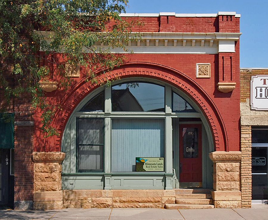
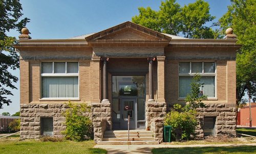
7 listings: 5 buildings, among them the Bank of Redwood Falls Building (listed 1980, the first), 1 site, and 1 structure.
How old are the homes in Redwood Falls?
18% of Redwood Falls’ homes were built before 1940 (Census estimate, ±4.2 points), against a typical 8.1% for a Minnesota town; the median home was built in 1973.
Founding dates: Wikidata, Wikipedia, the U.S. post office records of Blevins & Helbock (CC0) and the Census. Homes by year built: Census ACS 2020–24. National Register of Historic Places: National Park Service (list of May 22, 2026). Old photos, postcards and papers: Wikimedia Commons, the Library of Congress and other public archives, credited on each item’s page. Maps: U.S. Geological Survey historical topographic maps (via Esri) and Sanborn fire-insurance maps (Library of Congress). History text and census tables: Wikipedia (CC BY-SA 4.0). Places that used to be: USGS Geographic Names Information System (2021).
From Wikimedia Commons (5), Wikidata (1), the National Register of Historic Places (7), Wikipedia, Wikidata and Wikipedia for famous people, U.S. Geological Survey historical maps, U.S. Census counts (via Wikipedia), the US Post Offices dataset (Blevins & Helbock), the USGS Geographic Names Information System, Sanborn fire insurance maps (Library of Congress) and old county and town histories (Internet Archive). Archive images are copied here with their credits and licenses, shown on each photo’s page. Refreshed monthly.



 2011
 2011
 2011
 2010
 2008