Northfield dates to 1855, and 15% of its homes were built before 1940
More historic than 70% of U.S. towns · #47 of 273 in Minnesota. What drives it
14 places in town are on the National Register, among them the O. E. Rolvaag House, a National Historic Landmark, and a historic district with 55 buildings. Below: 11 old photos and papers, maps from 1884 on, and the census since 1880.
Founding year: Wikidata; Wikipedia’s history section gives the same year. First post office: 1856.The full story ↓
History grade
What drives Northfield’s History grade
On its age, its old homes and the National Register, Northfield is more historic than 70% of U.S. towns, #47 of 273 in Minnesota. Its National Register listings hold the grade up; its age pulls it down.
B+
HistoryA character grade: shown, never part of Northfield’s overall grade.
Minnesota towns list about as much on the Register as the country (a typical Minnesota town has 2.1 per 10,000 residents, the U.S. 2.4), so Northfield’s 33.3 sits above most of its state (91% of Minnesota towns have fewer) while its 69 historic buildings outnumber those of 87% of U.S. towns.
How sure. Graded on any two of the three inputs instead, the letter would range from C+ to A−. The pre-1940 share is a Census survey estimate (±3.0 points). Two sources give 1855.
Founding year: Wikidata (other dates in Quick answers). Homes: Census ACS 2020–24. National Register: National Park Service, May 2026 list; each listing counted once (boundary changes and added documentation belong to their listing), and a historic district counts its contributing buildings. How TownRatings grades history →
What stands out about Northfield’s past
Read from the archive, the National Register and the record. The page puts what stands out first.
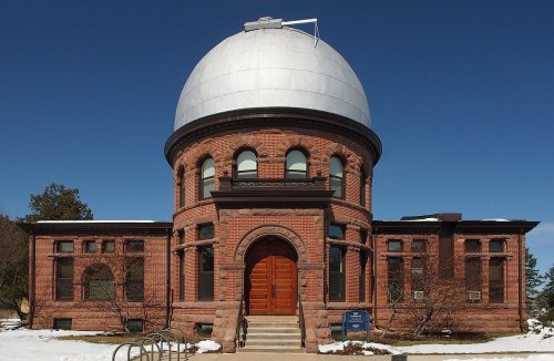
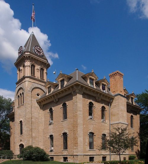
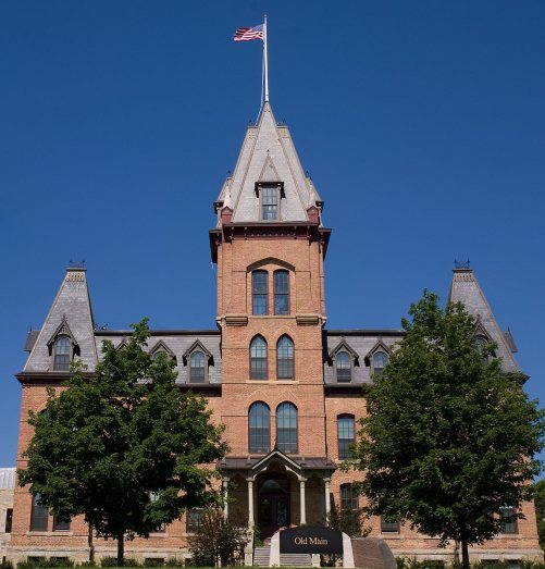
The country’s official list of buildings and places worth saving. One is a National Historic Landmark, the highest tier. Boundary changes and added documentation are counted with their listing.
National Park Service, National Register of Historic Places. Photos from Wikimedia Commons, credited on each place’s page.
Every building
Northfield, building by building, 1884–1922
Fire insurance maps drew every building, what it was made of and what it was used for, so insurers could price the risk of fire. Pick a year, then a sheet.
Southern Minnesota was first settled by the indigenous Mdewakanton and Wahpekute Dakota peoples in the late 1700s, after battling with the Ojibwe and being expelled from northern Minnesota. The Wahpekute settled in the Big Woods region, which included most of what is now Northfield and Faribault. The Wahpekute used the Cannon and Straight rivers for easy transportation and game hunting. They engaged in the burgeoning Minnesota fur trade, leading Alexander Faribault to establish a trading post in Wahpekute territory in 1826, which became the town of Faribault in 1855. In 1834, the Wahpekute tribe moved their settlement to Faribault's trading post, leading to a confluence of economic and cultural engagement.
Passages that mention Northfield, cut from the printed page as they were published.
History of Rice County, including explorers and pioneers of Minnesota and outline history of the state of Minnesota1882 · page 429Read the page →
Read the text
native place. Mr. Kelley was engaged in farming and the lumber business for about twenty years, when, on account of his failing health, he came to Minnesota and settled in Northfield on the 22d of April, 1855, pre-empting near what is now the city of Northfield. He was County Commissioner several terms before Minnesota was admitted as a State, was one of the building com-
Text read by machine from the scan; it may contain errors.
History of Rice County, including explorers and pioneers of Minnesota and outline history of the state of Minnesota1882 · page 266Read the page →
Read the text
ural surface, where the railroad crosses the northern line of the county, to be over 1050 feet above the sea level. At Faribault depot it is 993 feet; at Dandas depot, 945 feet; at Northfield depot, 905 feet. The entire western half, and the southeastern portions of the county, have a higher elevation. I have no means of knowing positively the relative elevations or the highest point in the
Text read by machine from the scan; it may contain errors.
Scans and text from the Internet Archive. Books published in 1930 or earlier, which are in the public domain.
Timeline
Northfield, 1855 to 1969
Woven from the archive, old maps, post office records, the National Register and the people born here.
Nothing in the archives for these yearsWeddings on Main Street, storms, parades, school pictures, the old store. If it’s in your family album, it belongs here.
In 1855, according to Wikidata and Wikipedia’s history of the town. Northfield’s post office opened in 1856, and the census of 1880 counted 2,296 people here.
How does Northfield rank for history?
Northfield is more historic than 70% of U.S. towns, #47 of 273 in Minnesota. The History grade combines the town’s founding era, the share of homes built before 1940 and its National Register listings. It’s a character grade, so it isn’t part of the overall grade. How it works.
What is on the National Register in Northfield?
14 listings: 12 buildings, among them the O. E. Rolvaag House (a National Historic Landmark since 1969), 1 historic district, the Northfield Commercial Historic District, with 55 contributing buildings, and 1 structure. 69 historic buildings in all.
How old are the homes in Northfield?
15% of Northfield’s homes were built before 1940 (Census estimate, ±3.0 points), against a typical 8.1% for a Minnesota town; the median home was built in 1986.
Founding dates: Wikidata, Wikipedia, the U.S. post office records of Blevins & Helbock (CC0) and the Census. Homes by year built: Census ACS 2020–24. National Register of Historic Places: National Park Service (list of May 22, 2026). Old photos, postcards and papers: Wikimedia Commons, the Library of Congress and other public archives, credited on each item’s page. Maps: U.S. Geological Survey historical topographic maps (via Esri) and Sanborn fire-insurance maps (Library of Congress). History text and census tables: Wikipedia (CC BY-SA 4.0). Places that used to be: USGS Geographic Names Information System (2021).
From Wikimedia Commons (10), the Library of Congress (1), Wikidata (1), the National Register of Historic Places (14), Wikipedia, Wikidata and Wikipedia for famous people, U.S. Geological Survey historical maps, U.S. Census counts (via Wikipedia), the US Post Offices dataset (Blevins & Helbock), the USGS Geographic Names Information System, Sanborn fire insurance maps (Library of Congress) and old county and town histories (Internet Archive). Archive images are copied here with their credits and licenses, shown on each photo’s page. Refreshed monthly.




 1869
 1901
 1906–1914
 1907
 1907–1909
 1907–1909
 1907–1916
 1907–1909
 1907–1909


