Minnesota City was platted in March 1852. The city took its name from the Minnesota Territory. A post office has been in operation in Minnesota City since 1852. The city was founded with hopes that it would be a useful port for steamboats. These hopes were dashed when it was discovered that the city was not built in the main channel of the Mississippi River, but rather on the Straight Slough, which was too shallow and sandy to be navigable for ships of that size. The city continued to prosper without river traffic, establishing the first public school, church, sawmill, and wheat farm in Winona county. The city was incorporated in 1896. The city was initially log cabins, and weathered winters well due to an abundance of firewood. Despite no issues with food or cold, disease took a toll on the first settlers, specifically cholera and typhus. The city hall had building materials purchased,…
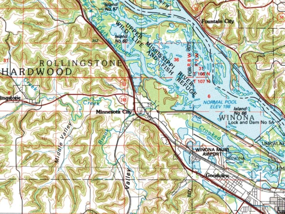
The U.S. Geological Survey’s map of Minnesota City.
1985Winona sheet · 1:100,000
U.S. Geological Survey historical topographic maps (public domain), via Esri’s collection of the scans. The red ring marks the center of Minnesota City.
People over time
Minnesota City, census by census
Between 141 and 301 people in every census since 1880.
14 censuses, 1880–2020.
U.S. Census Bureau decennial counts, from the census table on Minnesota City’s Wikipedia page.
Famous people
Famous people close to Minnesota City
Nobody well known was born in Minnesota City itself, so here are the best known from just nearby.
Founding dates: Wikidata, Wikipedia, the U.S. post office records of Blevins & Helbock (CC0) and the Census. Homes by year built: Census ACS 2020–24. National Register of Historic Places: National Park Service (list of May 22, 2026). Old photos, postcards and papers: Wikimedia Commons, the Library of Congress and other public archives, credited on each item’s page. Maps: U.S. Geological Survey historical topographic maps (via Esri) and Sanborn fire-insurance maps (Library of Congress). History text and census tables: Wikipedia (CC BY-SA 4.0). Places that used to be: USGS Geographic Names Information System (2021). How TownRatings grades history →
From Wikimedia Commons (5), Wikipedia, U.S. Geological Survey historical maps, U.S. Census counts (via Wikipedia), the US Post Offices dataset (Blevins & Helbock) and the USGS Geographic Names Information System. Archive images are copied here with their credits and licenses, shown on each photo’s page. Refreshed monthly.
 2023
 2023
 2021
 2012
 2005