Mazeppa Township dates to 1855, and 1 of its places is on the National Register
Most of Mazeppa Township was built recently: 10% of its homes predate 1940 and the median home dates from 1981. Its Register listing is the Lake Zumbro Hydroelectric Generating Plant. Below: maps from 1985 on and the census since 1880.
Mazeppa was platted in 1855, and named in honor of Hetman Ivan Mazepa via a poem by Lord Byron. The first census was taken in 1860, it showed 534 residents. The town was incorporated in 1877. Mazeppa in its early years was a flour milling center and boasted 7 trains a day at its peak. The line was nicknamed the "Bug Line" due to the crooked nature of the line east of town. The mill during its best years produced 600 barrels of flour a day and had 80 employees. The mill was powered by a turbine from water held back by 26 foot tall wooden dam on the Zumbro River and formed the "Mill Pond" as seen in historical pictures. The mill had its ups and downs until it burned down on Feb 2, 1891, foul play was suspected. The last train left Mazeppa in 1952. Despite valiant efforts at growth and industry, Mazeppa has since moved into the 21st Century as a quiet, well kept farm & bedroom community.
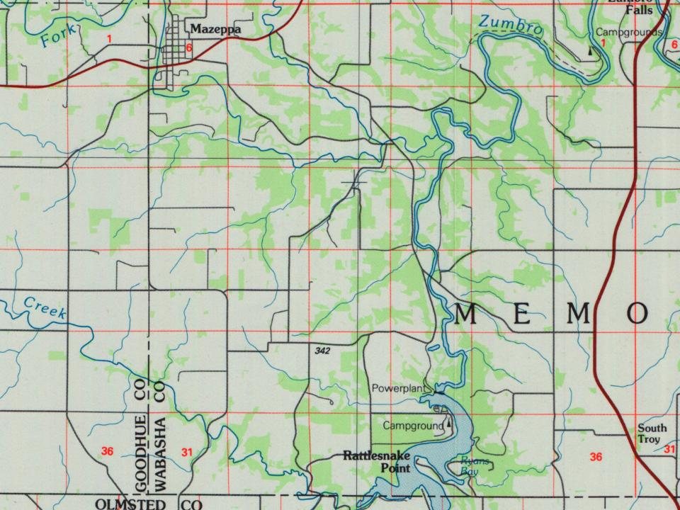
The U.S. Geological Survey’s map of Mazeppa Township.
1985Rochester sheet · 1:100,000
U.S. Geological Survey historical topographic maps (public domain), via Esri’s collection of the scans. The red ring marks the center of Mazeppa Township.
On the National Register
1 historic place in Mazeppa Township
The country’s official list of buildings and places worth saving.
Founding dates: Wikidata, Wikipedia, the U.S. post office records of Blevins & Helbock (CC0) and the Census. Homes by year built: Census ACS 2020–24. National Register of Historic Places: National Park Service (list of May 22, 2026). Old photos, postcards and papers: Wikimedia Commons, the Library of Congress and other public archives, credited on each item’s page. Maps: U.S. Geological Survey historical topographic maps (via Esri) and Sanborn fire-insurance maps (Library of Congress). History text and census tables: Wikipedia (CC BY-SA 4.0). Places that used to be: USGS Geographic Names Information System (2021). How TownRatings grades history →
From Wikimedia Commons (3), Wikidata (1), the National Register of Historic Places (1), Wikipedia, U.S. Geological Survey historical maps and U.S. Census counts (via Wikipedia). Archive images are copied here with their credits and licenses, shown on each photo’s page. Refreshed monthly.


 2026
 2020
 2005