Guest, Sign inJoin

Post to Kandiyohi Township

We’ll email a one-tap link to publish your post. No password, and nothing is public until you click it.
Already a member? Sign in
–Not graded
History · Kandiyohi Township

23% of Kandiyohi Township’s homes were built before 1940

1 place in town is on the National Register, among them a historic district with 6 buildings. Below: maps from 1956 on and the census since 1880.

1on the National Register
23%homes built before 1940
Photo: Myotus · CC BY 4.0

What stands out about Kandiyohi Township’s past

Read from the archive, the National Register and the record. The page puts what stands out first.

★ What stands out · Help out

Start Kandiyohi Township’s collection

The first neighbors to add old photos shape how Kandiyohi Township’s history is told.

Decades since 1900 with photos
00s10s20s30s40s50s60s70s80s90s
0 of 10 decades. The empty ones are waiting for someone’s album.
The story

How Kandiyohi Township came to be

From Wikipedia’s history of Kandiyohi Township.

Read it all →

Kandiyohi was laid out in 1869, when the railroad was extended to that point. In 1869 the Minnesota legislature voted Kandiyohi to be the new state capital due to its central location. The bill was vetoed by governor William Rainey Marshall on the grounds that "[t]he western treeless districts" further out from Kandiyohi would place the capital away from the likely population center.

Kandiyohi was derived from a Sioux name meaning "where the buffalo fish come from".

Text from Wikipedia, licensed CC BY-SA 4.0.

By decade

Kandiyohi Township, decade by decade

On the map

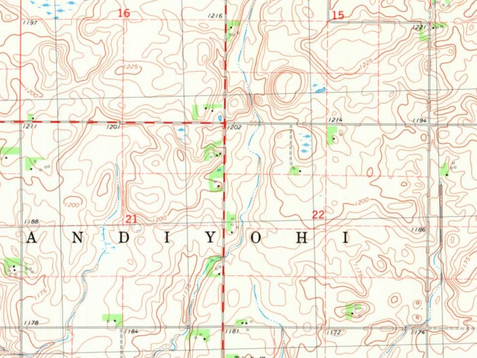
Kandiyohi Township on the map, 1956 to 1982

Every edition of the U.S. Geological Survey’s map of Kandiyohi Township. Tap a year, or press play to watch the town change.

Kandiyohi Township on the 1956 USGS mapKandiyohi Township on the 1982 USGS map1956Atwater sheet · 1:62,500

U.S. Geological Survey historical topographic maps (public domain), via Esri’s collection of the scans. The red ring marks the center of Kandiyohi Township.

On the National Register

1 listing protects 6 historic buildings

The country’s official list of buildings and places worth saving.

place listed
1
National Historic Landmarks
0
none yet
historic buildings protected
6
each building in a district counts
first listed
1991
Broman, Andreas, Johanna, Anna and Frank E., Fa…
Districts

Architectural styles listings

Italianate1
All 1 listings

National Park Service, National Register of Historic Places. Photos from Wikimedia Commons, credited on each place’s page.

People over time

Kandiyohi Township, census by census

010020030040050060018801900192019401960198020002020569

Grew from 75 people in 1880 to 569 in 2020, 7 times over.

13 censuses, 1880–2020.

U.S. Census Bureau decennial counts, from the census table on Kandiyohi Township’s Wikipedia page.

Places that used to be

Old burying grounds

5cemeteries and burying grounds inside Kandiyohi Township
Cloverleaf Memorial ParkEbenezerOak ParkOld BaptistTripolis

Places and cemeteries from the USGS Geographic Names Information System (2021).

Stories next door

History across the town line

Each neighbor’s History grade, on the same three inputs.

Questions about Kandiyohi Township’s history

What is on the National Register in Kandiyohi Township?

One place: the Broman, Andreas, Johanna, Anna and Frank E., Farmstead (listed 1991).

Memory lane

What the archives can’t tell you, neighbors can.

Town Square →
Start a conversation
Sources

Where this page comes from

Founding dates: Wikidata, Wikipedia, the U.S. post office records of Blevins & Helbock (CC0) and the Census. Homes by year built: Census ACS 2020–24. National Register of Historic Places: National Park Service (list of May 22, 2026). Old photos, postcards and papers: Wikimedia Commons, the Library of Congress and other public archives, credited on each item’s page. Maps: U.S. Geological Survey historical topographic maps (via Esri) and Sanborn fire-insurance maps (Library of Congress). History text and census tables: Wikipedia (CC BY-SA 4.0). Places that used to be: USGS Geographic Names Information System (2021). How TownRatings grades history →

From Wikimedia Commons (6), the National Register of Historic Places (1), Wikipedia, U.S. Geological Survey historical maps, U.S. Census counts (via Wikipedia) and the USGS Geographic Names Information System. Archive images are copied here with their credits and licenses, shown on each photo’s page. Refreshed monthly.