Cannon Falls’ post office opened in 1889, and 34% of its homes were built before 1940
More historic than 84% of U.S. towns · #10 of 273 in Minnesota. What drives it
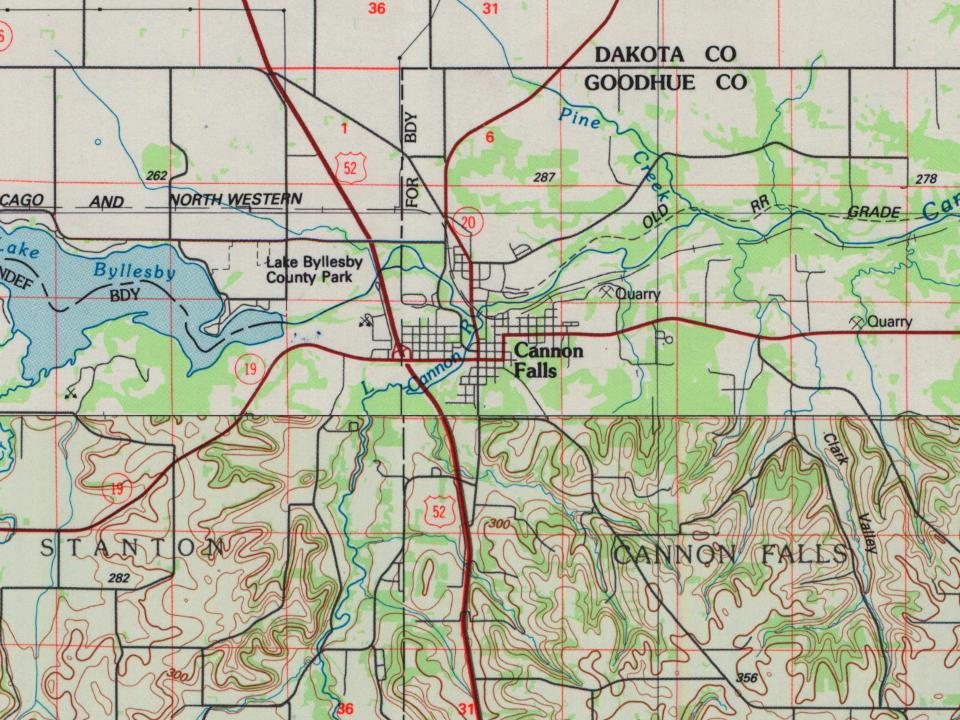
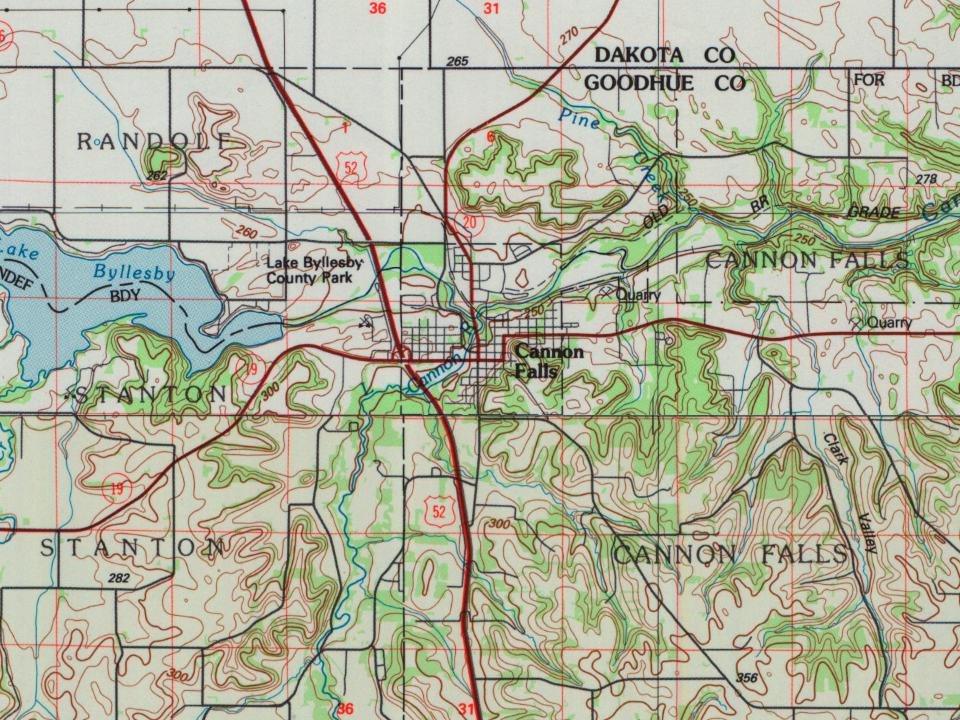
9 places in town are on the National Register, among them a historic district with 23 buildings. Below: 1 old photo or paper, maps from 1893 on, and old-book passages.
From Cannon Falls’ archive · credits on each photo
Quick answers
How Cannon Falls began
When was Cannon Falls founded?
1889
The Cannon Falls post office opened in 1889, the earliest record of the town by name. Another post office, Cannon River Falls (1855), opened inside today’s city and later closed.
2020 census: 4,220137 years
How historic is Cannon Falls?
A−
More historic than 84% of U.S. towns, on its age, its old homes and the National Register.
Founding year: the first Cannon Falls post office (Blevins & Helbock, CC0).
History grade
What drives Cannon Falls’ History grade
On its age, its old homes and the National Register, Cannon Falls is more historic than 84% of U.S. towns, #10 of 273 in Minnesota. Its share of homes from before 1940 holds the grade up; its age pulls it down.
A−
HistoryA character grade: shown, never part of Cannon Falls’ overall grade.
Minnesota towns list about as much on the Register as the country (a typical Minnesota town has 2.1 per 10,000 residents, the U.S. 2.4), so Cannon Falls’ 71.0 sits above most of its state (96% of Minnesota towns have fewer) while its 30 historic buildings outnumber those of 82% of U.S. towns.
How sure. Graded on any two of the three inputs instead, the letter would range from B+ to A+. The pre-1940 share is a Census survey estimate (±8.5 points). The founding year is the first post office, not a stated founding date.
Founding year: the first post office (other dates in Quick answers). Homes: Census ACS 2020–24. National Register: National Park Service, May 2026 list; each listing counted once (boundary changes and added documentation belong to their listing), and a historic district counts its contributing buildings. How TownRatings grades history →
What stands out about Cannon Falls’ past
Read from the archive, the National Register and the record. The page puts what stands out first.
National Park Service, National Register of Historic Places. Photos from Wikimedia Commons, credited on each place’s page.
Every building
Cannon Falls, building by building, 1893–1921
Fire insurance maps drew every building, what it was made of and what it was used for, so insurers could price the risk of fire. Pick a year, then a sheet.
1893Sheet 1 of 1
Edition
Sheets
BrickWoodStone
Sanborn Map Company, via the Library of Congress. Editions published in 1930 or earlier, which are in the public domain.
The story so far
Cannon Falls, in brief
Wikipedia doesn’t have a history of Cannon Falls yet. The photos, dates and memories neighbors add here are how it gets written.
Cannon Falls Township is a township in Goodhue County, Minnesota, United States. The population was 1,236 at the 2000 census. Cannon Falls Township was organized in 1858, and named for the falls on the Cannon River.
Its first post office opened in 1889. Between the 2010 and 2020 censuses its population grew from 4,083 to 4,220 (+3%).
Intro from Wikipedia. Population: U.S. Census Bureau.
From the old history books
What they wrote about Cannon Falls, 1878–1909
Passages that mention Cannon Falls, cut from the printed page as they were published.
History of Goodhue County, Minnesota1909 · page 167Read the page →
Read the text
Cannon Falls Township received its name from the Big Cannon river, and its branch, the Little Cannon, whose sudden change of level forms a falls in the western part of the township, at the point where the city of Cannon Falls is now located. The Big Cannon Hows through the northern part of the township, from west to east, and its valley is marked by many changes in topography. The outer bluffs of the river are frequently more than a mile apart and over two hundred feet above the water in the
Text read by machine from the scan; it may contain errors.
History of Goodhue County, Minnesota1909 · page 435Read the page →
Read the text
Western railroad, secured the beautiful home and spacious grounds of John L. Davis for a new church home. A chapel was fitted up in 1902, in which service is regularly held since the pastor was relieved of Cannon Falls. As the good mother rejoices to see her grown daughter establish a new home and family, so did the congregation and pastor of Belle Creek rejoice at the advance of Cannon Falls from a mission to an independent parish in 1905.
Text read by machine from the scan; it may contain errors.
History of Goodhue county, including a sketch of the territory and state of Minnesota1878 · page 194Read the page →
Read the text
Ascending (he prairie towards Cannon Falls, evidence is soon exhibited of passing over a region where sandstone is the outlier. Before reaching the village of Cannon Falls, the white St. Peter Sandstone is seen in the slopes of the bluffs, on either side of the Cannon River, capped with its covering of Trenton Limestone. In this locality the Saint Peter Sandstone has been worn down by erosion, forming the valleys of the Little Cannon and the Great Cannon, above the village of Cannon Falls. The material once forming this stratum may be seen
Text read by machine from the scan; it may contain errors.
History of Goodhue county, including a sketch of the territory and state of Minnesota1878 · page 195Read the page →
Read the text
Four miles south of the village of Cannon Falls, at the old Freeborn farm, on section 6, in the township of Leon, the Shell Limestone, in place beside the road, exhibits the same organic remains as those found in the bluffs west of the village. The strata here dips to the south about two degrees, and conceals the sandstone long before reaching the head of the stream. The Trenton Limestone affords good building material, as well as supplying lime to the inhabitants in many localities in the county.
Text read by machine from the scan; it may contain errors.
Scans and text from the Internet Archive. Books published in 1930 or earlier, which are in the public domain.
Timeline
Cannon Falls, 1855 to 1974
Woven from the archive, old maps, post office records, the National Register and the people born here.
The Cannon Falls post office opened in 1889, the earliest record of the town by name (U.S. post office records).
How does Cannon Falls rank for history?
Cannon Falls is more historic than 84% of U.S. towns, #10 of 273 in Minnesota. The History grade combines the town’s founding era, the share of homes built before 1940 and its National Register listings. It’s a character grade, so it isn’t part of the overall grade. How it works.
What is on the National Register in Cannon Falls?
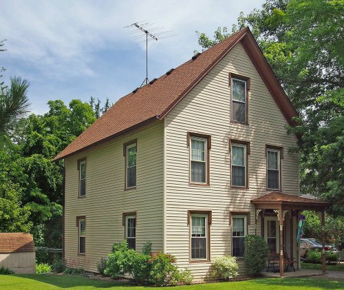
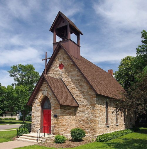
9 listings: 7 buildings, among them the Cannon Falls School (listed 1980, the first), 1 historic district, the Cannon Falls Commercial Historic District, with 23 contributing buildings, and 1 structure. 30 historic buildings in all.
How old are the homes in Cannon Falls?
34% of Cannon Falls’ homes were built before 1940 (Census estimate, ±8.5 points), against a typical 8.1% for a Minnesota town; the median home was built in 1967.
Founding dates: Wikidata, Wikipedia, the U.S. post office records of Blevins & Helbock (CC0) and the Census. Homes by year built: Census ACS 2020–24. National Register of Historic Places: National Park Service (list of May 22, 2026). Old photos, postcards and papers: Wikimedia Commons, the Library of Congress and other public archives, credited on each item’s page. Maps: U.S. Geological Survey historical topographic maps (via Esri) and Sanborn fire-insurance maps (Library of Congress). History text and census tables: Wikipedia (CC BY-SA 4.0). Places that used to be: USGS Geographic Names Information System (2021).
From the Library of Congress (1), the National Register of Historic Places (9), U.S. Geological Survey historical maps, the US Post Offices dataset (Blevins & Helbock), the USGS Geographic Names Information System, Sanborn fire insurance maps (Library of Congress) and old county and town histories (Internet Archive). Archive images are copied here with their credits and licenses, shown on each photo’s page. Refreshed monthly.





 Date?