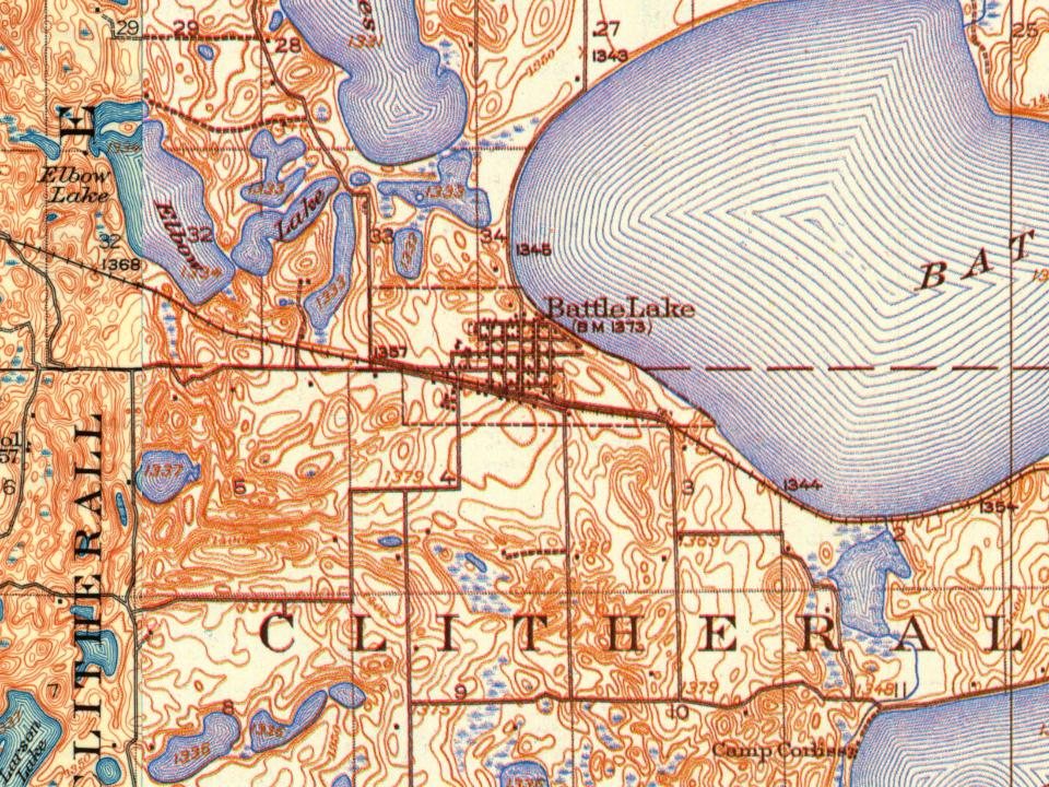
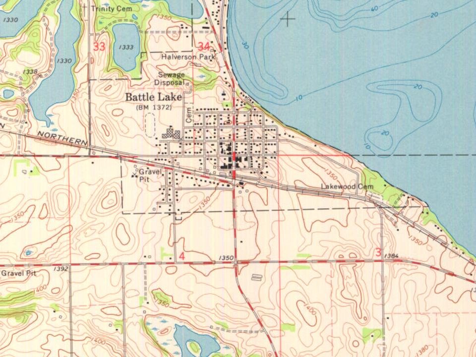
Battle Lake, Minnesota is named after the mesotrophic lake of which it borders. It was first referenced by early French cartographers as "Lac du Battaile" with the area being the site of numerous Native American conflicts or battles. It likely draws reference to the Ojibwe and Dakota people in 1795 during the Dakota-Ojibwe War. "Battle Lake" was first anglicized by Joseph Nicolas Nicollet when displayed on his hydrographic map of the Mississippi Valley in 1843. The town of Battle Lake was first platted on October 31st, 1881 by Torger and Bertha Olson when the Northern Pacific Railway was building a track and station through the couple's homesteaded land. The railway and station contributed to Battle Lake growing into a railway village or Railway town, though the train and station were later moved.
Passages that mention Battle Lake, cut from the printed page as they were published.
History of Otter Tail County, Minnesota1916 · page 863Read the page →
Read the text
Among the oldest citizens of Battle Lake, Otter Tail county, Minnesota, and among the most prominent citizens of the county, is the Hon. Orris Albertson, former sheriff of Otter Tail county, who has been engaged in many lines of endeavor and who. for many years, was engaged in the mercantile business at Battle Lake.
Text read by machine from the scan; it may contain errors.
History of Otter Tail County, Minnesota1916 · page 92Read the page →
Read the text
Hatch came to Battle Lake in 1881 and has been continuously in business since that time. He has the longest business career in this town of any man new in business. Mr. Hatch owns the grain elevator at Battle Lake, farm lands in Otter Tail county and other important industrial and financial interests.
Text read by machine from the scan; it may contain errors.
Scans and text from the Internet Archive. Books published in 1930 or earlier, which are in the public domain.
Timeline
Battle Lake, 1871 to 1929
Woven from the archive, old maps, post office records, the National Register and the people born here.
Founding dates: Wikidata, Wikipedia, the U.S. post office records of Blevins & Helbock (CC0) and the Census. Homes by year built: Census ACS 2020–24. National Register of Historic Places: National Park Service (list of May 22, 2026). Old photos, postcards and papers: Wikimedia Commons, the Library of Congress and other public archives, credited on each item’s page. Maps: U.S. Geological Survey historical topographic maps (via Esri) and Sanborn fire-insurance maps (Library of Congress). History text and census tables: Wikipedia (CC BY-SA 4.0). Places that used to be: USGS Geographic Names Information System (2021). How TownRatings grades history →
From Wikimedia Commons (11), Wikidata (1), the National Register of Historic Places (2), Wikipedia, U.S. Geological Survey historical maps, U.S. Census counts (via Wikipedia), the US Post Offices dataset (Blevins & Helbock), the USGS Geographic Names Information System and old county and town histories (Internet Archive). Archive images are copied here with their credits and licenses, shown on each photo’s page. Refreshed monthly.



 2019
 2019
 2019
 2019
 2019
 2019
 2019
 2019
 2019
 2019
 2005