Warren dates to 1830, and 3 of its places are on the National Register
More historic than 64% of U.S. towns · #246 of 701 in Michigan. What drives it
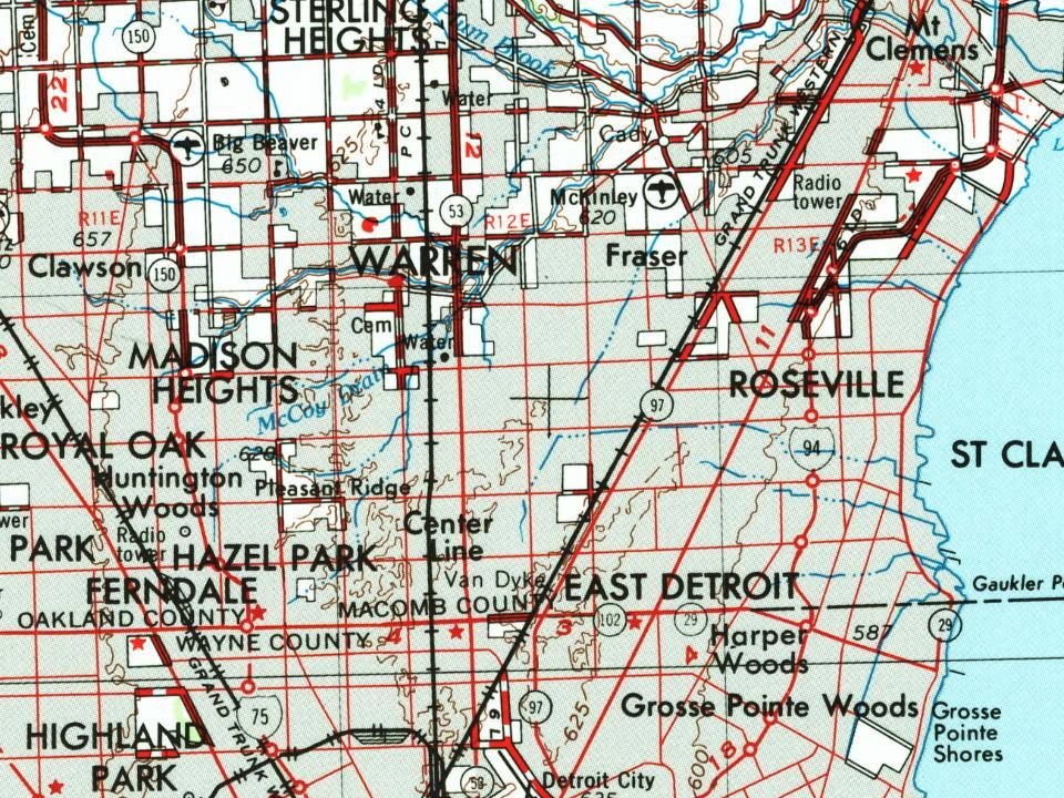
3 places in town are on the National Register, among them the General Motors Technical Center, a National Historic Landmark, and a historic district with 22 buildings. Most of Warren was built recently: 3% of its homes predate 1940 and the median home dates from 1965. Below: 6 old photos and papers, maps from 1954 on, and the census since 1900.
Warren dates its founding to 1830 (Wikidata). The census first counted it in 1900.
First census: 890 in 19002020 census: 139,387196 years
How did Warren get its name?
Warren was named for War of 1812 veteran and frontier cleric, Reverend Abel Warren.
More on the name
However, when it was originally organized the township was named for Reverend Warren, a Methodist Episcopal preacher who left his native New York in 1824 for Shelby Township.
How historic is Warren?
B
More historic than 64% of U.S. towns, on its age, its old homes and the National Register.
On its age, its old homes and the National Register, Warren is more historic than 64% of U.S. towns, #246 of 701 in Michigan. Its age holds the grade up; its share of homes from before 1940 pulls it down.
B
HistoryA character grade: shown, never part of Warren’s overall grade.
Among the 400 U.S. cities of 100,000 or more, Warren ranks #197 on History.
Few Michigan towns list much on the Register (a typical Michigan town has 0.0 per 10,000 residents, the U.S. 2.4), so Warren’s 1.7 sits above most of its state (68% of Michigan towns have fewer) while its 23 historic buildings outnumber those of 80% of U.S. towns.
Newer cities are common at Warren’s size: in the typical U.S. city of 100,000 or more, 5% of homes predate 1940.
How sure. Graded on any two of the three inputs instead, the letter would range from B− to A−. The pre-1940 share (±0.7 points) is firm at this size. Two sources give 1830.
Founding year: Wikidata (other dates in Quick answers). Homes: Census ACS 2020–24. National Register: National Park Service, May 2026 list; each listing counted once (boundary changes and added documentation belong to their listing), and a historic district counts its contributing buildings. How TownRatings grades history →
What stands out about Warren’s past
Read from the archive, the National Register and the record. The page puts what stands out first.
Lost post offices, old corners, places now gone and burying grounds
Warren’s post office has been open since 1840. Two other post offices opened and closed inside today’s town.
Warren
1840–today
Van Dyke
1925–1957
Base Line
1927–1957
18401930today
Hamlets and corners on the map
Bear Creek Village Mobile Home ParkContinental Mobile VillageGlenn Wood Mobile VillageJackson Trailer ParkLafayette Place Mobile Home ParkMotor City Trailer ParkParklane Court Mobile Home ParkShadylane Mobile Home EstatesTwin Pines Mobile Home ParkWarren Mobile Home Park
Gone or out of use
Acme HeliportairportBase Line Post Officepost officeEast Detroit Stationlocale
2cemeteries and burying grounds inside Warren
Detroit Memorial ParkWarren Union
US Post Offices dataset (Blevins & Helbock, CC0). Places and cemeteries from the USGS Geographic Names Information System (2021).
On the National Register
3 listings protect 23 historic buildings
The country’s official list of buildings and places worth saving. One is a National Historic Landmark, the highest tier.
Beebe's Corners, the original settlement in what would become the city of Warren, was founded in 1830 at the corner of Mound Road and Chicago Road; its first resident was Charles Groesbeck. Beebe's Corners was a carriage stop between Detroit and Utica, and included a distillery, mill, tavern, and trading post. In 1837 the now-defunct Warren Township was organized around the settlement; first under the name Hickory, then Aba in April 1838 and finally renamed Warren shortly thereafter. It was named for War of 1812 veteran and frontier cleric, Reverend Abel Warren. However, when it was originally organized the township was named for Reverend Warren, a Methodist Episcopal preacher who left his native New York in 1824 for Shelby Township. He went throughout the present-day Macomb, Lapeer, Oakland, and St. Clair Counties, baptizing, marrying, and burying pioneers of the area, as well as estab…
Passages that mention Warren, cut from the printed page as they were published.
History of Macomb County, Michigan, containing ... biographical sketches, portraits of prominent men and early settlers1882Read the page →
Read the text
and also recognized the change of name from Hickory to Aba. Romeo was incorporated as a village, March 9, 1838, and on the same date the village of Utica received authority to organize. The Act of March 26, 1839, changed the name Aha to Warren. On Feb. 16, 1842, the township of Macomb lost its eastern half. s ^
Text read by machine from the scan; it may contain errors.
History of Macomb County, Michigan, containing an account of its settlement, growth, development and resources...churches, schools and societies1882 · page 303Read the page →
Read the text
and also recognized the change of name from Hickory to Aba. Romeo was incorporated as a village, March 9, 1838, and on the same date the village of Utica received authority to organize. The Act of March 26, 1839, changed the name Aha to Warren. On Feb. 16, 1842, the township of Macomb lost its eastern half, ^ & I
Text read by machine from the scan; it may contain errors.
History of Macomb County, Michigan, containing ... biographical sketches, portraits of prominent men and early settlers1882Read the page →
Read the text
The village of Warren in this township was settled at an early day. It is twelve miles southwest of Mt. Clemens and fourteen north of Detroit. Its location is within a half mile of the D. &. B. C. R. R. , which renders the place a suburb of Detroit. It ia a
Text read by machine from the scan; it may contain errors.
History of Macomb County, Michigan, containing an account of its settlement, growth, development and resources...churches, schools and societies1882 · page 438Read the page →
Read the text
The Detroit & Bay City Railroad. — This railway is under the control of the Michigan Central Railroad Company. It enters Macomb County near the center of the southern boundary of Warren Township, and traverses through the townships of Warren, Sterling and Shelby, in a northwesterly direction. It leaves the county tbout the center of the western boundary of the latter township, and enters the adjacent county of Oakland.
Text read by machine from the scan; it may contain errors.
Scans and text from the Internet Archive. Books published in 1930 or earlier, which are in the public domain.
Timeline
Warren, 1830 to 2014
Woven from the archive, old maps, post office records, the National Register and the people born here.
Nothing in the archives for these yearsWeddings on Main Street, storms, parades, school pictures, the old store. If it’s in your family album, it belongs here.
In 1830, according to Wikidata. Warren’s post office opened in 1840, and the census of 1900 counted 890 people here.
How does Warren rank for history?
Warren is more historic than 64% of U.S. towns, #246 of 701 in Michigan. The History grade combines the town’s founding era, the share of homes built before 1940 and its National Register listings. It’s a character grade, so it isn’t part of the overall grade. How it works.
What is on the National Register in Warren?
Three places: the General Motors Technical Center (listed 2014), the General Motors Technical Center (2000) and the Warren Township District No. 4 School (2012).
How old are the homes in Warren?
3% of Warren’s homes were built before 1940 (Census estimate), against a typical 12% for a Michigan town; the median home was built in 1965.
Founding dates: Wikidata, Wikipedia, the U.S. post office records of Blevins & Helbock (CC0) and the Census. Homes by year built: Census ACS 2020–24. National Register of Historic Places: National Park Service (list of May 22, 2026). Old photos, postcards and papers: Wikimedia Commons, the Library of Congress and other public archives, credited on each item’s page. Maps: U.S. Geological Survey historical topographic maps (via Esri) and Sanborn fire-insurance maps (Library of Congress). History text and census tables: Wikipedia (CC BY-SA 4.0). Places that used to be: USGS Geographic Names Information System (2021).
From Wikimedia Commons (21), the Library of Congress (3), the National Register of Historic Places (3), Wikipedia, Wikidata and Wikipedia for famous people, U.S. Geological Survey historical maps, U.S. Census counts (via Wikipedia), the US Post Offices dataset (Blevins & Helbock), the USGS Geographic Names Information System and old county and town histories (Internet Archive). Archive images are copied here with their credits and licenses, shown on each photo’s page. Refreshed monthly.


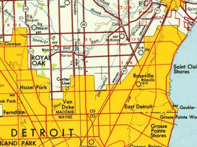


 1980
 1980
 1986
 1986
 2014
 2014
 2014
 2014
 2014
 2014
 2014
 2014
 2014
 2014
 2014
 2014
 2014
 2009
 2008
 2008
 2007
 2007