Built in 1907 by local contractor David Pierce, the Citizens Bank Block also housed a harness shop and a library. Albert Sleeper (1862–1934), who served in the Michigan State Senate and as governor, co-founded the bank with his uncle A. W. Merrell, taking sole ownership in 1900. Sleeper owned several other banks and extensive real estate. Sleeper and his wife, Mary Moore, set up a library in the space above the bank in 1908.
On February 25, 2004, a wolverine was spotted near Ubly, the first one sighted in Michigan in over 200 years.
Nothing in the archives for these yearsWeddings on Main Street, storms, parades, school pictures, the old store. If it’s in your family album, it belongs here.
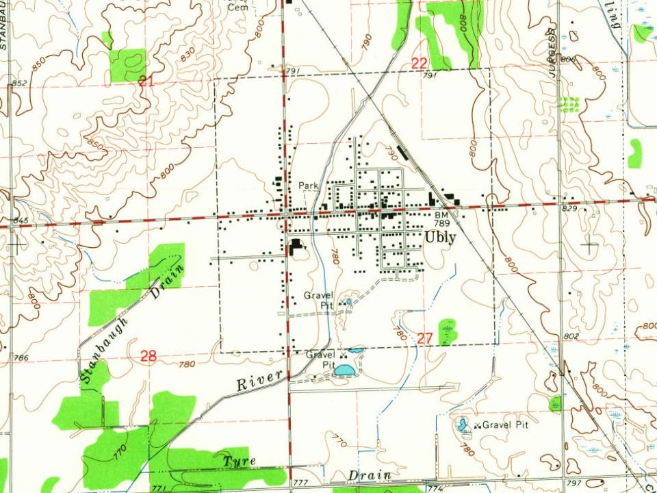
Every edition of the U.S. Geological Survey’s map of Ubly. Tap a year, or press play to watch the town change.
1963Ubly sheet · 1:24,000
U.S. Geological Survey historical topographic maps (public domain), via Esri’s collection of the scans. The red ring marks the center of Ubly.
Every building
Ubly, building by building, 1901–1909
Fire insurance maps drew every building, what it was made of and what it was used for, so insurers could price the risk of fire. Pick a year, then a sheet.
1901Sheet 1 of 1
Edition
Sheets
BrickWoodStone
Sanborn Map Company, via the Library of Congress. Editions published in 1930 or earlier, which are in the public domain.
People over time
Ubly, census by census
Between 432 and 899 people in every census since 1900.
13 censuses, 1900–2020.
U.S. Census Bureau decennial counts, from the census table on Ubly’s Wikipedia page.
Questions about Ubly’s history
What year was Ubly founded?
The Ubly post office opened in 1880, the earliest record of the town by name (U.S. post office records).
Founding dates: Wikidata, Wikipedia, the U.S. post office records of Blevins & Helbock (CC0) and the Census. Homes by year built: Census ACS 2020–24. National Register of Historic Places: National Park Service (list of May 22, 2026). Old photos, postcards and papers: Wikimedia Commons, the Library of Congress and other public archives, credited on each item’s page. Maps: U.S. Geological Survey historical topographic maps (via Esri) and Sanborn fire-insurance maps (Library of Congress). History text and census tables: Wikipedia (CC BY-SA 4.0). Places that used to be: USGS Geographic Names Information System (2021). How TownRatings grades history →
From Wikimedia Commons (3), Wikipedia, Wikidata and Wikipedia for famous people, U.S. Geological Survey historical maps, U.S. Census counts (via Wikipedia) and Sanborn fire insurance maps (Library of Congress). Archive images are copied here with their credits and licenses, shown on each photo’s page. Refreshed monthly.


 2015
 2008