St. James Township’s post office opened in 1895, and 1 of its places is on the National Register
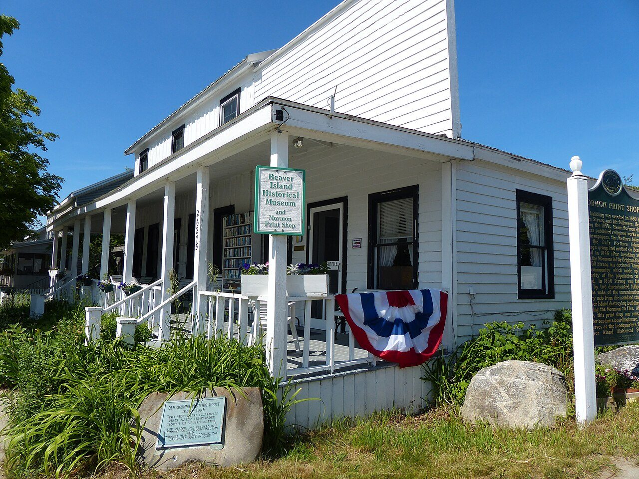
Most of St. James Township was built recently: 9% of its homes predate 1940 and the median home dates from 1977. Its Register listing is the Mormon Print Shop.
The St. James Township post office opened in 1895, the earliest record of the town by name. Another post office, High Island (1913), opened inside today’s town and later closed.
2020 census: 259131 years
Founding year: the first St. James Township post office (Blevins & Helbock, CC0).The full story ↓
What stands out about St. James Township’s past
Read from the archive, the National Register and the record. The page puts what stands out first.
The community was settled as early as 1847 when James Jesse Strang took over his Mormon church and settled his colony on Beaver Island. Originally part of Michilimackinac County, it received a post office named Beaver Island on January 13, 1849, with Charles Wright serving as the first postmaster. Strang named the new community after himself, and the post office was renamed St. James on October 10, 1854, when it became part of Emmet County. Strang declared himself to be a king—the only king ever crowned in the United States. After Strang's murder in 1856 by disgruntled followers, the community began to fold, and the post office closed on March 6, 1868. Charles Wright restored the post office under the name Beaver Island on December 19, 1868, and served again as postmaster. During the 1870s, St. James was also referred as Beaver Harbor. By 1895, the Mormons left the island, and St…
Founding dates: Wikidata, Wikipedia, the U.S. post office records of Blevins & Helbock (CC0) and the Census. Homes by year built: Census ACS 2020–24. National Register of Historic Places: National Park Service (list of May 22, 2026). Old photos, postcards and papers: Wikimedia Commons, the Library of Congress and other public archives, credited on each item’s page. Maps: U.S. Geological Survey historical topographic maps (via Esri) and Sanborn fire-insurance maps (Library of Congress). History text and census tables: Wikipedia (CC BY-SA 4.0). Places that used to be: USGS Geographic Names Information System (2021). How TownRatings grades history →
From the National Register of Historic Places (1), Wikipedia, the US Post Offices dataset (Blevins & Helbock) and the USGS Geographic Names Information System. Archive images are copied here with their credits and licenses, shown on each photo’s page. Refreshed monthly.