
Dimitri's Fine Food sign, 1986
Roseville’s story
186 years in pictures
Census counts: 6,836 in 1930, 47,710 in 2020. The archive holds 20 old photos and papers going back to 1986 and 5 maps from 1936 on.
- 1840Roseville is settled
Each edition grades its towns against each other only.

Roseville grades D overall, 650th among Michigan's 697 graded towns, mostly because of safety and health. It reports more crime per resident than 92% of U.S. towns, including 237 violent crimes reported to the FBI in 2025. Residents are less healthy than 76% of U.S. towns on CDC estimates. One bright spot: natural-hazard risk is low. Roseville’s property crime rate is 31.8 per 1,000 residents, where Michigan’s towns sit at 7.8 and U.S. towns at 9.9. On civic life, just 3 of Michigan’s 1,265 towns do worse. The biggest place to walk is Huron Park, 24 acres with 1.2 miles of trail.
Where Roseville beats most towns, and one thing worth knowing.
Where Roseville’s working residents go each day. Line width shows the share.
Census LEHD 2021
Each subject compared with towns across the country (schools within Michigan), ordered by how far Roseville is from typical.
How TownRatings grades towns →
Census counts: 6,836 in 1930, 47,710 in 2020. The archive holds 20 old photos and papers going back to 1986 and 5 maps from 1936 on.
Museums, parks, gardens and other places to visit around Roseville. Close and well known come first.
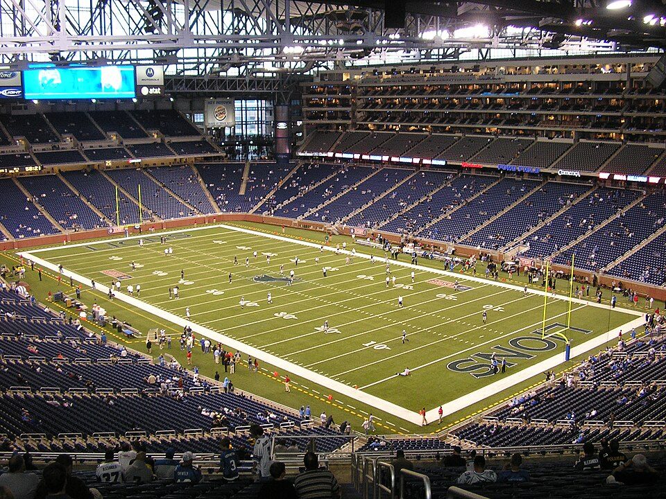 Big draw13 mi Stadium & arenaFord Field
 13 mi Stadium & arenaComerica Park
 14 mi LakeLake Saint Clair
 13 mi TheatreFox Theatre
 21 mi MuseumThe Henry Ford1.8M visitors a year
 12 mi MuseumDetroit Institute of Arts
Ford Field: Unknown, CC BY 2.5 · Comerica Park: City of Detroit, Public domain · Lake Saint Clair: Copernicus Sentinel-2, ESA, CC BY-SA 3.0 igo · Fox Theatre: Michael Barera, CC BY-SA 4.0 · The Henry Ford: Alvintrusty, CC BY-SA 3.0 · Detroit Institute of Arts: Michael Barera, CC BY-SA 4.0
Who provides power, water and the rest in Roseville, and how to reach them.
EPA SDWIS (Oct 9, 2026) · HIFLD + EIA-861 2025 · Census 2020 ZCTAs · NCES 2024–25 · registration: vote.gov, updated Sep 12, 2025.
Ordered by what stands out in Roseville.
Roseville has homes that are cheap against local pay, but it reports more crime than Eastpointe and its other graded neighbors.
Each of the 4 graded towns on its borders reports less crime per resident, from Eastpointe (D) to St. Clair Shores (B−). Property crime runs at 31.8 per 1,000 residents, about twice the Michigan rate, most of it theft.
Roseville’s violent crime rate is 5.1 per 1,000 residents.
FBI crime data, 2025 · crimes reported to police
The Roseville Community Schools runs its public schools. Two of its 13 schools are shown below, with the reason for each. 6 public schools serve Roseville, with 2,185 students in all.
| School | Level | Students | Letter |
|---|---|---|---|
| Roseville Middle SchoolLargest public middle schoolGrades 6–8 | Grades 6–8 | 620 | C− |
| Roseville High SchoolLargest public high schoolGrades 9–12 | Grades 9–12 | 1,211 | C− |
NCES · EDFacts · graded within MI on state tests and graduation
At 2.2 years of the Detroit metro’s $77K median household income, the typical home (about $171K) costs less against local pay than in 93% of Michigan towns; that ratio is one input to its B− for cost of living.
On the market in Roseville: a median 26 days to sell. In the year to September 2026, typical home values climbed 2.2%. Roseville: nearly two thirds of households are owner-occupiers.
| Roseville | Michigan towns | U.S. towns | |
|---|---|---|---|
| Households that own their home | 66% | 84% | 73% |
| Median rent | $1,233 a month | $1,045 a month | $1,185 a month |
Zillow Home Value Index · Redfin Data Center
The share of adults in Roseville who have obesity: 41%. On the CDC’s 32 measures, Roseville is ahead of Michigan on 1 and behind on 11. Among adults locally, 36% feel lonely and 20% report frequent mental distress.
| Roseville | Michigan towns | U.S. towns | |
|---|---|---|---|
| Sleep under 7 hours (CDC PLACES) | 40% | 34% | 36% |
| Feel lonely (CDC PLACES) | 36% | 32% | 33% |
| Frequent mental distress (CDC PLACES) | 20% | 18% | 17% |
| Smoke cigarettes (CDC PLACES) | 18% | 15% | 14% |
| What stands out | Roseville | MI |
|---|---|---|
| Fewer adults who have had cancer | 7.9% | 8.9% |
| More older adults who have lost all their teeth | 13.8% | 10.2% |
CDC PLACES 2025 · modeled estimates for adults · CMS · HRSA
Only 6% of working residents stay in Roseville for work; the rest commute out. Since 2011, Roseville has lost 1,819 jobs, to 14,488 in 2021. Its typical household income stands at $62,000. Half the trips to work are shorter than 11 miles.
| Roseville | Michigan towns | U.S. towns | |
|---|---|---|---|
| Median household income | $62,000 | $77,000 | $80,000 |
| Below the poverty line | 13% | 8.9% | 9.6% |
| Average trip to work | 26 minutes | 25 minutes | 25 minutes |
Census LEHD 2021 · ACS
On expected storm and flood damage, Roseville sits below 73% of U.S. communities. Federal disaster aid has reached households in Roseville after 6 declared disasters, most recently in 2023. Expected losses in Roseville break down as 44% from inland flooding and 27% from tornadoes. 5 flood insurance claims have been paid here since 2019.
FEMA disaster declarations and aid · FEMA flood insurance claims · FEMA National Risk Index · OpenFEMA
July afternoons reach 83°, January nights drop to 19° and about 32 inches of snow falls in a winter.
NOAA U.S. Climate Normals, 1991–2020
Trails total 1.4 miles in 8 parks and preserves. In Roseville, the density of trails is 0.1 miles per square mile. Parks and preserves locally: 8, covering 72 acres.
| Roseville | Michigan towns | U.S. towns | |
|---|---|---|---|
| Conserved land | 1.1% | 4.4% | 4.3% |
| Miles of trail per square mile | 0.1 miles per square mile | 0.3 | 0.4 |
| Biggest places to walk | Trails | Acres |
|---|---|---|
| 1. Huron Park | 1.2 mi | 24 |
| 2. Veteran's Memorial Park | — | 14 |
| 3. Dooley Park | — | 11 |
Trails & parks © OpenStreetMap contributors · Conserved land: USGS PAD-US
10 within 15 miles of the center of Roseville
About 5 of every 100 Roseville residents are enrolled in college, about the same as Michigan.
4 notable people were born in Roseville.
City in Michigan, United States
Roseville is a city in Macomb County in the U.S. state of Michigan. A northern suburb of Detroit, Roseville is located roughly 13 miles (20.9 km) northeast of downtown Detroit. As of the 2020 census, the city had a population of 47,710.
From Wikipedia, licensed CC BY-SA 4.0 · facts via Wikidata (CC0)
4 towns share a border with Roseville.
| Town | MI rank | Overall | Cost | Safety | Schools | Health |
|---|---|---|---|---|---|---|
| Roseville | #650 | D | B− | D | C | C− |
| St. Clair Shores | #334 | B | B− | B− | B | B |
| Warren | #612 | C− | C+ | C− | B | C− |
| Eastpointe | #687 | D− | B− | D | D | D |
| Fraser | #464 | C+ | B− | C | B+ | C |
Short answers, built from the data on this page.
Roseville grades D overall, better than 12% of U.S. towns and #650 of 697 in Michigan. It grades C− for health, D for safety and C for schools. Safety is its weak spot, with a D.
That is 2.2 years of the area's median household income ($76,664 across the Detroit-Warren-Dearborn, MI metro area). Cost of living, which also weighs rents, property taxes and how many households pay 30% or more of their income for housing, grades B−.
4 notable people were born here, including John Chirkun and Jeff Jackson.


