Homer Township dates to 1832, and 39% of its homes were built before 1940
More historic than 98% of U.S. towns · #10 of 701 in Michigan. What drives it
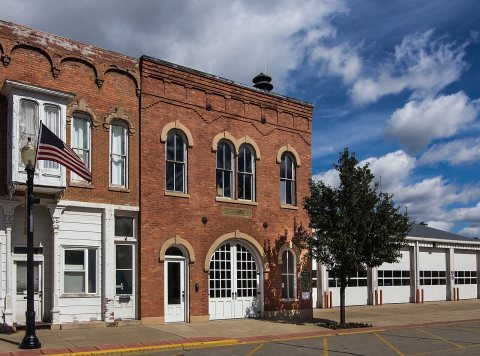
2 places in town are on the National Register, among them a historic district with 186 buildings. Below: 1 old photo or paper, maps from 1948 on, and the census since 1870.
Founding year: Wikidata. First post office: 1834.The full story ↓
History grade
What drives Homer Township’s History grade
On its age, its old homes and the National Register, Homer Township is more historic than 98% of U.S. towns, #10 of 701 in Michigan. All 3 inputs are above most U.S. towns; its National Register listings ranks highest and its age lowest.
A+
HistoryA character grade: shown, never part of Homer Township’s overall grade.
Few Michigan towns list much on the Register (a typical Michigan town has 0.0 per 10,000 residents, the U.S. 2.4), so Homer Township’s 644 sits above most of its state (99% of Michigan towns have fewer) while its 187 historic buildings outnumber those of 93% of U.S. towns.
How sure. Graded on any two of the three inputs instead, the letter would range from A to A+. The pre-1940 share is a Census survey estimate (±8.4 points). Two sources give 1832.
Founding year: Wikidata (other dates in Quick answers). Homes: Census ACS 2020–24. National Register: National Park Service, May 2026 list; each listing counted once (boundary changes and added documentation belong to their listing), and a historic district counts its contributing buildings. How TownRatings grades history →
What stands out about Homer Township’s past
Read from the archive, the National Register and the record. The page puts what stands out first.
Milton Barney arrived from Lyons, New York the summer of 1832 to scout the area and returned that September with his family and workmen to settle on the south bank of the Kalamazoo River in Section 5. Soon after Barney hired Osha Wilder to layout the plat for the village of Barneyville on the SW corner of Section 5, SE corner of Section 6, NE corner of Section 7, and NW corner of Section 8. For more a detailed history of the surrounding area see the entry for Homer Township and Clarendon Township.
Nothing in the archives for these yearsWeddings on Main Street, storms, parades, school pictures, the old store. If it’s in your family album, it belongs here.
Every edition of the U.S. Geological Survey’s map of Homer Township. Tap a year, or press play to watch the town change.
1948Homer sheet · 1:62,500
U.S. Geological Survey historical topographic maps (public domain), via Esri’s collection of the scans. The red ring marks the center of Homer Township.
Then & now
Stand where they stood
No then-and-now pairs yet. Take a photo from the same spot as an old one and they appear here side by side.
Retake this viewDAR (1917) - Charity Cook Chapter, 1918
Find the spot, match the angle, and add your photo. It becomes the first then-and-now pair on Homer Township’s page.
In 1832, according to Wikidata. Homer Township’s post office opened in 1834, and the census of 1870 counted 685 people here.
How does Homer Township rank for history?
Homer Township is more historic than 98% of U.S. towns, #10 of 701 in Michigan. The History grade combines the town’s founding era, the share of homes built before 1940 and its National Register listings. It’s a character grade, so it isn’t part of the overall grade. How it works.
What is on the National Register in Homer Township?
Two places: the Homer Village Historic District (listed 1996) and the Cortright-Van Patten Mill (1979).
How old are the homes in Homer Township?
39% of Homer Township’s homes were built before 1940 (Census estimate, ±8.4 points), against a typical 12% for a Michigan town; the median home was built in 1957.
Founding dates: Wikidata, Wikipedia, the U.S. post office records of Blevins & Helbock (CC0) and the Census. Homes by year built: Census ACS 2020–24. National Register of Historic Places: National Park Service (list of May 22, 2026). Old photos, postcards and papers: Wikimedia Commons, the Library of Congress and other public archives, credited on each item’s page. Maps: U.S. Geological Survey historical topographic maps (via Esri) and Sanborn fire-insurance maps (Library of Congress). History text and census tables: Wikipedia (CC BY-SA 4.0). Places that used to be: USGS Geographic Names Information System (2021).
From Wikimedia Commons (5), Wikidata (1), the National Register of Historic Places (2), Wikipedia, U.S. Geological Survey historical maps, U.S. Census counts (via Wikipedia), the US Post Offices dataset (Blevins & Helbock) and the USGS Geographic Names Information System. Archive images are copied here with their credits and licenses, shown on each photo’s page. Refreshed monthly.


 2019
 2018
 2016
 2005

