Most of Hancock Township was built recently: 5% of its homes predate 1940 and the median home dates from 1990. Below: 17 old photos and papers, maps from 1915 on, and the census since 1880.
Nothing in the archives for these yearsWeddings on Main Street, storms, parades, school pictures, the old store. If it’s in your family album, it belongs here.
Peaked at 8,981 in 1910; 4,501 people lived here in 2020.
15 censuses, 1880–2020.
U.S. Census Bureau decennial counts, from the census table on Hancock Township’s Wikipedia page.
On the map
Hancock Township on the map, 1915 to 1975
Every edition of the U.S. Geological Survey’s map of Hancock Township. Tap a year, or press play to watch the town change.
1915Houghton sheet · 1:62,500
U.S. Geological Survey historical topographic maps (public domain), via Esri’s collection of the scans. The red ring marks the center of Hancock Township.
Hancock is located within Ojibwa (Chippewa) homelands and ceded-territory established by the Treaty of 1842. The founding of the settlement of Hancock began during the summers of 1847 and 1848, when a small group of prospectors laboring on a rugged hillside (later named Quincy Hill) discovered a sequence of prehistoric Ojibwe copper mining pits, stretching out for 100 feet along the local amygdaloid lode. Upon inspecting one, they realized that the Native Americans were able to take copper in small quantities through these pits. The discovery formed the basis upon which the Quincy Mining Company was created in October 1848, under a special charter granted by the legislature.
Founding dates: Wikidata, Wikipedia, the U.S. post office records of Blevins & Helbock (CC0) and the Census. Homes by year built: Census ACS 2020–24. National Register of Historic Places: National Park Service (list of May 22, 2026). Old photos, postcards and papers: Wikimedia Commons, the Library of Congress and other public archives, credited on each item’s page. Maps: U.S. Geological Survey historical topographic maps (via Esri) and Sanborn fire-insurance maps (Library of Congress). History text and census tables: Wikipedia (CC BY-SA 4.0). Places that used to be: USGS Geographic Names Information System (2021). How TownRatings grades history →
From Wikimedia Commons (8), the Library of Congress (9), Wikipedia, U.S. Geological Survey historical maps, U.S. Census counts (via Wikipedia) and the USGS Geographic Names Information System. Archive images are copied here with their credits and licenses, shown on each photo’s page. Refreshed monthly.


 1898
 1898
 1900
 1900
 1900
 1900
 1900
 c. 1906
 c. 1906
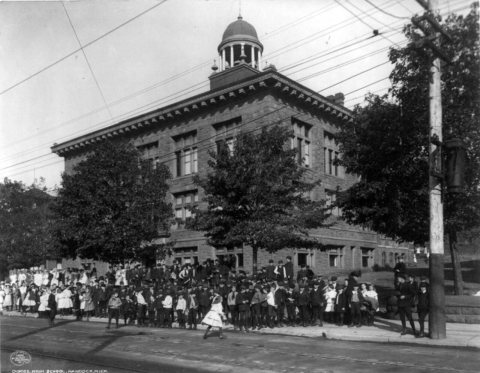 1906
 c. 1906
 c. 1906
 1906
 1906
 1906
 1906
 1906


