Founding year: Wikipedia. First post office: 1871.The full story ↓
History grade
What drives Essexville’s History grade
On its age, its old homes and the National Register, Essexville is more historic than 46% of U.S. towns, #402 of 701 in Michigan. Its share of homes from before 1940 holds the grade up; its National Register listings pull it down.
B−
HistoryA character grade: shown, never part of Essexville’s overall grade.
Few Michigan towns list much on the Register (a typical Michigan town has 0.0 per 10,000 residents, the U.S. 2.4), so Essexville’s 0.0 sits below most of its state (32% of Michigan towns have fewer) while its 0 listings outnumber those of 23% of U.S. towns.
How sure. Graded on any two of the three inputs instead, the letter would range from C to B. The pre-1940 share is a Census survey estimate (±8.5 points). Two sources give 1867.
Founding year: Wikipedia (other dates in Quick answers). Homes: Census ACS 2020–24. National Register: National Park Service, May 2026 list; each listing counted once (boundary changes and added documentation belong to their listing), and a historic district counts its contributing buildings. How TownRatings grades history →
What stands out about Essexville’s past
Read from the archive, the National Register and the record. The page puts what stands out first.
Essexville is named after Ransom P. Essex, a local settler. It was first platted in 1867. The Essexville Post Office
opened on Feb 27, 1871. The Post Office was closed from January 20 to February 24, 1879. It was incorporated as a village in 1883 within Hampton Township and as a city in 1934.
Passages that mention Essexville, cut from the printed page as they were published.
History of Bay County, Michigan1905 · page 200Read the page →
Read the text
On June 21, 1887, the Legislature passed an act to unite Bay City, West Bay City and the village of Essexville, the union to take place in 1 89 1, and provisions were made for a charter committee, representing all three corporations, which was to draft the consolidation charter, and submit it to the Legislature of 1889 for action. The politicians managed to
Text read by machine from the scan; it may contain errors.
History of Bay County, Michigan1905 · page 155Read the page →
Read the text
Essexville has for years had the post office of Hampton township. Although rural free delivery has in recent years provided a more speedy and modern mail service, still the post office continues to do a prosperous business for "Uncle Sam," under the able management of Dr. E. F. Crummer.
Text read by machine from the scan; it may contain errors.
Scans and text from the Internet Archive. Books published in 1930 or earlier, which are in the public domain.
Timeline
Essexville, 1867 to 1970
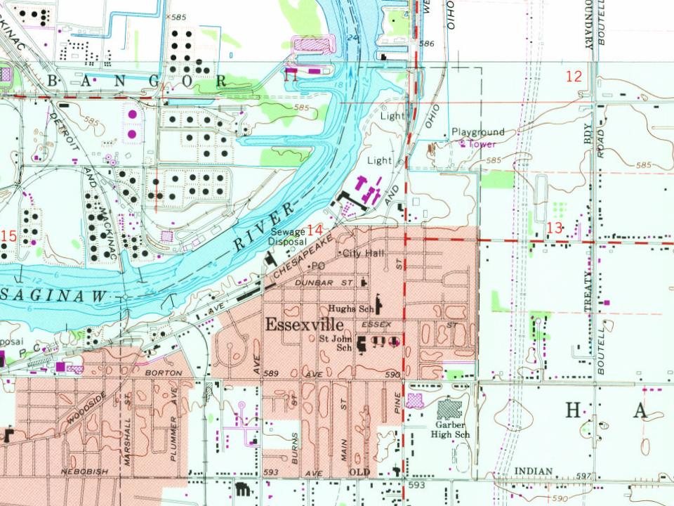
Woven from the archive, old maps, post office records, the National Register and the people born here.
Nothing in the archives for these yearsWeddings on Main Street, storms, parades, school pictures, the old store. If it’s in your family album, it belongs here.
In 1867, according to Wikipedia’s history of the town. Essexville’s post office opened in 1871, and the census of 1890 counted 1,545 people here.
How does Essexville rank for history?
Essexville is more historic than 46% of U.S. towns, #402 of 701 in Michigan. The History grade combines the town’s founding era, the share of homes built before 1940 and its National Register listings. It’s a character grade, so it isn’t part of the overall grade. How it works.
How old are the homes in Essexville?
24% of Essexville’s homes were built before 1940 (Census estimate, ±8.5 points), against a typical 12% for a Michigan town; the median home was built in 1952.
Founding dates: Wikidata, Wikipedia, the U.S. post office records of Blevins & Helbock (CC0) and the Census. Homes by year built: Census ACS 2020–24. National Register of Historic Places: National Park Service (list of May 22, 2026). Old photos, postcards and papers: Wikimedia Commons, the Library of Congress and other public archives, credited on each item’s page. Maps: U.S. Geological Survey historical topographic maps (via Esri) and Sanborn fire-insurance maps (Library of Congress). History text and census tables: Wikipedia (CC BY-SA 4.0). Places that used to be: USGS Geographic Names Information System (2021).
From Wikimedia Commons (3), Wikipedia, Wikidata and Wikipedia for famous people, U.S. Geological Survey historical maps, U.S. Census counts (via Wikipedia), the US Post Offices dataset (Blevins & Helbock), the USGS Geographic Names Information System and old county and town histories (Internet Archive). Archive images are copied here with their credits and licenses, shown on each photo’s page. Refreshed monthly.




 Date?
 2005