Dowagiac’s post office opened in 1848, and 35% of its homes were built before 1940
More historic than 90% of U.S. towns · #62 of 701 in Michigan. What drives it
Its Register listings are the Michigan Central Railroad Dowagiac Depot and the Criffield-Whiteley House. Below: 6 old photos and papers, maps from 1884 on, and the census since 1860.
Founding year: the first Dowagiac post office (Blevins & Helbock, CC0).The full story ↓
History grade
What drives Dowagiac’s History grade
On its age, its old homes and the National Register, Dowagiac is more historic than 90% of U.S. towns, #62 of 701 in Michigan. All 3 inputs are above most U.S. towns; its share of homes from before 1940 ranks highest and its National Register listings lowest.
A
HistoryA character grade: shown, never part of Dowagiac’s overall grade.
Few Michigan towns list much on the Register (a typical Michigan town has 0.0 per 10,000 residents, the U.S. 2.4), so Dowagiac’s 3.5 sits above most of its state (73% of Michigan towns have fewer) while its 2 listings outnumber those of 60% of U.S. towns.
How sure. Graded on any two of the three inputs instead, the letter would range from A− to A. The pre-1940 share is a Census survey estimate (±6.1 points). The founding year is the first post office, not a stated founding date.
Founding year: the first post office (other dates in Quick answers). Homes: Census ACS 2020–24. National Register: National Park Service, May 2026 list; each listing counted once (boundary changes and added documentation belong to their listing), and a historic district counts its contributing buildings. How TownRatings grades history →
What stands out about Dowagiac’s past
Read from the archive, the National Register and the record. The page puts what stands out first.
Fire insurance maps drew every building, what it was made of and what it was used for, so insurers could price the risk of fire. Pick a year, then a sheet.
Passages that mention Dowagiac, cut from the printed page as they were published.
History of Cass county, Michigan1882 · page 182Read the page →
Read the text
for the Michigan Central Railroad from Kalamazoo to Niles. As soon as it was decided to locate one of the stations of the line at the point now known as Dowagiac, he associated with himself Jacob Beeson, of Niles, and they together purchased from Patrick Hamilton (of whom we shall have much to say in this chapter) a tract of land consisting of eighty acres in the northeastern corner of the Township of Pokagon.
Text read by machine from the scan; it may contain errors.
A twentieth century history of Cass County, Michigan1906 · page 155Read the page →
Read the text
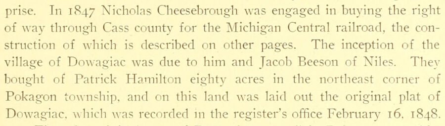
prise. In I1S47 Nicholas Cheesebroi.igh was engaged in buying the right of way through Cass county for the Michigan Central railroad, the construction of which is described on other pages. The inception of the village of Dowagiac was due to him and Jacob Beeson of Niles. They bought of Patrick Hamilton eightv acres in the northeast corner of Pokagon township, and on this land was laid out the original plat of Dowagiac. which was recorded ui the register's office Febrtiary 16. 1848.
Text read by machine from the scan; it may contain errors.
Dowagiac is commercially one of the most important stations on the Michigan Central Railroad. Its shipments have in some years exceeded those of any other point on the line. The amount of business transacted at this station in 1878, the last year for which the statistics are available, is set forth in the following : FREIGHT FOHWARUED AND RECEIVED. pounds.
Text read by machine from the scan; it may contain errors.
A twentieth century history of Cass County, Michigan1906 · page 193Read the page →
Read the text
As elsewhere stated, the milling interests are the ijldest institutions of Dowagiac. William Renniston ha\ing built a carding mill in 1830, and a few years later a grist mill on the creek near the Cnlby Company's present mill, on the northeast corner of section six in LaGrange township, where the Cassopolis and Dowagiac road crosses a branch of the Dowagiac creek on the mill dam. After being owned by several parties, this property was sold by Erastus H. Spalding in 1868 to Mr.
Text read by machine from the scan; it may contain errors.
Scans and text from the Internet Archive. Books published in 1930 or earlier, which are in the public domain.
By decade
Dowagiac, decade by decade
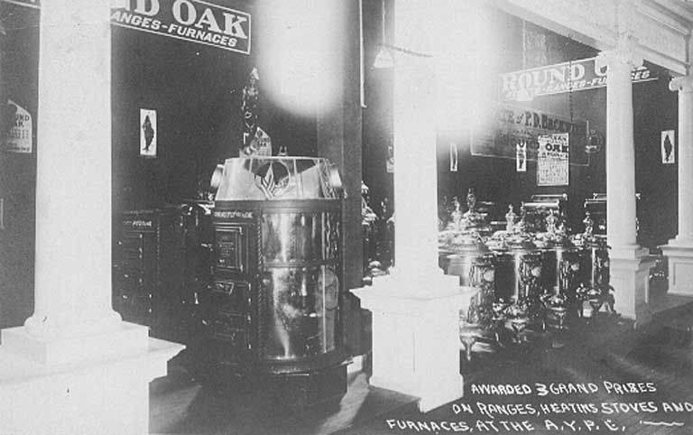
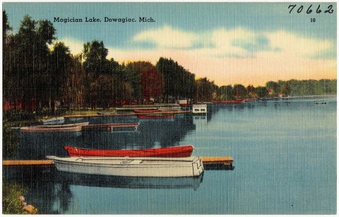
3 decades in the archive, from the 1880s to the 1930s. Scroll each row; tap a photo for its story.
Nothing in the archives for these yearsWeddings on Main Street, storms, parades, school pictures, the old store. If it’s in your family album, it belongs here.
The Dowagiac post office opened in 1848, the earliest record of the town by name (U.S. post office records).
How does Dowagiac rank for history?
Dowagiac is more historic than 90% of U.S. towns, #62 of 701 in Michigan. The History grade combines the town’s founding era, the share of homes built before 1940 and its National Register listings. It’s a character grade, so it isn’t part of the overall grade. How it works.
What is on the National Register in Dowagiac?
Two places: the Michigan Central Railroad Dowagiac Depot (listed 1993) and the Criffield-Whiteley House (2016).
How old are the homes in Dowagiac?
35% of Dowagiac’s homes were built before 1940 (Census estimate, ±6.1 points), against a typical 12% for a Michigan town; the median home was built in 1950.
Founding dates: Wikidata, Wikipedia, the U.S. post office records of Blevins & Helbock (CC0) and the Census. Homes by year built: Census ACS 2020–24. National Register of Historic Places: National Park Service (list of May 22, 2026). Old photos, postcards and papers: Wikimedia Commons, the Library of Congress and other public archives, credited on each item’s page. Maps: U.S. Geological Survey historical topographic maps (via Esri) and Sanborn fire-insurance maps (Library of Congress). History text and census tables: Wikipedia (CC BY-SA 4.0). Places that used to be: USGS Geographic Names Information System (2021).
From Wikimedia Commons (18), the National Register of Historic Places (2), Wikipedia, Wikidata and Wikipedia for famous people, U.S. Geological Survey historical maps, U.S. Census counts (via Wikipedia), the US Post Offices dataset (Blevins & Helbock), the USGS Geographic Names Information System, Sanborn fire insurance maps (Library of Congress) and old county and town histories (Internet Archive). Archive images are copied here with their credits and licenses, shown on each photo’s page. Refreshed monthly.







 c. 1930
 c. 1930
 c. 1930
 2020
 2020
 2017
 2017
 2016
 2016
 2016
 2016
 2013
 2012
 2009
 2005


