Founding year: Wikidata. First post office: 1846.The full story ↓
History grade
What drives Chesaning’s History grade
On its age, its old homes and the National Register, Chesaning is more historic than 72% of U.S. towns. Its share of homes from before 1940 holds the grade up; its National Register listings pull it down.
B+
HistoryA character grade: shown, never part of Chesaning’s overall grade.
Few Michigan towns list much on the Register (a typical Michigan town has 0.0 per 10,000 residents, the U.S. 2.4), so Chesaning’s 0.0 sits below most of its state (32% of Michigan towns have fewer) while its 0 listings outnumber those of 23% of U.S. towns.
How sure. Graded on any two of the three inputs instead, the letter would range from B− to A. The pre-1940 share is a Census survey estimate (±8.7 points). Two sources give 1842.
Founding year: Wikidata (other dates in Quick answers). Homes: Census ACS 2020–24. National Register: National Park Service, May 2026 list; each listing counted once (boundary changes and added documentation belong to their listing), and a historic district counts its contributing buildings. How TownRatings grades history →
What stands out about Chesaning’s past
Read from the archive, the National Register and the record. The page puts what stands out first.
Fire insurance maps drew every building, what it was made of and what it was used for, so insurers could price the risk of fire. Pick a year, then a sheet.
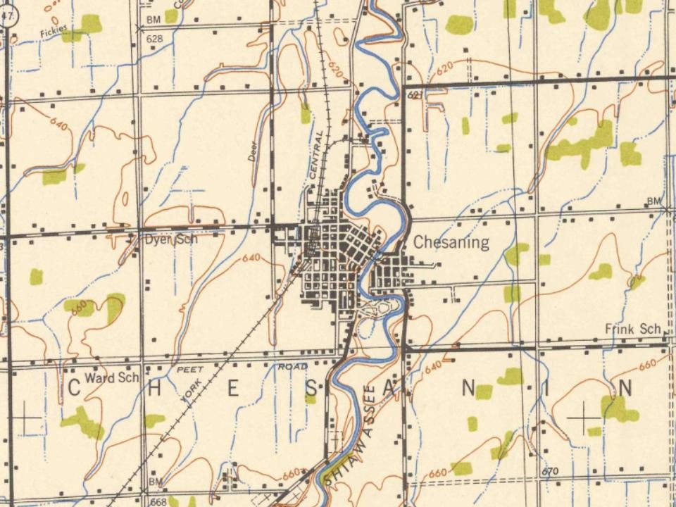
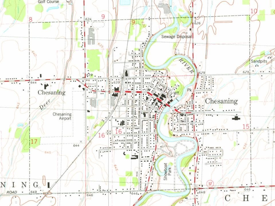
The first mention of Chesaning in the written pages of history is the Saginaw Treaty, signed in 1819. This treaty was between members of the Saginaw Tribe, Chippewa Indians, and the government of the United States. They established a number of reservations, including 10,000 acres (40 km2) along the banks of the Shiawassee River known as "Big Rock Reserve." Chesaning is a Chippewa word meaning "big rock place". The treaty continued in effect until 1837 when a second treaty led to the reserve being surveyed and offered for sale in 1841. The first land was sold at $5 per acre to brothers Wellington and George W. Chapman, and Rufus Mason. After making their land purchase, they traveled back to Massachusetts and moved their families to their new wilderness home by late summer of 1842.
Passages that mention Chesaning, cut from the printed page as they were published.
History of Saginaw County, Michigan1881 · page 830Read the page →
Read the text
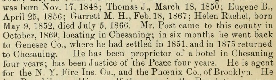
was born Nov. 17, 1848; Thomas J., March 18, 1850; Eugene B., April 25, 1856; Garrett M. H., Feb. 18, 1867; Helen Rachel, born May 9, 1852, died July 5, 1866. Mr. Post came to this county in October, 1869, locating in Chesaning; in six months he went back to Genesee Co., where he had settled in 1851, and in 1875 returned to Chesaning. He has been proprietor of a hotel in Chesaning four years; has been Justice of the Peace four years. He is agent for the N. Y. Fire Ins. Co., and the Phoenix Co., of Brooklyn. He
Text read by machine from the scan; it may contain errors.
History of Saginaw County, Michigan1881 · page 830Read the page →
Read the text
was born Nov. 17, 1848; Thomas J., March 18, 1850; Eugene B., April 25, 1856; Garrett M. H., Feb. 18, 1867; Helen Rachel, born May 9, 1852, died July 5, 1866. Mr. Post came to this county in October, 1869, locating in Chesaning; in six months he went back to Genesee Co., where he had settled in 1851, and in 1875 returned to Chesaning. He has been proprietor of a hotel in Chesaning four years; has been Justice of the Peace four years. He is agent for the N. Y. Fire Ins. Co., and the Phoenix Co., of Brooklyn. Pie
Text read by machine from the scan; it may contain errors.
History of Saginaw County, Michigan1881 · page 800Read the page →
Read the text
The beautiful village of Chesaning is situated near the center of the township, is 21 miles by railroad from the county-seat, and 14 miles north of Owosso. It contains a population of nearly 900.
Text read by machine from the scan; it may contain errors.
History of Saginaw County, Michigan1881 · page 795Read the page →
Read the text
election was held in April of that year, at which time Wm. Smith was elected Supervisor and Justice of the Peace; Rufus P. Mason, Clerk; and L. Stevens, Treasurer. In 1853 the name of the township of Northampton was changed to " Chesaning," an Indian word signifying "Big Rock." Jan. 10, 1856, township 9 north, ranges 1 and 2 east, was set of by the Board of Supervisors and called Brady township, and Jan. 1, 1857, township 9 north, range 4 east, was set off and named Maple Grove township. So that now
Text read by machine from the scan; it may contain errors.
Scans and text from the Internet Archive. Books published in 1930 or earlier, which are in the public domain.
In 1842, according to Wikidata. Chesaning’s post office opened in 1846, and the census of 1870 counted 721 people here.
How does Chesaning rank for history?
Chesaning is more historic than 72% of U.S. towns. The History grade combines the town’s founding era, the share of homes built before 1940 and its National Register listings. It’s a character grade, so it isn’t part of the overall grade. How it works.
How old are the homes in Chesaning?
30% of Chesaning’s homes were built before 1940 (Census estimate, ±8.7 points), against a typical 12% for a Michigan town; the median home was built in 1957.
Founding dates: Wikidata, Wikipedia, the U.S. post office records of Blevins & Helbock (CC0) and the Census. Homes by year built: Census ACS 2020–24. National Register of Historic Places: National Park Service (list of May 22, 2026). Old photos, postcards and papers: Wikimedia Commons, the Library of Congress and other public archives, credited on each item’s page. Maps: U.S. Geological Survey historical topographic maps (via Esri) and Sanborn fire-insurance maps (Library of Congress). History text and census tables: Wikipedia (CC BY-SA 4.0). Places that used to be: USGS Geographic Names Information System (2021).
From Wikimedia Commons (4), the Library of Congress (1), Wikipedia, U.S. Geological Survey historical maps, U.S. Census counts (via Wikipedia), Sanborn fire insurance maps (Library of Congress) and old county and town histories (Internet Archive). Archive images are copied here with their credits and licenses, shown on each photo’s page. Refreshed monthly.





 Date?
 2019
 2019
 2019
 2009


