Battle Creek dates to 1831, and 30% of its homes were built before 1940
More historic than 96% of U.S. towns · #28 of 701 in Michigan. What drives it
16 places in town are on the National Register, among them four historic districts with 247 buildings between them. Below: 3 old photos and papers, maps from 1887 on, and the census since 1840.
Founding year: Wikidata. First post office: 1832.The full story ↓
History grade
What drives Battle Creek’s History grade
On its age, its old homes and the National Register, Battle Creek is more historic than 96% of U.S. towns, #28 of 701 in Michigan. All 3 inputs are above most U.S. towns; its National Register listings ranks highest and its age lowest.
A+
HistoryA character grade: shown, never part of Battle Creek’s overall grade.
Few Michigan towns list much on the Register (a typical Michigan town has 0.0 per 10,000 residents, the U.S. 2.4), so Battle Creek’s 55.2 sits above most of its state (91% of Michigan towns have fewer) while its 289 historic buildings outnumber those of 95% of U.S. towns.
How sure. Graded on any two of the three inputs instead, the letter would range from A to A+. The pre-1940 share (±2.1 points) is firm at this size. Two sources give 1831.
Founding year: Wikidata (other dates in Quick answers). Homes: Census ACS 2020–24. National Register: National Park Service, May 2026 list; each listing counted once (boundary changes and added documentation belong to their listing), and a historic district counts its contributing buildings. How TownRatings grades history →
What stands out about Battle Creek’s past
Read from the archive, the National Register and the record. The page puts what stands out first.
In about 1774, the Potawatomi and the Ottawa Native American tribes formed a joint village near the future Battle Creek, Michigan. The first permanent European settlements in Battle Creek Township, after the removal of the Potawatomi to a reservation, began about 1831. Westward migration from New York and New England had increased to Michigan following the completion of the Erie Canal in New York in 1824. Most settlers chose to locate on the Goguac prairie, which was fertile and easily cultivated. A post office was opened in Battle Creek in 1832 under Postmaster Pollodore Hudson. The first school was taught in a small log house about 1833 or 1834. Asa Langley and several workers (Adrian Godbey, Jackson Morgan, Ethan baker, etc.) built the first sawmill in 1837. A brick manufacturing plant, called the oldest enterprise in the township, was established in 1840 by Simon Carr and operated u…
fire aepartment. Battle Creek, 321; mills mill inamifiicturing establishments of Battle Creek, 1861. 323; oldest building in Battle Creek, 334; rural mail carriers, Battle Creek, 327; new high school. Battle Creek, 329; old Brooks mansion, 340; Willard library.
Text read by machine from the scan; it may contain errors.
History of Calhoun county, Michigan1913 · page 183Read the page →
Read the text
In 1836 the village of Verona was surveyed and laid out by General Ezra Convis. It holds (juite an important history of this vicinity as having been for two or three years a rival of the then strugging village of Battle Creek. It has even been asserted that had General Convis lived. and brought his interest as a member and speaker of the House of Representatives to bear, the terminus of the railroad would have been there instead of at Battle Creek and it would have stood now as a city instead of a mere hamlet.
Text read by machine from the scan; it may contain errors.
Dairy supplies come from known and carefully inspected sources. The finest fruits, fresh and preserved, are served at every meal. In addition to these there is a long list of special foods for which Battle Creek is famous. The toasted wheat flakes, corn flakes and rice flakes first prepared at Battle Creek, are now familiar on breakfast tables everywhere.
Text read by machine from the scan; it may contain errors.
Scans and text from the Internet Archive. Books published in 1930 or earlier, which are in the public domain.
Timeline
Battle Creek, 1831 to 1970
Woven from the archive, old maps, post office records, the National Register and the people born here.
Nothing in the archives for these yearsWeddings on Main Street, storms, parades, school pictures, the old store. If it’s in your family album, it belongs here.
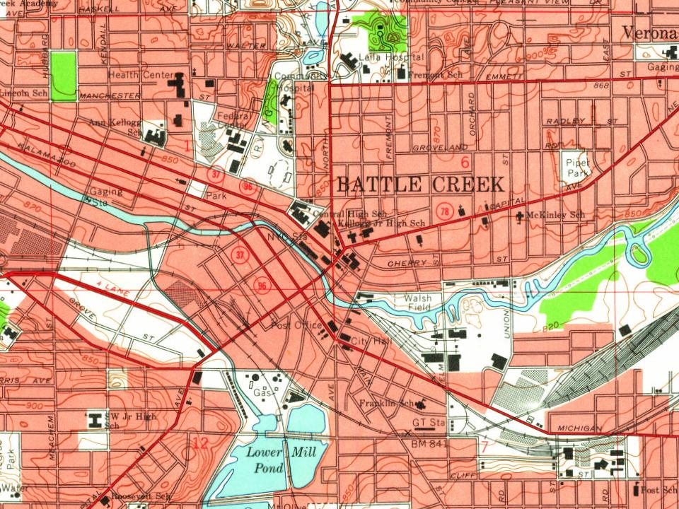
Every edition of the U.S. Geological Survey’s map of Battle Creek. Tap a year, or press play to watch the town change.
1918Battle Creek sheet · 1:62,500
U.S. Geological Survey historical topographic maps (public domain), via Esri’s collection of the scans. The red ring marks the center of Battle Creek.
Every building
Battle Creek, building by building, 1887–1919
Fire insurance maps drew every building, what it was made of and what it was used for, so insurers could price the risk of fire. Pick a year, then a sheet.
In 1831, according to Wikidata. Battle Creek’s post office opened in 1832, and the census of 1840 counted 993 people here.
How does Battle Creek rank for history?
Battle Creek is more historic than 96% of U.S. towns, #28 of 701 in Michigan. The History grade combines the town’s founding era, the share of homes built before 1940 and its National Register listings. It’s a character grade, so it isn’t part of the overall grade. How it works.
What is on the National Register in Battle Creek?
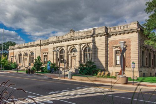
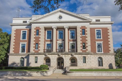
16 listings: 12 buildings, among them the Penn Central Railway Station (listed 1971, the first), and 4 historic districts with 247 contributing buildings. 289 historic buildings in all.
How old are the homes in Battle Creek?
30% of Battle Creek’s homes were built before 1940 (Census estimate, ±2.1 points), against a typical 12% for a Michigan town; the median home was built in 1956.
Founding dates: Wikidata, Wikipedia, the U.S. post office records of Blevins & Helbock (CC0) and the Census. Homes by year built: Census ACS 2020–24. National Register of Historic Places: National Park Service (list of May 22, 2026). Old photos, postcards and papers: Wikimedia Commons, the Library of Congress and other public archives, credited on each item’s page. Maps: U.S. Geological Survey historical topographic maps (via Esri) and Sanborn fire-insurance maps (Library of Congress). History text and census tables: Wikipedia (CC BY-SA 4.0). Places that used to be: USGS Geographic Names Information System (2021).
From Wikimedia Commons (3), Wikidata (3), the National Register of Historic Places (16), Wikipedia, Wikidata and Wikipedia for famous people, U.S. Geological Survey historical maps, U.S. Census counts (via Wikipedia), the US Post Offices dataset (Blevins & Helbock), the USGS Geographic Names Information System, Sanborn fire insurance maps (Library of Congress) and old county and town histories (Internet Archive). Archive images are copied here with their credits and licenses, shown on each photo’s page. Refreshed monthly.








 1895