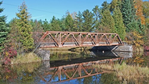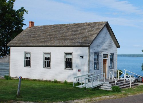
183 years in pictures
Census counts: 1,185 in 1900, 1,883 in 2020. The archive holds 15 old photos and papers going back to 1941 and 2 maps from 1954 on.
3 places on the National Register of Historic Places.
- 1843Baraga Township is settled
Each edition grades its towns against each other only.

Baraga Township gives you more for your money than most places: homes are within reach, about $133K for a typical one, or 2.4 years of the county’s $55K median household income. It grades C− overall, 590th of 697 graded towns in Michigan. The low prices come with trade-offs. CDC estimates put its residents' health behind 90% of the country, and the median household income is $52K, and 16% of residents live below the poverty line. On the plus side, it has 255 miles of trail and 27% conserved land. 44% of working residents work locally in Baraga Township, above both the Michigan town median (5.9%) and the median of U.S. towns (8%). Baraga Plains Waterfowl Management Area, at 15,178 acres with 61.3 miles of trail, is the biggest park or preserve. Only 115 of Michigan’s 1,279 towns score higher on history.
Where Baraga Township beats most towns.
Where Baraga Township’s working residents go each day. Line width shows the share.
Census LEHD 2021
Each subject compared with towns across the country (schools within Michigan), ordered by how far Baraga Township is from typical.
How TownRatings grades towns →
Census counts: 1,185 in 1900, 1,883 in 2020. The archive holds 15 old photos and papers going back to 1941 and 2 maps from 1954 on.
3 places on the National Register of Historic Places.
Who provides power, water and the rest in Baraga Township, and how to reach them.
EPA SDWIS (Oct 9, 2026) · HIFLD + EIA-861 2025 · Census 2020 ZCTAs · NCES 2024–25 · registration: vote.gov, updated Sep 12, 2025.
Ordered by what stands out in Baraga Township.
Baraga Township draws workers from L'Anse Township and beyond and has a shorter frost-free season than nearly all U.S. towns, but it scores below L'Anse Township and its other neighbors on health.
255 miles of trail in 7 parks and preserves. The trail density in Baraga Township is 1.4 miles per square mile.
| Biggest places to walk | Trails | Acres |
|---|---|---|
| 1. Baraga Plains Waterfowl Management Area | 61.3 mi | 15,178 |
| 2. Ottawa National Forest - Ontonagon Ranger District | 57.5 mi | 17,007 |
| 3. Ottawa National Forest - Kenton Ranger District | 14.6 mi | 3,911 |
Trails & parks © OpenStreetMap contributors · Conserved land: USGS PAD-US
Each of its 3 graded neighbors has a higher School Grade than its C, Portage Township highest at A+.
Its public schools are run by the Baraga Area Schools. Two of its 3 schools are below, each with why it’s listed. The largest public high school is Baraga School, with 324 students.
| School | Level | Students | Letter |
|---|---|---|---|
| Pelkie Mennonite School PrivateLargest elementary schoolGrades 1–8 | Grades 1–8 | 23 | – |
| Baraga SchoolLargest public high schoolGrades K–12 | Grades K–12 | 324 | C |
NCES · EDFacts · graded within MI on state tests and graduation
1,663 jobs are based in Baraga Township, 1.7 for every working resident, so most of the people who work here commute in. The average commute takes 13.1 minutes, against 24.2 across Michigan.
Baraga Township’s average trip to work is 13 minutes. Jobs based in Baraga Township fell to 1,663 in 2021, 232 fewer than in 2011. 17% of Baraga Township residents live below the poverty line.
| Baraga Township | Michigan towns | U.S. towns | |
|---|---|---|---|
| Average trip to work | 13 minutes | 25 minutes | 25 minutes |
| Below the poverty line | 17% | 8.9% | 9.6% |
| Median household income | $52,000 | $77,000 | $80,000 |
Census LEHD 2021 · ACS
All 3 graded neighbors score healthier than its D, from L'Anse Township (C−) to Chassell Township (B+).
20% of adults smoke cigarettes in Baraga Township. Baraga Township beats the Michigan average on 0 of 32 CDC measures and trails it on 15. 17% of adults report frequent physical distress in Baraga Township.
| Baraga Township | Michigan towns | U.S. towns | |
|---|---|---|---|
| Smoke cigarettes (CDC PLACES) | 20% | 15% | 14% |
| Diabetes (CDC PLACES) | 15% | 12% | 12% |
| Frequent physical distress (CDC PLACES) | 17% | 14% | 14% |
| High blood pressure (CDC PLACES) | 42% | 36% | 35% |
| What stands out | Baraga Township | MI |
|---|---|---|
| More older adults who have lost all their teeth | 16.3% | 10.2% |
| More adults facing a utility shut-off | 12.2% | 8.7% |
| More smokers | 20.4% | 14.6% |
CDC PLACES 2025 · modeled estimates for adults · CMS · HRSA
Expected storm and flood damage is lower than in 74% of U.S. communities.
FEMA National Risk Index · OpenFEMA
The Watton 2wsw weather station, 15 miles away, records that the frost-free season runs about 123 days, shorter than in 97% of U.S. towns. The Watton 2wsw weather station, 15 miles away, records that 121 inches of snow fall in a normal winter, more than in 99% of U.S. towns.
Baraga Township has cold, snowy winters and pleasant summers. July afternoons reach 78° and January nights drop to 8°.
NOAA U.S. Climate Normals, 1991–2020
1 within 15 miles of the center of Baraga Township
About 3 of every 100 Baraga Township residents are enrolled in college, against 6 across Michigan.
26.8% of the town is conserved land, across 7 parks and preserves.
3 places in Baraga Township on the National Register of Historic Places.
Village in Michigan, United States
Baraga ( BAIR-ə-gə) is a village in Baraga County in the U.S. state of Michigan. The population was 1,883 at the 2020 census. The village is named after Bishop Frederic Baraga. The village is located in Baraga Township on the Keweenaw Bay on Lake Superior at the junction of US 41 and M-38. It is entirely within the boundaries of the L'Anse Indian Reservation. The Baraga ZIP code 49908 also serves areas of northern and northwestern Baraga Township.
From Wikipedia, licensed CC BY-SA 4.0 · facts via Wikidata (CC0)
5 towns share a border with Baraga Township.
| Town | MI rank | Overall | Cost | Safety | Schools | Health |
|---|---|---|---|---|---|---|
| Baraga Township | #590 | C− | A | — | C | D |
| L'Anse Township | #506 | C+ | A− | — | B | C− |
| Laird Township | — | — | — | — | — | — |
| Portage Township | #145 | A− | B− | — | A+ | B |
| Covington Township | — | — | — | — | — | — |
| Chassell Township | — | — | B− | — | B+ | B+ |
Chassell Township has fewer than 2,500 residents, so it gets subject grades but no overall grade. Baraga Township, L'Anse Township, Portage Township and Chassell Township report no FBI crime data of their own. Laird Township and Covington Township aren’t graded (fewer than 1,000 residents, or not enough data). Compare Baraga Township with a neighbor →
Short answers, built from the data on this page.
Baraga Township grades C− overall, better than 21% of U.S. towns and #590 of 697 in Michigan. It grades D for health and C for schools. Health is its weak spot, with a D.
Not for the area. Cost of living, which also weighs rents, property taxes and how many households pay 30% or more of their income for housing, grades A.