
Dane & Perkins Mill Site, c. 1908
West Kennebunk’s story
139 years in pictures
The archive holds 5 old photos and papers going back to 1908 and 4 maps from 1891 on.
- 1887West Kennebunk is settled
Each edition grades its towns against each other only.

Home to 1,395 people, the town was settled in 1887.
6.8% of residents are 65 or older in West Kennebunk, where Maine’s towns sit at 22% and U.S. towns at 18%. Only one of the 144 Maine towns we compare has a lower median age than West Kennebunk. West Kennebunk’s density of trails is 1.7 miles per square mile, against 0.7 in Maine’s towns and 0.4 across U.S. towns. We don’t grade West Kennebunk yet; the figures below are still real.
Where West Kennebunk beats most towns.
In a town this size, neighbors are the best guide. Ask them anything.
The archive holds 5 old photos and papers going back to 1908 and 4 maps from 1891 on.
West Kennebunk is unincorporated, so York County and regional agencies provide most services.
EPA SDWIS (Oct 9, 2026) · HIFLD + EIA-861 2025 · Census 2020 ZCTAs · NCES 2024–25 · registration: vote.gov, updated Aug 3, 2026.
Ordered by what stands out in West Kennebunk.
For West Kennebunk, the average trip to work is 31 minutes. Just 5% of the town’s working residents have a job in town. Employers in West Kennebunk added 268 jobs between 2013 and 2023, to 1,099. Only 5 of the 144 Maine towns we compare have a higher median household income than West Kennebunk.
| West Kennebunk | Maine towns | U.S. towns | |
|---|---|---|---|
| Median household income | $124,000 | $78,000 | $80,000 |
| Average trip to work | 31 minutes | 25 minutes | 25 minutes |
| Working residents who work in town | 5.5% | 12% | 8% |
| Below the poverty line | 7.1% | 9% | 9.6% |
Census LEHD 2023 · ACS
In West Kennebunk, the risk rating from FEMA is 19 of 100. Since 1978, 4 flood insurance claims have been paid out in the town. 43% of the town’s expected losses from natural hazards come from inland flooding, followed by hurricanes at 30%.
FEMA flood insurance claims · FEMA National Risk Index · OpenFEMA
The typical July afternoon high is 81°F.
NOAA U.S. Climate Normals, 1991–2020
Against the Maine average, West Kennebunk comes out ahead on 15 CDC measures out of 32, and behind on 1. In West Kennebunk, a quarter of adults have been diagnosed with depression. 12% of adults in West Kennebunk report frequent physical distress; 9% have diabetes.
| West Kennebunk | Maine towns | U.S. towns | |
|---|---|---|---|
| Sleep under 7 hours (CDC PLACES) | 30% | 33% | 36% |
| Frequent physical distress (CDC PLACES) | 12% | 14% | 14% |
| Diabetes (CDC PLACES) | 9% | 11% | 12% |
| Fair or poor health (CDC PLACES) | 15% | 19% | 19% |
| What stands out | West Kennebunk | ME |
|---|---|---|
| Fewer adults facing food insecurity | 7.1% | 10.7% |
| Fewer adults facing a utility shut-off | 5.3% | 7.4% |
| More binge drinkers | 18.2% | 15.5% |
CDC PLACES 2025 · modeled estimates for adults · CMS · HRSA
Count the trails in 1 park or preserve and they come to 5.8 miles. Parks and preserves in West Kennebunk: one, of 5 acres.
| Biggest places to walk | Trails | Acres |
|---|---|---|
| 1. West Kennebunk Field | — | 5 |
Trails & parks © OpenStreetMap contributors · Conserved land: USGS PAD-US
80% of West Kennebunk households live in a home they own. West Kennebunk’s midpoint rent comes in at $1,602 a month.
| West Kennebunk | Maine towns | U.S. towns | |
|---|---|---|---|
| Median rent | $1,602 a month | $1,106 a month | $1,185 a month |
| Households that own their home | 80% | 81% | 73% |
Census ACS, 2020–24 · Zillow Home Value Index · Redfin Data Center
Museums, parks, gardens and other places to visit around West Kennebunk. Close and well known come first.
 39 mi LakeLake Winnipesaukee
 24 mi LighthousePortland Head Light
 25 mi LandmarkFort Gorges
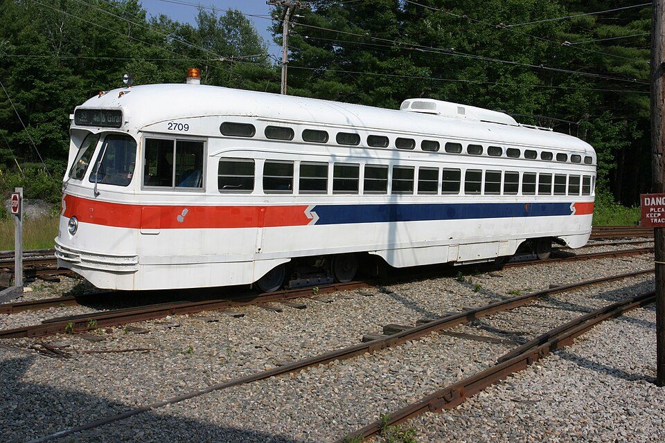 5 mi MuseumSeashore Trolley Museum
 17 mi LighthouseCape Neddick Light
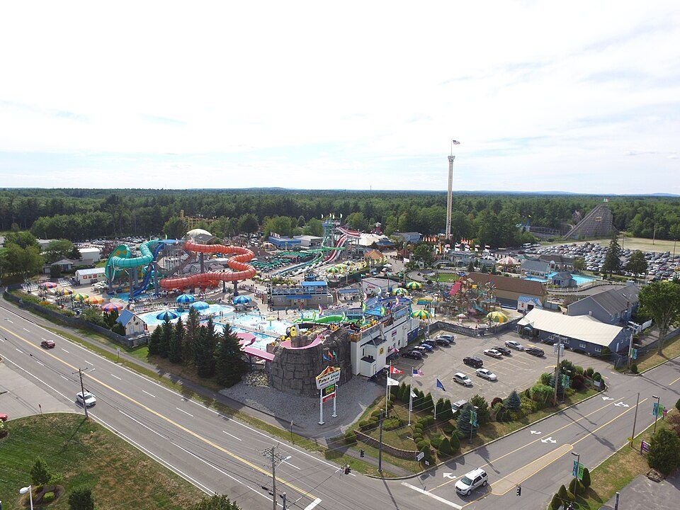 11 mi Theme parkFuntown Splashtown USA
Lake Winnipesaukee: No machine-readable author provided. JohnJHenderson~commonswiki assumed (based o, Public domain · Portland Head Light: Aniarku, CC BY-SA 3.0 · Fort Gorges: Dirk Ingo Franke, CC BY 3.0 · Seashore Trolley Museum: Rene Schwietzke from Jena, Germany, CC BY 2.0 · Cape Neddick Light: Stefan Hillebrand, CC BY-SA 3.0 · Funtown Splashtown USA: Paulec252, CC BY-SA 4.0
3 within 15 miles of the center of West Kennebunk
About 4 of every 100 West Kennebunk residents are enrolled in college, against 6 across Maine.
Where West Kennebunk’s working residents go each day. Line width shows the share.
Census LEHD 2023
Census-designated place in Maine, United States
West Kennebunk is a census-designated place (CDP) in the town of Kennebunk in York County, Maine, United States. As of the 2020 census, West Kennebunk had a population of 1,191. It is part of the Portland–South Portland–Biddeford, Maine Metropolitan Statistical Area.
From Wikipedia, licensed CC BY-SA 4.0 · facts via Wikidata (CC0)
Short answers, built from the data on this page.
We don’t grade West Kennebunk yet; the figures below are still real.


