4 places in town are on the National Register, among them a historic district with 8 buildings. Below: 11 old photos and papers, maps from 1901 on, and the census since 1910.
Founding year: Wikidata. First post office: 1827.The full story ↓
History grade
What drives Southwest Harbor’s History grade
On its age, its old homes and the National Register, Southwest Harbor is more historic than 93% of U.S. towns. All 3 inputs are above most U.S. towns; its age ranks highest and its share of homes from before 1940 lowest.
A
HistoryA character grade: shown, never part of Southwest Harbor’s overall grade.
Maine towns list more on the Register than most of the country (a typical Maine town has 15.9 per 10,000 residents, the U.S. 2.4), so Southwest Harbor’s 77.3 sits above most of its state (83% of Maine towns have fewer) while its 12 historic buildings outnumber those of 77% of U.S. towns.
NoteThe founding year comes from Wikidata alone; no second source gives 1761.
How sure. Graded on any two of the three inputs instead, the letter would range from A− to A+. The pre-1940 share is a Census survey estimate (±5.9 points).
Founding year: Wikidata (other dates in Quick answers). Homes: Census ACS 2020–24. National Register: National Park Service, May 2026 list; each listing counted once (boundary changes and added documentation belong to their listing), and a historic district counts its contributing buildings. How TownRatings grades history →
What stands out about Southwest Harbor’s past
Read from the archive, the National Register and the record. The page puts what stands out first.
Lost post offices, old corners and burying grounds
Southwest Harbor’s post office has been open since 1827. Two other post offices opened and closed inside today’s town.
Southwest Harbor
1827–today
Seawall
1882–1928
Manset
1893–1966
18201920today
Hamlets and corners on the map
MansetSeawallWonderland
11cemeteries and burying grounds inside Southwest Harbor
Clark FamilyDolliver FamilyEvergreenGilleyKingLurveyMoore FamilyMount HeightNewmanOldUnion
US Post Offices dataset (Blevins & Helbock, CC0). Places and cemeteries from the USGS Geographic Names Information System (2021).
On the map
Southwest Harbor on the map, 1904 to 1983
Every edition of the U.S. Geological Survey’s map of Southwest Harbor. Tap a year, or press play to watch the town change.
1904Mount Desert sheet · 1:62,500
U.S. Geological Survey historical topographic maps (public domain), via Esri’s collection of the scans. The red ring marks the center of Southwest Harbor.
Every building
Southwest Harbor, building by building, 1901–1921
Fire insurance maps drew every building, what it was made of and what it was used for, so insurers could price the risk of fire. Pick a year, then a sheet.
1901Sheet 1 of 1
Edition
Sheets
BrickWoodStone
Sanborn Map Company, via the Library of Congress. Editions published in 1930 or earlier, which are in the public domain.
Archaeological evidence indicates continuous Indigenous habitation of Mount Desert Island for thousands of years. The Wabanaki peoples, particularly the Penobscot and Passamaquoddy nations, called the island Pemetic, meaning "the sloping land." They seasonally traveled from the mainland to fish, hunt, and gather berries and shellfish in the Southwest Harbor area.
The first permanent European settlement on Mount Desert Island was established in 1761 when Abraham Somes, a cooper from Gloucester, Massachusetts, and James Richardson brought their families to the area. Somes obtained land grants from Francis Bernard, the royal governor of Massachusetts, and established Somesville at the northern end of Somes Sound.
Nothing in the archives for these yearsWeddings on Main Street, storms, parades, school pictures, the old store. If it’s in your family album, it belongs here.
Nothing in the archives for these yearsWeddings on Main Street, storms, parades, school pictures, the old store. If it’s in your family album, it belongs here.
In 1761, according to Wikidata. Southwest Harbor’s post office opened in 1827, and the census of 1910 counted 888 people here.
How does Southwest Harbor rank for history?
Southwest Harbor is more historic than 93% of U.S. towns. The History grade combines the town’s founding era, the share of homes built before 1940 and its National Register listings. It’s a character grade, so it isn’t part of the overall grade. How it works.
What is on the National Register in Southwest Harbor?
4 listings: 3 buildings, among them the Claremont Hotel (listed 1978, the first), and 1 historic district, the Seawall Campground, with 8 contributing buildings. 12 historic buildings in all.
How old are the homes in Southwest Harbor?
19% of Southwest Harbor’s homes were built before 1940 (Census estimate, ±5.9 points), against a typical 19% for a Maine town; the median home was built in 1982.
Founding dates: Wikidata, Wikipedia, the U.S. post office records of Blevins & Helbock (CC0) and the Census. Homes by year built: Census ACS 2020–24. National Register of Historic Places: National Park Service (list of May 22, 2026). Old photos, postcards and papers: Wikimedia Commons, the Library of Congress and other public archives, credited on each item’s page. Maps: U.S. Geological Survey historical topographic maps (via Esri) and Sanborn fire-insurance maps (Library of Congress). History text and census tables: Wikipedia (CC BY-SA 4.0). Places that used to be: USGS Geographic Names Information System (2021).
From Wikimedia Commons (21), the Library of Congress (8), the National Register of Historic Places (4), Wikipedia, U.S. Geological Survey historical maps, U.S. Census counts (via Wikipedia), the US Post Offices dataset (Blevins & Helbock), the USGS Geographic Names Information System and Sanborn fire insurance maps (Library of Congress). Archive images are copied here with their credits and licenses, shown on each photo’s page. Refreshed monthly.


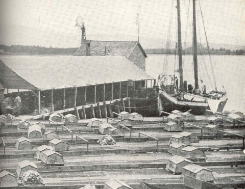


 1912
 1912
 1919
 1923
 1923
 1980
 1980
 2014
 2014
 2014
 2014
 2014
 2014
 2012
 2012
 2012
 2012
 2012
 2012
 2012
 2012
 2012
 2011
 2011
 2011


