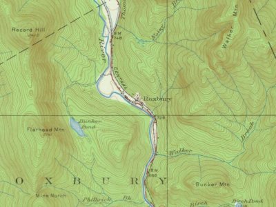
Most of Roxbury was built recently: 4% of its homes predate 1940 and the median home dates from 1969. Below: 1 old photo or paper, maps from 1927 on, and the census since 1830.
Originally known as Township No. 7, it was first settled about 1809. It was incorporated as a town on March 17, 1835, and named after Roxbury, Massachusetts. Farmers grew hay and raised livestock. Set on an intervale surrounded by the Western Maine Mountains, Roxbury was noted in the 19th century for abundant forests and mineral deposits. The Swift River falls provided water power for watermills, and industries included a sawmill, gristmill, shingle mill and shoe factory. In 1837, the population was 182. By 1859, it had grown to 246. The Rumford Falls & Rangeley Lakes Railroad was completed in 1896, carrying freight, tourists and "rusticators" up the Swift River valley through Roxbury to Mooselookmeguntic Lake.
Nothing in the archives for these yearsWeddings on Main Street, storms, parades, school pictures, the old store. If it’s in your family album, it belongs here.
In 1835, according to Wikidata and Wikipedia’s history of the town. Roxbury’s post office opened in 1849, and the census of 1830 counted 122 people here.
Founding dates: Wikidata, Wikipedia, the U.S. post office records of Blevins & Helbock (CC0) and the Census. Homes by year built: Census ACS 2020–24. National Register of Historic Places: National Park Service (list of May 22, 2026). Old photos, postcards and papers: Wikimedia Commons, the Library of Congress and other public archives, credited on each item’s page. Maps: U.S. Geological Survey historical topographic maps (via Esri) and Sanborn fire-insurance maps (Library of Congress). History text and census tables: Wikipedia (CC BY-SA 4.0). Places that used to be: USGS Geographic Names Information System (2021). How TownRatings grades history →
From Wikimedia Commons (2), Wikipedia, Wikidata and Wikipedia for famous people, U.S. Geological Survey historical maps, U.S. Census counts (via Wikipedia), the US Post Offices dataset (Blevins & Helbock) and the USGS Geographic Names Information System. Archive images are copied here with their credits and licenses, shown on each photo’s page. Refreshed monthly.


 2013


