Founding year: Wikidata; Wikipedia’s history section gives the same year. First post office: 1828.The full story ↓
History grade
What drives Rome’s History grade
On its age, its old homes and the National Register, Rome is more historic than 50% of U.S. towns. Its age holds the grade up; its National Register listings pull it down.
B−
HistoryA character grade: shown, never part of Rome’s overall grade.
Maine towns list more on the Register than most of the country (a typical Maine town has 15.9 per 10,000 residents, the U.S. 2.4), so Rome’s 0.0 sits below most of its state (10% of Maine towns have fewer) while its 0 listings outnumber those of 23% of U.S. towns.
How sure. Graded on any two of the three inputs instead, the letter would range from C to B+. The pre-1940 share is a Census survey estimate (±4.7 points). Two sources give 1804.
Founding year: Wikidata (other dates in Quick answers). Homes: Census ACS 2020–24. National Register: National Park Service, May 2026 list; each listing counted once (boundary changes and added documentation belong to their listing), and a historic district counts its contributing buildings. How TownRatings grades history →
What stands out about Rome’s past
Read from the archive, the National Register and the record. The page puts what stands out first.
Originally a part of West Pond Plantation, Rome was first settled about 1780 by Richard Furbush from Lebanon. The town was incorporated on March 7, 1804, and named after Rome in Italy. Although farmers found the surface broken and uneven, the hills and valleys offered excellent grazing. By 1839, when the population was 1,074, it was described as "a beautiful farming town," with "a pleasant and flourishing village." In 1837, its wheat crop was 4,117 bushels.
The ponds abounded in trout, perch and pickerel. By 1859, Rome had one sawmill, one gristmill, and one shingle mill, although agriculture remained the principal occupation. By 1870, when the population was 725, it had two post offices: Rome and Belgrade Mills.
Passages that mention Rome, cut from the printed page as they were published.
Illustrated history of Kennebec County, Maine1892 · page 988Read the page →
Read the text
THE town of Rome was incorporated from the plantation of West Pond, March 6, 1804, as the one hundred and fiftieth town in the province of Maine. It is situated twenty miles northwest from Augusta, with which it is connected by a daily stage running to New Sharon. It has seven times as many hills as the eternal city whose name it bears, and granite enough to rebuild the old Roman capital.
Text read by machine from the scan; it may contain errors.
Illustrated history of Kennebec County, Maine1892 · page 989Read the page →
Read the text
Stores. — Simon Robbins kept store merchandise in one corner of his grist mill and was probably the first trader in Rome. The first store at the Corner was built by Charles Whittier about 1840. He traded in it till it burned, when he built another. Amaziah Tracy
Text read by machine from the scan; it may contain errors.
Scans and text from the Internet Archive. Books published in 1930 or earlier, which are in the public domain.
Timeline
Rome, 1804 to 2020
Woven from the archive, old maps, post office records, the National Register and the people born here.
Nothing in the archives for these yearsWeddings on Main Street, storms, parades, school pictures, the old store. If it’s in your family album, it belongs here.
In 1804, according to Wikidata and Wikipedia’s history of the town. Rome’s post office opened in 1828, and the census of 1810 counted 585 people here.
How does Rome rank for history?
Rome is more historic than 50% of U.S. towns. The History grade combines the town’s founding era, the share of homes built before 1940 and its National Register listings. It’s a character grade, so it isn’t part of the overall grade. How it works.
How old are the homes in Rome?
14% of Rome’s homes were built before 1940 (Census estimate, ±4.7 points), against a typical 19% for a Maine town; the median home was built in 1986.
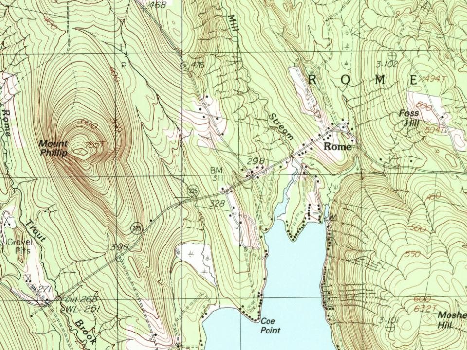
Founding dates: Wikidata, Wikipedia, the U.S. post office records of Blevins & Helbock (CC0) and the Census. Homes by year built: Census ACS 2020–24. National Register of Historic Places: National Park Service (list of May 22, 2026). Old photos, postcards and papers: Wikimedia Commons, the Library of Congress and other public archives, credited on each item’s page. Maps: U.S. Geological Survey historical topographic maps (via Esri) and Sanborn fire-insurance maps (Library of Congress). History text and census tables: Wikipedia (CC BY-SA 4.0). Places that used to be: USGS Geographic Names Information System (2021).
From Wikimedia Commons (4), Wikipedia, Wikidata and Wikipedia for famous people, U.S. Geological Survey historical maps, U.S. Census counts (via Wikipedia), the US Post Offices dataset (Blevins & Helbock), the USGS Geographic Names Information System and old county and town histories (Internet Archive). Archive images are copied here with their credits and licenses, shown on each photo’s page. Refreshed monthly.




 2022
 2022
 2022