148 years in pictures
Census counts: 202 in 2000, 234 in 2020. The archive holds 3 old photos and papers going back to 1930 and 5 maps from 1893 on.
- 1878Long Island is settled
Each edition grades its towns against each other only.
Long Island’s median rent is $2,194 a month, above both the Maine town median ($1,106 a month) and the median of U.S. towns ($1,185 a month). Among 144 Maine towns, just 10 have a higher January low than Long Island. The Conservation Area, at 116 acres with 2.2 miles of trail, is the biggest park or preserve. Long Island has fewer than 1,000 residents, too few for fair grades; the figures below are still real.
Coastal flooding makes up 36% of the storm damage FEMA expects here.
FEMA National Risk Index · OpenFEMA · OpenStreetMap
Census counts: 202 in 2000, 234 in 2020. The archive holds 3 old photos and papers going back to 1930 and 5 maps from 1893 on.
Museums, parks, gardens and other places to visit around Long Island. Close and well known come first.
5 mi LighthousePortland Head Light
4 mi LandmarkFort Gorges19 mi Ancient sitePopham Colony
5 mi MuseumMaine Narrow Gauge Railroad Museum
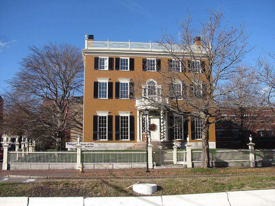
6 mi MuseumPortland Museum of Art18 mi LandmarkSpirit Pond runestonesPortland Head Light: Aniarku, CC BY-SA 3.0 · Fort Gorges: Dirk Ingo Franke, CC BY 3.0 · Maine Narrow Gauge Railroad Museum: No machine-readable author provided. Gwernol assumed (based on copyright claims), CC BY-SA 3.0 · Portland Museum of Art: John Phelan, CC BY 3.0
Who provides power, water and the rest in Long Island, and how to reach them.
EPA SDWIS (Oct 9, 2026) · HIFLD + EIA-861 2025 · Census 2020 ZCTAs · NCES 2024–25 · registration: vote.gov, updated Aug 3, 2026.
Ordered by what stands out in Long Island.
The typical Long Island home is worth about $637,000, up 5% in a year, 55% above the Maine typical home. 88% of Long Island households own their home, where Maine’s towns sit at 81% and U.S. towns at 73%.
Census ACS, 2020–24 · Zillow Home Value Index · Redfin Data Center
Its public schools are run by the Long Island Public Schools. Its one school is below.
| School | Level | Students | Letter |
|---|---|---|---|
| Long Island Elementary SchoolLargest public elementary schoolGrades K–5 | Grades K–5 | 8 | – |
NCES · EDFacts
Most working residents leave Long Island for work: only 5% work in town. Since 2013, Long Island has added 20 jobs, to 27 in 2023. 4.4% of residents live below the poverty line in Long Island.
| Long Island | Maine towns | U.S. towns | |
|---|---|---|---|
| Below the poverty line | 4.4% | 9% | 9.6% |
| Working residents who work in town | 5.2% | 12% | 8% |
| Median household income | $91,000 | $78,000 | $80,000 |
| Average trip to work | 27 minutes | 25 minutes | 25 minutes |
Census LEHD 2023 · ACS
Long Island has chilly, snowy winters and pleasant summers, with plenty of rain. The July high in Long Island is 79°F.
NOAA U.S. Climate Normals, 1991–2020
Expected storm and flood damage is lower than in 61% of U.S. communities. Since 1978, 13 flood insurance claims have been paid out in Long Island.
FEMA flood insurance claims · FEMA National Risk Index · OpenFEMA
13% of Long Island adults report frequent mental distress. Only 1 of the 144 Maine towns we compare have a lower share of adults who feel lonely than Long Island. 15% of Long Island adults say their health is fair or poor.
| Long Island | Maine towns | U.S. towns | |
|---|---|---|---|
| Frequent mental distress (CDC PLACES) | 13% | 18% | 17% |
| Sleep under 7 hours (CDC PLACES) | 27% | 33% | 36% |
| Feel lonely (CDC PLACES) | 27% | 32% | 33% |
| Smoke cigarettes (CDC PLACES) | 9.3% | 15% | 14% |
| What stands out | Long Island | ME |
|---|---|---|
| Fewer adults facing housing insecurity | 5.4% | 9.8% |
| Fewer adults facing food insecurity | 5.9% | 10.7% |
| More adults who have had cancer | 13.7% | 9.9% |
CDC PLACES 2025 · modeled estimates for adults · CMS · HRSA
4.8 miles of trail in 8 parks and preserves. Long Island’s trail density is 0.1 miles per square mile.
| Long Island | Maine towns | U.S. towns | |
|---|---|---|---|
| Miles of trail per square mile | 0.1 miles per square mile | 0.7 | 0.4 |
| Conserved land | 0.7% | 4.7% | 4.3% |
| Biggest places to walk | Trails | Acres |
|---|---|---|
| 1. The Conservation Area | 2.2 mi | 116 |
| 2. Little Chebeague Island | 1.2 mi | 69 |
| 3. Alan E. Hutchinson Wildlife Management Area | 0.3 mi | 50 |
Trails & parks © OpenStreetMap contributors · Conserved land: USGS PAD-US
3 within 15 miles of the center of Long Island
About 2 of every 100 Long Island residents are enrolled in college, against 6 across Maine.
In a town this size, neighbors are the best guide. Ask them anything.
Town in Maine, United States
Long Island is a Casco Bay island and town in Cumberland County, Maine, United States, which seceded from the city of Portland in 1993. The population was 234 at the 2020 census. It is part of the Portland-South Portland-Biddeford metropolitan area.
From Wikipedia, licensed CC BY-SA 4.0 · facts via Wikidata (CC0)
Short answers, built from the data on this page.
Long Island has fewer than 1,000 residents, too few for fair grades; the figures below are still real.