More historic than 33% of U.S. towns · #138 of 143 in Maine. What drives it
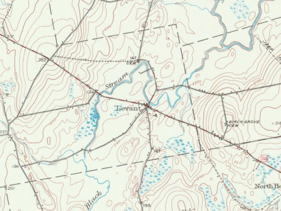
Most of Levant was built recently: 4% of its homes predate 1940 and the median home dates from 1995. Below: maps from 1902 on and the census since 1820.
Founding year: Wikidata. First post office: 1819.The full story ↓
History grade
What drives Levant’s History grade
On its age, its old homes and the National Register, Levant is more historic than 33% of U.S. towns, #138 of 143 in Maine. Its age holds the grade up; its National Register listings pull it down.
C
HistoryA character grade: shown, never part of Levant’s overall grade.
Maine towns list more on the Register than most of the country (a typical Maine town has 15.9 per 10,000 residents, the U.S. 2.4), so Levant’s 0.0 sits below most of its state (10% of Maine towns have fewer) while its 0 listings outnumber those of 23% of U.S. towns.
How sure. Graded on any two of the three inputs instead, the letter would range from D to B−. The pre-1940 share is a Census survey estimate (±3.2 points). Two sources give 1802.
Founding year: Wikidata (other dates in Quick answers). Homes: Census ACS 2020–24. National Register: National Park Service, May 2026 list; each listing counted once (boundary changes and added documentation belong to their listing), and a historic district counts its contributing buildings. How TownRatings grades history →
What stands out about Levant’s past
Read from the archive, the National Register and the record. The page puts what stands out first.
Originally called Kenduskeag Plantation, the town was founded in 1802 by Major Moses Hodsden who built three houses, a sawmill, a grist-mill, a store, and a blacksmith shop in what is now the village of Kenduskeag. At the time, these were likely the only framed buildings between Bangor and the Kennebec River. In 1813 the plantation became a town, and was given the name Levant, which is that part of the Middle East which borders the Mediterranean.
In 1852, the village of Kenduskeag broke away from the rest of Levant and took part of the neighboring town of Glenburn to form the present town of Kenduskeag. Prior to the break the town had 1,841 inhabitants.
Passages that mention Levant, cut from the printed page as they were published.
History of Penobscot County, Maine1882 · page 405Read the page →
Read the text
when he purchased it, was a wilderness; but in pioneer style he went to work, cleared up the land, and by industry and economy has succeeded in securing for himself and family one of the finest farms in the town of Levant, if not in the county. He was Secretary of the first religious society of the town of Levant. This society first met at the house of Deacon Nathan Fisk, and they employed the Rev. Royal W. Spaulding, who was ordained
Text read by machine from the scan; it may contain errors.
History of Penobscot County, Maine1882 · page 405Read the page →
Read the text
when he purchased it, was a wilderness; but in pioneer style he went to work, cleared up the land, and by industry and economy has succeeded in securing for himself and family one of the finest farms .in the town of Levant, if not in the county. He was Secretary of the first religious society of the town of Levant. This society first met at the house of Deacon Nathan Fisk, and they employed the Rev. Royal W. Spaulding, who was ordained
Text read by machine from the scan; it may contain errors.
History of Penobscot County, Maine1882 · page 403Read the page →
Read the text
The present town of Levant was one of the regular thirty-six mile townships for many years, or until the formation of Kenduskeag in 1852, which, as already noticed, took about half its area from the soil of Levant.
Text read by machine from the scan; it may contain errors.
History of Penobscot County, Maine1882 · page 404Read the page →
Read the text
of West Levant post-office, a good-sized tributary running west from Stetson ; and between this point and Carmel, which it reaches after a course of nearly five miles in Levant, it has four tributaries closely resembling each other.
Text read by machine from the scan; it may contain errors.
Scans and text from the Internet Archive. Books published in 1930 or earlier, which are in the public domain.
Timeline
Levant, 1802 to 2020
Woven from the archive, old maps, post office records, the National Register and the people born here.
In 1802, according to Wikidata. Levant’s post office opened in 1819, and the census of 1820 counted 143 people here.
How does Levant rank for history?
Levant is more historic than 33% of U.S. towns, #138 of 143 in Maine. The History grade combines the town’s founding era, the share of homes built before 1940 and its National Register listings. It’s a character grade, so it isn’t part of the overall grade. How it works.
How old are the homes in Levant?
4% of Levant’s homes were built before 1940 (Census estimate, ±3.2 points), against a typical 19% for a Maine town; the median home was built in 1995.
Founding dates: Wikidata, Wikipedia, the U.S. post office records of Blevins & Helbock (CC0) and the Census. Homes by year built: Census ACS 2020–24. National Register of Historic Places: National Park Service (list of May 22, 2026). Old photos, postcards and papers: Wikimedia Commons, the Library of Congress and other public archives, credited on each item’s page. Maps: U.S. Geological Survey historical topographic maps (via Esri) and Sanborn fire-insurance maps (Library of Congress). History text and census tables: Wikipedia (CC BY-SA 4.0). Places that used to be: USGS Geographic Names Information System (2021).
From Wikipedia, Wikidata and Wikipedia for famous people, U.S. Geological Survey historical maps, U.S. Census counts (via Wikipedia), the US Post Offices dataset (Blevins & Helbock), the USGS Geographic Names Information System and old county and town histories (Internet Archive). Archive images are copied here with their credits and licenses, shown on each photo’s page. Refreshed monthly.