Freeport in pictures
Census counts: 1,320 in 1790, 8,737 in 2020. The archive holds 24 old photos and papers going back to 1887 and 4 maps from 1892 on.
5 places on the National Register of Historic Places.
Explore the history →Each edition grades its towns against each other only.

A town of 8,934. 3.1 times the library visits per person than the typical Maine town.
For most people who can afford it, yes. Freeport grades A overall, 9th of 142 graded towns in Maine. Its schools outperform 93% of the state's. CDC estimates put its residents' health ahead of 87% of the country. What holds it back is price: the typical home is worth about $685K, 7.4 years of the Portland metro’s $92K median household income. 60% of adults 25 and older hold a bachelor’s degree or more in Freeport, above both the Maine town median (32%) and the median of U.S. towns (29%). Only 3 of Maine’s 285 towns score higher on hazard risk. Freeport's civic life (library use, community groups, volunteering) is stronger than in 97% of U.S. towns.
Where Freeport beats most towns.
| School | Grades | Students |
|---|---|---|
| Morse Street School | PK–2 | 288 |
| Mast Landing School | 3–5 | 266 |
| L'Ecole Francaise du Maine | PK–4 | 69 |
Where Freeport’s working residents go each day. Line width shows the share.
Census LEHD 2023
Each subject compared with towns across the country (schools within Maine), ordered by how far Freeport is from typical.
How TownRatings grades towns →
Census counts: 1,320 in 1790, 8,737 in 2020. The archive holds 24 old photos and papers going back to 1887 and 4 maps from 1892 on.
5 places on the National Register of Historic Places.
Explore the history →Museums, parks, gardens and other places to visit around Freeport. Close and well known come first.
17 mi LighthousePortland Head Light16 mi Ancient sitePopham Colony
14 mi LandmarkFort Gorges
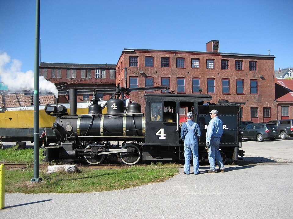
15 mi MuseumMaine Narrow Gauge Railroad Museum16 mi LandmarkSpirit Pond runestones
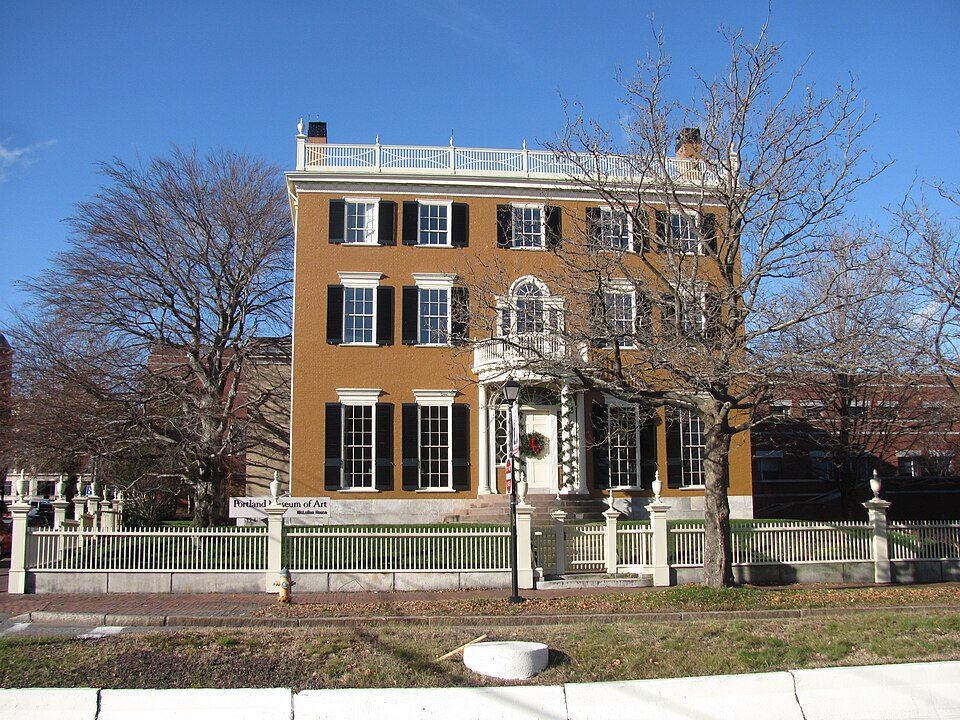
16 mi MuseumPortland Museum of ArtPortland Head Light: Aniarku, CC BY-SA 3.0 · Fort Gorges: Dirk Ingo Franke, CC BY 3.0 · Maine Narrow Gauge Railroad Museum: No machine-readable author provided. Gwernol assumed (based on copyright claims), CC BY-SA 3.0 · Portland Museum of Art: John Phelan, CC BY 3.0
Who provides power, water and the rest in Freeport, and how to reach them.
EPA SDWIS (Oct 9, 2026) · HIFLD + EIA-861 2025 · Census 2020 ZCTAs · NCES 2024–25 · registration: vote.gov, updated Aug 3, 2026.
Ordered by what stands out in Freeport.
Freeport has schools in the top 5% of Maine, draws workers from Portland and beyond and gets more snow than nearly all U.S. towns.
52 miles of trail in 40 parks and preserves. The trail density in Freeport is 1.1 miles per square mile. The biggest place to walk is Wolfe's Neck Woods State Park, 434 acres with 4.5 miles of trail.
| Biggest places to walk | Trails | Acres |
|---|---|---|
| 1. Wolfe's Neck Woods State Park | 4.5 mi | 434 |
| 2. Hedgehog Mountain | 3.1 mi | 199 |
| 3. Florida Lake Preserve | 3.1 mi | 192 |
Trails & parks © OpenStreetMap contributors · Conserved land: USGS PAD-US
Its A ranks #6 of the 142 Maine towns we grade for schools. Its A for schools comes with a C− for cost of living: the typical home is worth about $685K.
Its public schools are run by RSU 05. Three of its 7 schools are below, each with why it’s listed. The largest public high school is Freeport High School, with 593 students.
| School | Level | Students | Letter |
|---|---|---|---|
| Freeport Middle SchoolLargest public middle schoolGrades 6–8 | Grades 6–8 | 288 | A |
| Freeport High SchoolLargest public high schoolGrades 9–12 | Grades 9–12 | 593 | A+ |
| Mast Landing SchoolTop results in townGrades 3–5 | Grades 3–5 | 266 | A |
NCES · EDFacts · graded within ME on state tests and graduation
At 7.4 years of the Portland metro’s $92K median household income, the typical home (about $685K) costs more against local pay than in 89% of Maine towns; that ratio is one input to its C− for cost of living. 62% of renter households pay 30% or more of their income for housing, against 48.4% across Maine.
Freeport’s median rent is $1,439 a month. The typical Freeport home is worth about $685,000, up 3.5% in a year, 66% above the Maine typical home.
| Freeport | Maine towns | U.S. towns | |
|---|---|---|---|
| Median rent | $1,439 a month | $1,106 a month | $1,185 a month |
| Households that own their home | 78% | 81% | 73% |
Census ACS, 2020–24 · Zillow Home Value Index · Redfin Data Center
6,566 jobs are based in Freeport, 1.8 for every working resident, so most of the people who work here commute in.
About one in 5 of Freeport’s working residents works in town. 21% of Freeport workers work from home. Since 2013, Freeport has added 402 jobs, to 6,566 in 2023.
| Freeport | Maine towns | U.S. towns | |
|---|---|---|---|
| Work from home | 21% | 14% | 11% |
| Working residents who work in town | 20% | 12% | 8% |
| Median household income | $107,000 | $78,000 | $80,000 |
| Average trip to work | 24 minutes | 25 minutes | 25 minutes |
Census LEHD 2023 · ACS
Its widest gap with Maine is tooth loss: 8.6% of those 65+ have lost all their teeth, against 14.8% statewide.
28% of adults sleep under 7 hours in Freeport. Freeport beats the Maine average on 17 of 32 CDC measures and trails it on 0. 27% of adults have obesity in Freeport.
| Freeport | Maine towns | U.S. towns | |
|---|---|---|---|
| Sleep under 7 hours (CDC PLACES) | 28% | 33% | 36% |
| Obesity (CDC PLACES) | 27% | 33% | 35% |
| Get no exercise (CDC PLACES) | 17% | 23% | 25% |
| Smoke cigarettes (CDC PLACES) | 11% | 15% | 14% |
| What stands out | Freeport | ME |
|---|---|---|
| Fewer older adults who have lost all their teeth | 8.6% | 14.8% |
| Fewer adults facing food insecurity | 7.6% | 10.7% |
CDC PLACES 2025 · modeled estimates for adults · CMS · HRSA
Among 143 Maine towns, just 3 have a lower FEMA risk score than Freeport. Since 1978, 3 flood insurance claims have been paid out in Freeport.
FEMA flood insurance claims · FEMA National Risk Index · OpenFEMA
Reported crimes fell from 132 to 58 over the last three FBI years, a drop beyond ordinary year-to-year swings. Violent crime is rare: 2 reported in 2025, 0.2 per 1,000 residents.
Maine has less reported crime than most states, so among its own towns Freeport sits closer to the middle.
| Freeport | Maine towns | U.S. towns | |
|---|---|---|---|
| Violent crimes per 1,000 (2025) | 0.2 per 1,000 residents | 0.6 | 1.6 |
| Property crimes per 1,000 (2025) | 6.3 per 1,000 residents | 7.5 | 9.9 |
FBI crime data, 2025 · crimes reported to police
The Gray weather station, 9 miles away, records that 84 inches of snow fall in a normal winter, more than in 95% of U.S. towns. July afternoons average 78.2°, cooler than in 95% of U.S. towns; January nights average 13.9°.
Freeport has cold, snowy winters and pleasant summers, with plenty of rain.
| Freeport | Maine towns | U.S. towns | |
|---|---|---|---|
| July high | 78°F | 79°F | 85°F |
| January low | 14°F | 10°F | 22°F |
NOAA U.S. Climate Normals, 1991–2020
2 within 15 miles of the center of Freeport
About 5 of every 100 Freeport residents are enrolled in college, about the same as Maine.
7,879 counted in 2010 and 8,737 in 2020; an estimated 8,934 in 2025.
U.S. Census 2010 & 2020 counts · Census Bureau estimate, July 1, 2025
5 places in Freeport on the National Register of Historic Places.
5 notable people were born in Freeport.
Town in Maine, United States
Freeport is a town in Cumberland County, Maine, United States. Freeport is included in the Lewiston-Auburn, Maine metropolitan New England City and Town Area. The population was 8,737 at the 2020 census. Once home to a prominent shipbuilding industry, timber operations, and farming, it is now known for its numerous outlet stores; Freeport is home to L.L. Bean, Wolfe's Neck Woods State Park, and the Desert of Maine. Freeport is part of the Portland-South Portland-Biddeford metropolitan area. The Harraseeket Historic District is in Freeport.
From Wikipedia, licensed CC BY-SA 4.0 · facts via Wikidata (CC0)
6 towns share a border with Freeport.
| Town | ME rank | Overall | Cost | Safety | Schools | Health |
|---|---|---|---|---|---|---|
| Freeport | #9 | A | C− | B+ | A | A |
| Yarmouth | #8 | A | D− | A | A+ | A |
| Brunswick | #24 | A− | C− | B | A− | A |
| Harpswell | #34 | B+ | C | — | A− | A |
| Pownal | — | — | C+ | — | A | A− |
| Durham | #50 | B | C | — | A | B+ |
| Chebeague Island | — | — | — | — | — | — |
Pownal has fewer than 2,500 residents, so it gets subject grades but no overall grade. Harpswell, Pownal and Durham report no FBI crime data of their own. Chebeague Island isn’t graded (fewer than 1,000 residents, or not enough data). Compare Freeport with a neighbor →
Short answers, built from the data on this page.
For most people who can afford it, yes. Freeport grades A overall, better than 89% of U.S. towns and #9 of 142 in Maine. It grades A for health, B+ for safety and A for schools. Cost of living is its weak spot, with a C−.
Yes, by national standards. Maine has less crime than most states, so among its own towns Freeport sits nearer the middle.
Yes. Cost of living, which also weighs rents, property taxes and how many households pay 30% or more of their income for housing, grades C−.
5 notable people were born here, including Aaron Lufkin Dennison and Marianne Brenton.