6 places in town are on the National Register, among them three historic districts with 34 buildings between them. Below: 5 old photos and papers, maps from 1884 on, and the census since 1800.
Founding year: the first Eastport post office (Blevins & Helbock, CC0).The full story ↓
History grade
What drives Eastport’s History grade
On its age, its old homes and the National Register, Eastport is more historic than 98% of U.S. towns. All 3 inputs are above most U.S. towns; its share of homes from before 1940 ranks highest and its age lowest.
A+
HistoryA character grade: shown, never part of Eastport’s overall grade.
Maine towns list more on the Register than most of the country (a typical Maine town has 15.9 per 10,000 residents, the U.S. 2.4), so Eastport’s 293 sits above most of its state (97% of Maine towns have fewer) while its 37 historic buildings outnumber those of 83% of U.S. towns.
How sure. Graded on any two of the three inputs instead, the letter would range from A to A+. The pre-1940 share is a Census survey estimate (±5.7 points). The founding year is the first post office, not a stated founding date.
Founding year: the first post office (other dates in Quick answers). Homes: Census ACS 2020–24. National Register: National Park Service, May 2026 list; each listing counted once (boundary changes and added documentation belong to their listing), and a historic district counts its contributing buildings. How TownRatings grades history →
What stands out about Eastport’s past
Read from the archive, the National Register and the record. The page puts what stands out first.
Fire insurance maps drew every building, what it was made of and what it was used for, so insurers could price the risk of fire. Pick a year, then a sheet.
The native Passamaquoddy Tribe has called this area home for at least 10,000 years. Some archeologists estimate the habitation at 20,000 years. The first known European contact was the St. Croix colony founded by the French explorer Samuel de Champlain in 1604. Near present-day Calais, the unsuccessful Saint Croix Island Acadia settlement predates the first successful English settlement at Jamestown, Virginia, by three years. On June 25, 1604, Champlain and his men spent a long and severe winter on St. Croix Island with no fresh water and diminished supplies. 36 of the 80 settlers died of scurvy, and the colony moved across the Bay of Fundy to Port Royal in present-day Nova Scotia.
Passages that mention Eastport, cut from the printed page as they were published.
Eastport and Passamaquoddy [microform]1888 · page 430Read the page →
Read the text
solicitation of the compiler and publisher of this interesting work on Eastport. In its preparation, I have been enabled to give almost an exact reproduction (or, in other words, as much as the space in this chapter will allow) of the work prepared and presented by me to the town of Eastport in 1872. This chapter contains a record of those citizens of Eastport and natives of the town removed therefrom who assisted in the war for the suppression of the Rebellion,
Text read by machine from the scan; it may contain errors.
Eastport and Passamaquoddy [microform]1888 · page 68Read the page →
Read the text
A gradual and, at certain periods, a rapid increase in wealth and population has taken place from the first settlement. The plantation No. 8 was incorporated into a town by the name of Eastport in February, 1798, and included Lubec, which was set off as a separate town in June, 1811. It is the fifth town incorporated in the county. ‘There are now thirty towns. The number of families in 1785 was ten or twelve, and the number of inhabitants about seventy-five.
Text read by machine from the scan; it may contain errors.
Scans and text from the Internet Archive. Books published in 1930 or earlier, which are in the public domain.
Timeline
Eastport, 1781 to 1908
Woven from the archive, old maps, post office records, the National Register and the people born here.
The Eastport post office opened in 1802, the earliest record of the town by name (U.S. post office records).
How does Eastport rank for history?
Eastport is more historic than 98% of U.S. towns. The History grade combines the town’s founding era, the share of homes built before 1940 and its National Register listings. It’s a character grade, so it isn’t part of the overall grade. How it works.
What is on the National Register in Eastport?
6 listings: 3 buildings and 3 historic districts, the Fort Sullivan, the Eastport Historic District and the Boynton Street Historic District, with 34 contributing buildings. 37 historic buildings in all.
How old are the homes in Eastport?
49% of Eastport’s homes were built before 1940 (Census estimate, ±5.7 points), against a typical 19% for a Maine town; the median home was built in 1941.
Founding dates: Wikidata, Wikipedia, the U.S. post office records of Blevins & Helbock (CC0) and the Census. Homes by year built: Census ACS 2020–24. National Register of Historic Places: National Park Service (list of May 22, 2026). Old photos, postcards and papers: Wikimedia Commons, the Library of Congress and other public archives, credited on each item’s page. Maps: U.S. Geological Survey historical topographic maps (via Esri) and Sanborn fire-insurance maps (Library of Congress). History text and census tables: Wikipedia (CC BY-SA 4.0). Places that used to be: USGS Geographic Names Information System (2021).
From Wikimedia Commons (5), Wikidata (1), the National Register of Historic Places (6), Wikipedia, Wikidata and Wikipedia for famous people, U.S. Geological Survey historical maps, U.S. Census counts (via Wikipedia), the US Post Offices dataset (Blevins & Helbock), the USGS Geographic Names Information System, Sanborn fire insurance maps (Library of Congress) and old county and town histories (Internet Archive). Archive images are copied here with their credits and licenses, shown on each photo’s page. Refreshed monthly.


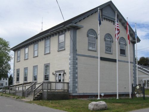


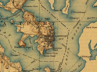
 1852
 1852


