Arrowsic dates to 1841, and 20% of its homes were built before 1940
5 places in town are on the National Register, among them three historic districts with 9 buildings between them. Below: 5 old photos and papers, maps from 1894 on, and the census since 1860.
The Abenaki people called the island Arrowseag, meaning "place of obstruction," a reference to Upper Hell Gate on the Sasanoa River. Until it was widened by the Army Corps of Engineers in 1898 and 1908, the stretch was choked with boulders and ledges. Indian canoe passage would have been risky in the swift current between Merrymeeting Bay and Sheepscot Bay.
Passages that mention Arrowsic, cut from the printed page as they were published.
History of Bath and environs, Sagadahoc County, Maine. 1607-1894 ..1894 · page 36Read the page →
Read the text
The Town Comprised what is now Arrowsic, Georgetown, Phipsburg, Bath, Woolwich, and West Bath. Town meetings were held at the dwelling-house of Samuel Denny until they were held in the "meeting-house at Pleasant Cove," which was at the Noble and afterwards Lithgow and later the Morse farm, immediately south of Fiddlers Reach, March 8, 1742. When the meeting-house on Arrowsic Island was built and completed in 1763, the town meetings were held in that house. If meetings were called in winter, there
Text read by machine from the scan; it may contain errors.
History of Bath and environs, Sagadahoc County, Maine. 1607-1894 ..1894 · page 33Read the page →
Read the text
Battle of Arrowsic. — At the time of the Watts settlement at Butlers Cove, the garrison and its forces were made the command of Penhallow. In 1720, there were twenty dwelling-houses occupied by farmers. On Sept. 10, 1722, at dawn of day, an armed force was sent out from the garrison to protect the farmers in gathering their crops. This escort discovered a large number of Indians prowling about in the adjoining woods. They immediately attacked the Indians, killing one and wounding three. The whites then re-
Text read by machine from the scan; it may contain errors.
Scans and text from the Internet Archive. Books published in 1930 or earlier, which are in the public domain.
Timeline
Arrowsic, 1841 to 1990
Woven from the archive, old maps, post office records, the National Register and the people born here.
Nothing in the archives for these yearsWeddings on Main Street, storms, parades, school pictures, the old store. If it’s in your family album, it belongs here.
In 1841, according to Wikidata. Arrowsic’s post office opened in 1871, and the census of 1860 counted 347 people here.
What is on the National Register in Arrowsic?
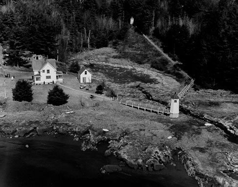
5 listings: 1 building, 3 historic districts, the Doubling Point Light Station, the Kennebec River Light Station and the Squirrel Point Light Station, with 9 contributing buildings, and 1 structure. 10 historic buildings in all.
Founding dates: Wikidata, Wikipedia, the U.S. post office records of Blevins & Helbock (CC0) and the Census. Homes by year built: Census ACS 2020–24. National Register of Historic Places: National Park Service (list of May 22, 2026). Old photos, postcards and papers: Wikimedia Commons, the Library of Congress and other public archives, credited on each item’s page. Maps: U.S. Geological Survey historical topographic maps (via Esri) and Sanborn fire-insurance maps (Library of Congress). History text and census tables: Wikipedia (CC BY-SA 4.0). Places that used to be: USGS Geographic Names Information System (2021). How TownRatings grades history →
From Wikimedia Commons (7), the Library of Congress (2), Wikidata (3), the National Register of Historic Places (5), Wikipedia, U.S. Geological Survey historical maps, U.S. Census counts (via Wikipedia), the US Post Offices dataset (Blevins & Helbock), the USGS Geographic Names Information System and old county and town histories (Internet Archive). Archive images are copied here with their credits and licenses, shown on each photo’s page. Refreshed monthly.




 Date?
 Date?
 Date?
 Date?
 2018
 2018
 2017
 2008
