Guest, Sign inJoin

Post to Sharpsburg

We’ll email a one-tap link to publish your post. No password, and nothing is public until you click it.
Already a member? Sign in
Sharpsburg clockPhoto: myself (User:Piotrus) · CC BY-SA 3.0
–Not graded
History · Sharpsburg

Sharpsburg dates to 1763, and 72% of its homes were built before 1940

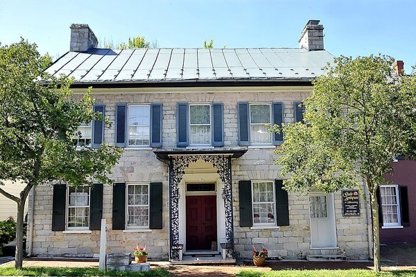
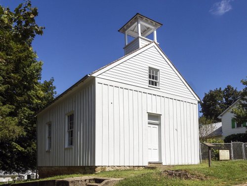
10 places in town are on the National Register, among them the Tolson's Chapel and School, a National Historic Landmark, and two historic districts with 570 buildings between them. Below: maps from 1884 on and the census since 1870.

1763founded
10on the National Register
72%homes built before 1940
2famous people
Quick answers

How Sharpsburg began

When was Sharpsburg founded?

1763

Sharpsburg dates its founding to 1763 (Wikidata). The census first counted it in 1870.

First census: 1,001 in 18702020 census: 560263 years
Founding year: Wikidata. First post office: 1792.The full story ↓

What stands out about Sharpsburg’s past

Read from the archive, the National Register and the record. The page puts what stands out first.

★ What stands out · On the National Register

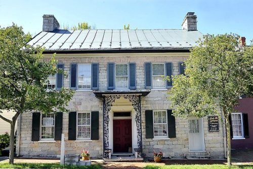
10 listings protect 584 historic buildings

The country’s official list of buildings and places worth saving. One is a National Historic Landmark, the highest tier.

places listed
10
National Historic Landmark
1
Tolson's Chapel and School
historic buildings protected
584
each building in a district counts
first listed
1966
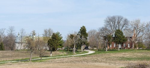
Antietam National Battlefield
BuildingsDistricts★ landmark

Architectural styles listings

Federal4
Early Republic3
Greek Revival2
Colonial2
Georgian2
Vernacular Limestone1
All 10 listings

National Park Service, National Register of Historic Places. Photos from Wikimedia Commons, credited on each place’s page.

Help out

Start Sharpsburg’s collection

The first neighbors to add old photos shape how Sharpsburg’s history is told.

Decades since 1900 with photos
00s10s20s30s40s50s60s70s80s90s
0 of 10 decades. The empty ones are waiting for someone’s album.
On the map

Sharpsburg on the map, 1884 to 1984

Every edition of the U.S. Geological Survey’s map of Sharpsburg. Tap a year, or press play to watch the town change.

Sharpsburg on the 1884 USGS mapSharpsburg on the 1891 USGS mapSharpsburg on the 1984 USGS map1884Harpers Ferry sheet · 1:125,000

U.S. Geological Survey historical topographic maps (public domain), via Esri’s collection of the scans. The red ring marks the center of Sharpsburg.

The story

How Sharpsburg came to be

From Wikipedia’s history of Sharpsburg.

Read it all →

The first American of European descent to own land in what would become Sharpsburg was trader Edmund Cartledge. By the time Cartledge surveyed his "Hickory Tavern" land tract in 1737, the Great Philadelphia Wagon Road was established over the path that would become Sharpsburg's main street. The patent says Hickory Tavern sits between the wagon road and Garrison Spring, today's Big Spring. Thousands of immigrants used this route to travel south from Pennsylvania as far as the Carolinas.

Text from Wikipedia, licensed CC BY-SA 4.0.

From the old history books

What they wrote about Sharpsburg in 1906

Passages that mention Sharpsburg, cut from the printed page as they were published.

Heights. On July 5 Gen. Gordon’s division crossed the Potomac at Boteler’s ford near Shepherdstown and encamped on the Antietam near its mouth. Gen. Vaughn marched to Sharpsburg. McCausland also crossed at Shepherdstown and went to Sharpsburg while a detachment of cavalry went on to Boonsboro, six …
A history of Washington County, Maryland from the earliest settlements to the present time, including a history of Hagerstown1906 · page 355Read the page →
Read the text

Heights. On July 5 Gen. Gordon’s division crossed the Potomac at Boteler’s ford near Shepherdstown and encamped on the Antietam near its mouth. Gen. Vaughn marched to Sharpsburg. McCausland also crossed at Shepherdstown and went to Sharpsburg while a detachment of cavalry went on to Boonsboro, six miles from Sharpsburg and thence across South Mountain into Frederick

Text read by machine from the scan; it may contain errors.
On the last day of 1803, George Carey’s barn and stable at the cross roads, four miles from Sharpsburg, were burned and Whilst the fire, Which was incendiary, was raging, the store house of Carey & Zeigler near by was entered and rob¬ bed of $1,800 in money. Two negroes belonging to Benjamin Tyson,…
A history of Washington County, Maryland from the earliest settlements to the present time, including a history of Hagerstown1906 · page 132Read the page →
Read the text

On the last day of 1803, George Carey’s barn and stable at the cross roads, four miles from Sharpsburg, were burned and Whilst the fire, Which was incendiary, was raging, the store house of Carey & Zeigler near by was entered and rob¬ bed of $1,800 in money. Two negroes belonging to Benjamin Tyson, of Sharpsburg, were arrested for the crime and $1,500 of the money recovered.

Text read by machine from the scan; it may contain errors.

Scans and text from the Internet Archive. Books published in 1930 or earlier, which are in the public domain.

Timeline

Sharpsburg, 1763 to 2021

Woven from the archive, old maps, post office records, the National Register and the people born here.

  1. 18th century
  2. 1763
    FoundingSharpsburg is established
  3. 1792Post officeThe Sharpsburg post office opens
  4. 1796Born hereDavid Spangler is born here
  5. 19th century
  6. 1880CensusPopulation peaks at 1,260
  7. 1884On the mapFirst mapped by the U.S. Geological Survey
  8. 1890BuiltAntietam National Battlefield is built
  9. 1898Born hereHowell G. Crim is born here
  10. 21st century
  11. 2021LandmarkTolson's Chapel and School named a National Historic Landmark
By decade

No old photos in the archives yet

Weddings on Main Street, storms, parades, school pictures, the old store. If it’s in your family album, it belongs here.

Be the first to add onePhotograph a print flat, in daylight, no flash.
Add from your album
Every building

Sharpsburg, building by building, 1922

Fire insurance maps drew every building, what it was made of and what it was used for, so insurers could price the risk of fire. Pick a sheet.

Sharpsburg fire insurance map, 1922, sheet 11922Sheet 1 of 6

Sanborn Map Company, via the Library of Congress. Editions published in 1930 or earlier, which are in the public domain.

People over time

Sharpsburg, census by census

02004006008001,0001,2001,40018801900192019401960198020002020Peak: 1,260

Peaked at 1,260 in 1880; 560 people lived here in 2020.

16 censuses, 1870–2020.

U.S. Census Bureau decennial counts, from the census table on Sharpsburg’s Wikipedia page.

Famous people

2 famous people were born in Sharpsburg

Writers, athletes, leaders and more, ranked by how widely they’re known.

See all →
Places that used to be

Places now gone and burying grounds

Sharpsburg’s post office has been open since 1792.

Gone or out of use
First Methodist Churchchurch
2cemeteries and burying grounds inside Sharpsburg
First MethodistSharpsburg Reformed

US Post Offices dataset (Blevins & Helbock, CC0). Places and cemeteries from the USGS Geographic Names Information System (2021).

Questions about Sharpsburg’s history

What year was Sharpsburg founded?

In 1763, according to Wikidata. Sharpsburg’s post office opened in 1792, and the census of 1870 counted 1,001 people here.

What is on the National Register in Sharpsburg?

10 listings: 8 buildings, among them the Tolson's Chapel and School (a National Historic Landmark since 2021), and 2 historic districts, the Antietam National Battlefield and the Sharpsburg Historic District, with 570 contributing buildings. 584 historic buildings in all.

Memory lane

What the archives can’t tell you, neighbors can.

Town Square →
Start a conversation
Sources

Where this page comes from

Founding dates: Wikidata, Wikipedia, the U.S. post office records of Blevins & Helbock (CC0) and the Census. Homes by year built: Census ACS 2020–24. National Register of Historic Places: National Park Service (list of May 22, 2026). Old photos, postcards and papers: Wikimedia Commons, the Library of Congress and other public archives, credited on each item’s page. Maps: U.S. Geological Survey historical topographic maps (via Esri) and Sanborn fire-insurance maps (Library of Congress). History text and census tables: Wikipedia (CC BY-SA 4.0). Places that used to be: USGS Geographic Names Information System (2021). How TownRatings grades history →

From Wikidata (1), the National Register of Historic Places (10), Wikipedia, Wikidata and Wikipedia for famous people, U.S. Geological Survey historical maps, U.S. Census counts (via Wikipedia), the US Post Offices dataset (Blevins & Helbock), the USGS Geographic Names Information System, Sanborn fire insurance maps (Library of Congress) and old county and town histories (Internet Archive). Archive images are copied here with their credits and licenses, shown on each photo’s page. Refreshed monthly.