Guest, Sign inJoin

Post to Scaggsville

We’ll email a one-tap link to publish your post. No password, and nothing is public until you click it.
Already a member? Sign in
DHistory
History · Scaggsville

Scaggsville’s post office opened in 1897

More historic than 14% of U.S. towns · #202 of 261 in Maryland. What drives it

Most of Scaggsville was built recently: 1% of its homes predate 1940 and the median home dates from 1988. Below: maps from 1892 on.

1897first post office
0on the National Register
1%homes built before 1940
Photo: Pi.1415926535 · CC BY-SA 3.0
Quick answers

How Scaggsville began

When was Scaggsville founded?

1897

The Scaggsville post office opened in 1897, the earliest record of the town by name.

2020 census: 9,217129 years

How historic is Scaggsville?

D

More historic than 14% of U.S. towns, on its age, its old homes and the National Register.

What drives the grade ↓
Founding year: the first Scaggsville post office (Blevins & Helbock, CC0).The full story ↓
History grade

What drives Scaggsville’s History grade

On its age, its old homes and the National Register, Scaggsville is more historic than 14% of U.S. towns, #202 of 261 in Maryland. Its age holds the grade up; its share of homes from before 1940 pulls it down.

D
HistoryA character grade: shown, never part of Scaggsville’s overall grade.
All U.S. towns we grade (21,289)Ahead of 14%
NewerOlder
Maryland towns of 2,500+ (261)Ahead of 23%

Few Maryland towns list much on the Register (a typical Maryland town has 0.9 per 10,000 residents, the U.S. 2.4), so Scaggsville’s 0.0 sits below most of its state (20% of Maryland towns have fewer) while its 0 listings outnumber those of 23% of U.S. towns.

How sure. Graded on any two of the three inputs instead, the letter would range from D to C−. The pre-1940 share (±1.0 points) is firm at this size. The founding year is the first post office, not a stated founding date.

Founding year: the first post office (other dates in Quick answers). Homes: Census ACS 2020–24. National Register: National Park Service, May 2026 list; each listing counted once (boundary changes and added documentation belong to their listing), and a historic district counts its contributing buildings. How TownRatings grades history →

What stands out about Scaggsville’s past

Read from the archive, the National Register and the record. The page puts what stands out first.

★ What stands out · Places that used to be

Lost post offices and old corners

Scaggsville had its own post office from 1897 to 1907.

Scaggsville
1897–1907
18901960today
Hamlets and corners on the map
Cardinal ForestChelsea EstatesCoon ManorGraeloch WoodsHammond HillsHammond ParkHammond VillageHillcrest HeightsKindler EstatesLakeviewLeishear KnollsLeishear VillageLillys AdditionMurray HillPine ValleyRosemontSaybrookTower AcresTwin OaksWarfields RangeWellington Estates

US Post Offices dataset (Blevins & Helbock, CC0). Places and cemeteries from the USGS Geographic Names Information System (2021).

Help out

Start Scaggsville’s collection

The first neighbors to add old photos shape how Scaggsville’s history is told.

Decades since 1900 with photos
00s10s20s30s40s50s60s70s80s90s
0 of 10 decades. The empty ones are waiting for someone’s album.
On the map

Scaggsville on the map, 1892 to 1981

Every edition of the U.S. Geological Survey’s map of Scaggsville. Tap a year, or press play to watch the town change.

Scaggsville on the 1892 USGS mapScaggsville on the 1907 USGS mapScaggsville on the 1926 USGS mapScaggsville on the 1944 USGS mapScaggsville on the 1951 USGS mapScaggsville on the 1971 USGS mapScaggsville on the 1981 USGS map1892Laurel sheet · 1:62,500

U.S. Geological Survey historical topographic maps (public domain), via Esri’s collection of the scans. The red ring marks the center of Scaggsville.

The story

How Scaggsville came to be

From Wikipedia’s history of Scaggsville.

Read it all →

The town is named for the Scaggs family, who settled 700 acres (2.8 km2) of farmland in the 1830s and continue to live in the region. The area also used the name "Hells Corner" as a postal address in Civil War times. The historic path running through town was shown on maps as far back as 1795. This path is now named Lime Kiln Road, Scaggsville Road, and Whiskey Bottom Road. In the 19th century, Scaggsville was a stagecoach stop on the trip from Washington, D.C., to Baltimore. Stagecoaches would ford the Patuxent River until a wooden bridge was built in 1859, which washed out in an 1868 flood. Three additional bridges washed out by 1883 before a steel truss bridge was built. In 1941, the Maryland Gazette reported that the town consisted of 15 households. Today, it has grown to a suburban community made up of several neighborhoods.

Text from Wikipedia, licensed CC BY-SA 4.0.

Timeline

Scaggsville, 1892 to 1907

Woven from the archive, old maps, post office records, the National Register and the people born here.

  1. 19th century
  2. 1892On the mapFirst mapped by the U.S. Geological Survey
  3. 1897Post officeThe Scaggsville post office opens
  4. 20th century
  5. 1907Post officeThe Scaggsville post office closes
By decade

Scaggsville, decade by decade

Today30 recent
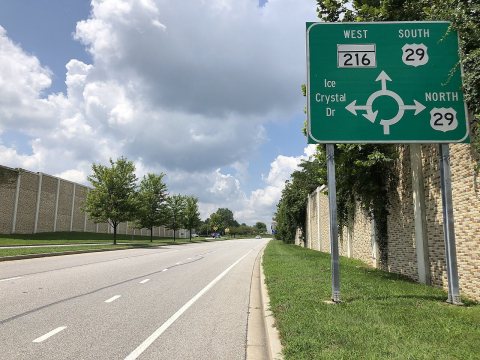
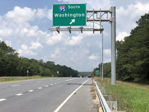
2020-08-12 14 35 02 View east along Maryland State Route 216 (Scaggsville Road) at the exit for Interstate 95 SOUTH (Wa…20202020-08-12 14 35 02 View east along Maryland State Ro…2020-08-12 14 28 43 View east along Maryland State Route 216 (Scaggsville Road) just west of the exit for U.S. Route 29…20202020-08-12 14 28 43 View east along Maryland State Ro…2020-08-12 12 55 40 View west along Maryland State Route 216 (Scaggsville Road) just west of the exit for U.S. Route 29…20202020-08-12 12 55 40 View west along Maryland State Ro…2020-08-12 12 55 02 View west along Maryland State Route 216 (Scaggsville Road) at the exit for U.S. Route 29 NORTH (Ba…20202020-08-12 12 55 02 View west along Maryland State Ro…2020-08-12 12 52 40 View west along Maryland State Route 216 (Scaggsville Road) just east of the exit for U.S. Route 29…20202020-08-12 12 52 40 View west along Maryland State Ro…2020-08-12 12 50 06 View west along Maryland State Route 216 (Scaggsville Road) at Leishear Road in20202020-08-12 12 50 06 View west along Maryland State Ro…2020-08-12 12 46 06 View west along Maryland State Route 216 (Scaggsville Road) at the exit for Interstate 95 SOUTH (Wa…20202020-08-12 12 46 06 View west along Maryland State Ro…2019-09-03 10 34 24 View north along U.S. Route 29 (Columbia Pike) from the overpass for Johns Hopkins Road in20192019-09-03 10 34 24 View north along U.S. Route 29 (C…2019-09-03 10 32 34 View south along U.S. Route 29 (Columbia Pike) from the overpass for Johns Hopkins Road on the edge…20192019-09-03 10 32 34 View south along U.S. Route 29 (C…2019-09-03 10 26 22 View north along U.S. Route 29 (Columbia Pike) from the overpass for Maryland State Route 216 (Scag…20192019-09-03 10 26 22 View north along U.S. Route 29 (C…2019-09-03 10 24 30 View south along U.S. Route 29 (Columbia Pike) from the overpass for Maryland State Route 216 (Scag…20192019-09-03 10 24 30 View south along U.S. Route 29 (C…2019-08-19 17 18 12 View north along U.S. Route 29 (Columbia Pike) at Exit 15 (Johns Hopkins Road, TO Gorman Road) on t…20192019-08-19 17 18 12 View north along U.S. Route 29 (C…2019-08-19 17 16 30 View north along U.S. Route 29 (Columbia Pike) at Exit 13 (Maryland State Route 216, Fulton, Laurel…20192019-08-19 17 16 30 View north along U.S. Route 29 (C…2019-08-07 09 19 28 View south along U.S. Route 29 (Columbia Pike) at Exit 13 (Maryland State Route 216, Fulton, Laurel…20192019-08-07 09 19 28 View south along U.S. Route 29 (C…2019-08-07 09 16 02 View south along U.S. Route 29 (Columbia Pike) at Exit 15 (Johns Hopkins Road, TO Gorman Road) in20192019-08-07 09 16 02 View south along U.S. Route 29 (C…2019-07-15 10 42 15 View north along Interstate 95 from the overpass for Gorman Road on the edge of Scaggsville and Nor…20192019-07-15 10 42 15 View north along Interstate 95 fr…2019-07-15 10 41 52 View south along Interstate 95 from the overpass for Gorman Road on the edge of Scaggsville and Nor…20192019-07-15 10 41 52 View south along Interstate 95 fr…2019-07-15 10 30 49 View north along Interstate 95 from the overpass for Maryland State Route 216 (Scaggsville Road) on…20192019-07-15 10 30 49 View north along Interstate 95 fr…2019-07-15 10 28 28 View south along the northbound lanes of Interstate 95 from the overpass for Maryland State Route 2…20192019-07-15 10 28 28 View south along the northbound l…2019-07-15 10 27 42 View south along the southbound lanes of Interstate 95 from the overpass for Maryland State Route 2…20192019-07-15 10 27 42 View south along the southbound l…2019-06-05 12 25 11 View north along Interstate 95 at the exit for the Rest Area and Maryland Welcome Center along the …20192019-06-05 12 25 11 View north along Interstate 95 at…2019-06-05 12 23 12 View north along Interstate 95 at Exit 35B (Maryland State Route 216 WEST, Scaggsville) along the e…20192019-06-05 12 23 12 View north along Interstate 95 at…2019-06-05 12 21 01 View north along Interstate 95 at Exit 35A (Maryland State Route 216 EAST, Laurel) along the edge o…20192019-06-05 12 21 01 View north along Interstate 95 at…2019-06-05 11 45 42 View south along Interstate 95 at Exit 35A (Maryland State Route 216 EAST, Laurel) along the edge o…20192019-06-05 11 45 42 View south along Interstate 95 at…2019-06-05 11 44 15 View south along Interstate 95 at Exit 35B (Maryland State Route 216 WEST, Scaggsville) along the e…20192019-06-05 11 44 15 View south along Interstate 95 at…2019-06-05 11 42 17 View south along Interstate 95 at the exit for the Rest Area and Maryland Welcome Center along the …20192019-06-05 11 42 17 View south along Interstate 95 at…Aerial view of routes 29 and 216 interchange, September 20182018Aerial view of routes 29 and 216 interchange, Septemb…2016-09-17 14 33 38 View north along U.S. Route 29 (Columbia Pike) between Maryland State Route 216 (Scaggsville Road) …20162016-09-17 14 33 38 View north along U.S. Route 29 (C…2016-09-16 13 44 57 View north along Maryland State Route 983 (Scaggsville Road) just south of Doves Fly Way in20162016-09-16 13 44 57 View north along Maryland State R…2016-09-16 13 41 20 View east along Maryland State Route 216 (Scaggsville Road) just west of Sweet Cherry Lane in20162016-09-16 13 41 20 View east along Maryland State Ro…
Famous people

Famous people close to Scaggsville

Nobody well known was born in Scaggsville itself, so here are the best known from just nearby.

See all →
Stories next door

History across the town line

Each neighbor’s History grade, on the same three inputs.

Questions about Scaggsville’s history

What year was Scaggsville founded?

The Scaggsville post office opened in 1897, the earliest record of the town by name (U.S. post office records).

How does Scaggsville rank for history?

Scaggsville is more historic than 14% of U.S. towns, #202 of 261 in Maryland. The History grade combines the town’s founding era, the share of homes built before 1940 and its National Register listings. It’s a character grade, so it isn’t part of the overall grade. How it works.

How old are the homes in Scaggsville?

1% of Scaggsville’s homes were built before 1940 (Census estimate, ±1.0 points), against a typical 3.3% for a Maryland town; the median home was built in 1988.

Memory lane

What the archives can’t tell you, neighbors can.

Town Square →
Start a conversation
Sources

Where this page comes from

Founding dates: Wikidata, Wikipedia, the U.S. post office records of Blevins & Helbock (CC0) and the Census. Homes by year built: Census ACS 2020–24. National Register of Historic Places: National Park Service (list of May 22, 2026). Old photos, postcards and papers: Wikimedia Commons, the Library of Congress and other public archives, credited on each item’s page. Maps: U.S. Geological Survey historical topographic maps (via Esri) and Sanborn fire-insurance maps (Library of Congress). History text and census tables: Wikipedia (CC BY-SA 4.0). Places that used to be: USGS Geographic Names Information System (2021).

From Wikimedia Commons (30), Wikipedia, U.S. Geological Survey historical maps, the US Post Offices dataset (Blevins & Helbock) and the USGS Geographic Names Information System. Archive images are copied here with their credits and licenses, shown on each photo’s page. Refreshed monthly.