Guest, Sign inJoin

Post to Rosaryville

We’ll email a one-tap link to publish your post. No password, and nothing is public until you click it.
Already a member? Sign in
Old Most Holy Rosary Church, Rosaryville, MD
Maryland›Prince George's County

RosaryvilleMD

A town in Maryland, home to 12,883 people.

5 bordering townsMap →
Photo: Roberto221 · CC BY-SA 4.0
Photo of Rosaryville

Rosaryville, MD · Photo: Roberto221 · CC BY-SA 4.0 · Source ↗

Is Rosaryville a good place to live?

A town of contrasts. Its weakest subject is schools — its schools rank behind 92% of the state's. It also trails on cost of living — the typical home is worth about $479K, 3.8 years of the Washington metro’s $127K median household income. On incomes it is strong: the median household earns $159K. The overall grade lands at C, 211th of 259 in Maryland. Set against the rest, it does better than 31% of U.S. towns. Only 29 of Maryland’s 329 towns score lower on history. The biggest place to walk is Rosaryville State Park, 1,077 acres with 14.8 miles of trail.

Figures: incomes, Census ACS, 2020–24 · schools, state test and graduation results · home values, Zillow · National Register of Historic Places · OpenStreetMap.

What makes Rosaryville stand out

Where Rosaryville beats most towns, and one thing worth knowing.

Get outside

17 miles of trails in Rosaryville

39.9% of the town is conserved land, across 3 parks and preserves.

Map of trails and conserved land in RosaryvilleConservedTrails
1
Rosaryville State Park14.8 mi of trails · 1,077 acres
Directions
2
Mellwood Hills Community Park0.7 mi of trails · 65 acres
Directions
3
Hollaway Estates Park15 acres
Directions
Trails © OpenStreetMap contributors · USGS PAD-US

How Rosaryville grades

Each subject compared with towns across the country (schools within Maryland), ordered by how far Rosaryville is from typical.

How grading works

Character Graded, but not part of the overall grade.
Described, not graded Taste, not quality: snow or an older crowd is neither good nor bad.

How TownRatings grades towns →

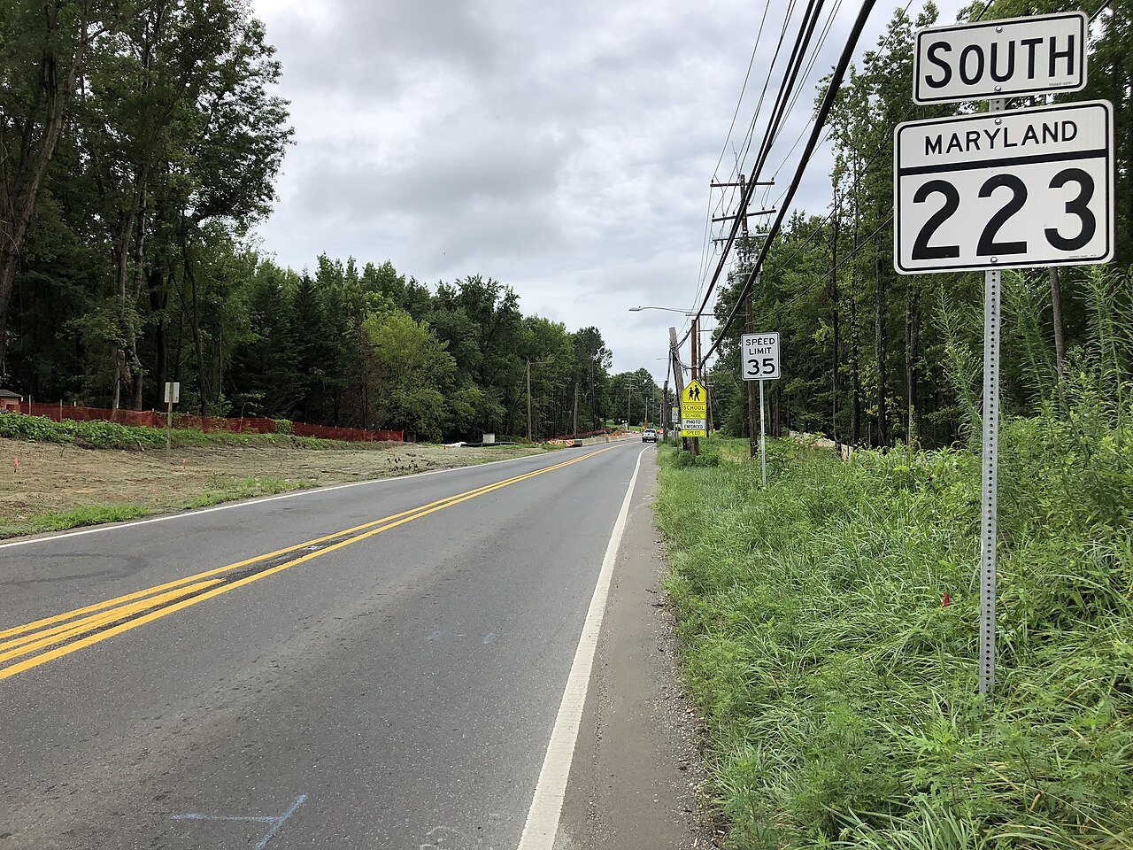
2020-08-13 14 14 10 View south along Maryland State Route 223 (Woodyard Road) at Dower House Road along the edge of Mel…
2020-08-13 14 14 10 View south along Maryland State Route 223 (Woodyard Road) at Dower House Road along the edge of Mel…, 2020
Rosaryville’s story

Rosaryville in pictures

Census counts: 8,976 in 1990, 11,548 in 2020. The archive holds 3 old photos and papers going back to 2020 and 7 maps from 1900 on.

Explore the history →
Nearby attractions

White House and 282 more within 40 miles

Museums, parks, gardens and other places to visit around Rosaryville. Close and well known come first.

All 308 attractions →
Sources: National Park Service · ski areas © OpenSkiMap / OpenStreetMap contributors · Wikidata · Wikipedia readership · photos via Wikimedia Commons
Photo credits

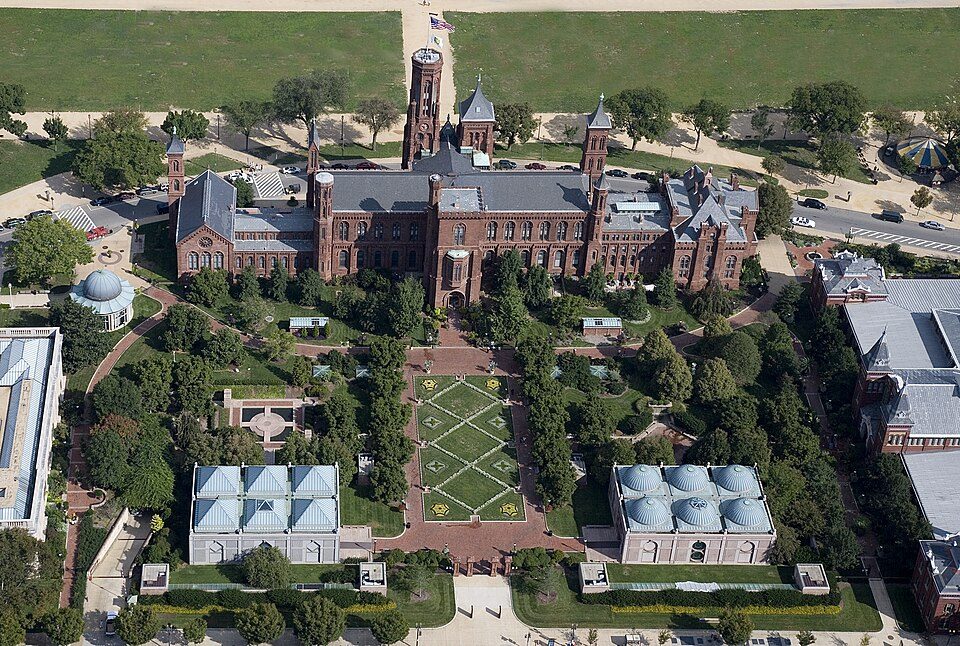
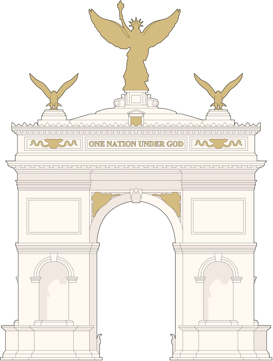
White House: This image or media was taken or created by Matt H. Wade. To see his entire port, CC BY-SA 3.0 · Washington Monument: Oren Rozen, CC BY-SA 4.0 · Arlington National Cemetery: Protoant, Public domain · Smithsonian Institution: Highsmith, Carol M., 1946-, photographer, Public domain · United States Triumphal Arch: Hstoops, CC0 · Northwest Stadium: Maryland GovPics, CC BY 2.0

Getting set up

Moving to Rosaryville: who provides what

Rosaryville is unincorporated, so Prince George's County and regional agencies provide most services.

PowerPotomac Electric Power21.7¢/kWh · EIA 2025HIFLD · EIA
WaterWSSC WaterNo health-based violations in 5 years · EPAEPA
Internet4 providers99% of addresses get 100/20 MbpsFCC
Trash & county servicesPrince George's CountyPrince George's County provides services here
SchoolsPrince George's County Public SchoolsWhich school depends on your addressNCES
Register to voteOnlineIn Maryland you can register online until 21 days before Election Day, in person up to and including Election Day, or by mail (postmarked 21 days before).vote.gov
Who runs elections herePrince George's County Board of ElectionsPrince George's County; contacts on the Handbook page.FVAP, Jul 2023
ZIP codes20772, 2062320772 75% · 20623 25%Census 2020

EPA SDWIS (Oct 9, 2026) · HIFLD + EIA-861 2025 · Census 2020 ZCTAs · NCES 2024–25 · registration: vote.gov, updated Mar 11, 2026.

The data

Ordered by what stands out in Rosaryville.

Rosaryville sends many workers across the state line to Arlington, keeps more of its land conserved than most of Maryland and is healthy by national standards but mid-pack in Maryland.

OutdoorsA+

Open space protected for good: nearly a third of Rosaryville

Its 2,335 conserved acres are a larger share of the town than in 99% of Maryland towns. Its A+ for the outdoors ranks #4 of 261 in Maryland.

Trails total 17 miles in 3 parks and preserves. The trail density for Rosaryville comes to 1.9 miles per square mile, above both the Maryland town median (0.6) and the median of U.S. towns (0.4). Parks and preserves in the town: 3, covering 1,157 acres.

#27for trails in MD
39.9%
conserved · 2,335 of 5,855 acres
17 mi
of trails · 1.9 per sq mi
Biggest places to walkTrailsAcres
1. Rosaryville State Park14.8 mi1,077
2. Mellwood Hills Community Park0.7 mi65
3. Hollaway Estates Park—15

Trails & parks © OpenStreetMap contributors · Conserved land: USGS PAD-US

SchoolsD

Rosaryville’s grade for schools is a D

Two of the 6 schools are below, and why each made the list. Its public schools are run by the Prince George's County Public Schools. The 4 public schools in Rosaryville teach 1,988 students between them.

8%of MD districts it outscoresDSchool Grade
SchoolLevelStudentsLetter
James Madison MiddleLargest public middle schoolGrades 6–8Grades 6–8800C+
Fellowship Baptist Academy PrivateLargest high schoolGrades 1–12Grades 1–1221–

NCES · EDFacts · graded within MD on state tests and graduation

Natural hazardsHazard risk grade A

Natural hazards: very low risk in Rosaryville, mostly inland flooding

Storm and flood damage is expected to run lower than in 92% of U.S. communities. 58% of Rosaryville’s expected losses from natural hazards come from inland flooding, followed by hurricanes at 9%. The town has had 12 paid flood insurance claims since 1985.

8risk score of 100
FEMA risk score
8Very low riskLowerHigher
Inland floodingHurricanesHeat waves
12
paid flood claims since 1985

FEMA flood insurance claims · FEMA National Risk Index · OpenFEMA

Work & commuteJobs & income grade A

For most of its workers, the job is outside Rosaryville

40% of working residents cross a state line to work, Arlington among the top destinations. Rosaryville has 572 jobs for its 5,423 working residents: even if every job went to a resident, most would still commute out.

For residents in Rosaryville, the share who live below the poverty line is 3.8%. Most working residents leave Rosaryville for work: only 1% work in town. Jobs based in the town fell to 572 in 2023, 8,201 fewer than in 2013. Also worth knowing: the typical journey to work for Rosaryville comes to 43 minutes, above both Maryland’s towns (32 minutes) and U.S. towns (25 minutes).

1%work in town
RosaryvilleMaryland townsU.S. towns
Average trip to work43 minutes32 minutes25 minutes
Median household income$159,000$113,000$80,000
Below the poverty line3.8%7%9.6%
Work from home19%18%11%

Where working residents work

In Rosaryville1%
Washington29%
Lake Arbor3%
Arlington2%
Baltimore2%
15 mi
median commute distance
572
jobs based in Rosaryville
A commuter town
jobs vs. working residents
C+
Walkability grade: more walkable than 42% of U.S. towns

Census LEHD 2023 · ACS

Climate

Four seasons and pleasant summers: that is Rosaryville’s year

Summer afternoons peak near 88° in July, and January nights bottom out around 26°; snowfall runs to about 16 inches a winter. Expect chilly winters and warm summers in Rosaryville.

16″snow a winter

Typical low → high °F

Winter28–47°
Spring44–66°
Summer66–86°
Fall48–68°
Oct 29
typical first frost
Apr 9
typical last frost
+1.6°
vs. the 20th-century average

NOAA U.S. Climate Normals, 1991–2020

HealthB

Rosaryville ranks healthier than 64% of the country’s towns

Within Maryland it is less healthy than 65% of the 261 graded towns: Maryland sets a high bar. Against the 2,234 U.S. towns with household incomes like Rosaryville’s, it is less healthy than 94%: its national edge comes with its incomes.

In Rosaryville, 11% of adults report frequent physical distress. On the CDC’s 32 measures, Rosaryville is ahead of Maryland on 8 and behind on 9. 46% of adults in Rosaryville sleep under 7 hours; 12% binge drink.

64%healthier than U.S. townsBHealth Grade
RosaryvilleMaryland townsU.S. towns
Depression (CDC PLACES)14%20%23%
Sleep under 7 hours (CDC PLACES)46%38%36%
Binge drink (CDC PLACES)12%14%16%
Obesity (CDC PLACES)43%36%35%
32 measures vs. Maryland
8 better15 too close to call9 worse
What stands outRosaryvilleMD
Fewer adults with depression14.2%19.4%
Fewer adults who have had cancer5.6%7.6%
More adults facing housing insecurity17.5%13.5%
Medstar Southern Maryland Hospital Center
2.8 mi away · emergency room
None
primary care, dental or mental-health shortage
35th
percentile among MD towns

CDC PLACES 2025 · modeled estimates for adults · CMS · HRSA

Who lives here

Rosaryville looks like Maryland by age

The median household earns $158,923, against $103,678 across Maryland, one input to its A for jobs and income.

Here, 39% of adults 25 and older have a bachelor’s degree, against 44% in Maryland as a whole. Age groups here sit within 4 points of the Maryland average. For Rosaryville, the age of the median resident is 47.4 years.

47.4median age · MD 39.4
RosaryvilleMaryland townsU.S. towns
Median age47.4 years39.4 years40.5 years
Under 1819%23%22%
Aged 65 or older21%16%18%
Bachelor’s degree or more, 25+39%42%29%
RosaryvilleMarylandUnited States

Ages · share of residents

Education · adults 25 and older

No diploma6%
High school22%
Some college26%
Associate’s6%
Bachelor’s26%
Graduate13%

Women and men · all residents

53% women, 47% men

That’s an even split within the survey’s margin of ±6.6 points. Across Maryland, 51.3% of residents are women. Among residents 25 to 34, 71% are men (MD 50%).

Ages and education in Rosaryville
RosaryvilleMDU.S.
Under 1011.3%11.9%11.6%
10 to 178%10.3%10.3%
18 to 249.2%8.5%9.1%
25 to 3410.4%13.2%13.7%
35 to 449.6%13.6%13.2%
45 to 5414%12.6%12.2%
55 to 6417%13.3%12.7%
65 to 7416.1%9.9%10.2%
75 and older4.4%6.8%7%
No diploma6.3%8.9%10.4%
High school22.4%23.4%26%
Some college25.9%17.4%19.1%
Associate’s6.4%6.8%8.8%
Bachelor’s25.8%22.7%21.6%
Graduate13.1%20.8%14.1%

U.S. Census Bureau · ACS 2020-2024 5-year estimates

HousingCost of living grade C

Homes in Rosaryville sell for about $545K

A home in Rosaryville typically sold within 36 days of listing. The typical rent for Rosaryville comes to $2,362 a month. Among households in the town, 93% live in a home they own.

$545Kmedian sale price
RosaryvilleMaryland townsU.S. towns
Median rent$2,362 a month$1,809 a month$1,185 a month
Households that own their home93%74%73%
Market temperature
Seller’s marketA seller's marketBuyer’sSeller’s
36
days on market
100.5%
sale-to-list price
13
homes sold in September

Census ACS, 2020–24 · Zillow Home Value Index · Redfin Data Center

Keep exploring

Everything we know about Rosaryville

17pages on Rosaryville
After high school

Colleges nearby

19 within 15 miles of the center of Rosaryville

A commuter town

99% of working residents leave Rosaryville for work

Where Rosaryville’s working residents go each day. Line width shows the share.

29% → Washington Washington 29% 3% → Lake Arbor Lake Arbor 3% 2% → Arlington Arlington 2% 2% → Baltimore Baltimore 2% 2% → Alexandria Alexandria 2% 2% → Waldorf Waldorf 2% Rosaryville · 1% stay
572jobs based in Rosaryville
1%of working residents work in town
15 mimedian commute distance

Census LEHD 2023

About Rosaryville

Census-designated place in Maryland, US

Rosaryville is an unincorporated area and census-designated place (CDP) in Prince George's County, Maryland, United States, located south of Clinton and Upper Marlboro beside U.S. Route 301. Per the 2020 census, the population was 11,548. including housing developments and rural open space. It was named for a local Catholic church. Close to Rosaryville are the Marlton housing development, Maryland Veterans Cemetery, the Southern Maryland Farmers Market, and Rosaryville State Park.

From Wikipedia, licensed CC BY-SA 4.0 · facts via Wikidata (CC0)

Area
9.2 sq mi
Elevation
223 ft

Rosaryville’s neighbors

5 towns share a border with Rosaryville.

Explore the map →
How the neighbors grade
TownMD rankOverallCostSafetySchoolsHealth
Rosaryville#211CC—DB
Clinton#192C+C+—DB−
Brandywine#220CC−—DB
Queensland——C−—DB−
Melwood#229C−B−—DC+
Marlton#222CC—DB

Queensland has fewer than 2,500 residents, so it gets subject grades but no overall grade. Rosaryville, Clinton, Brandywine, Queensland, Melwood and Marlton report no FBI crime data of their own. Compare Rosaryville with a neighbor →

Questions about Rosaryville

Short answers, built from the data on this page.

Is Rosaryville, MD a good place to live?

Rosaryville grades C overall, better than 31% of U.S. towns and #211 of 259 in Maryland. It grades B for health and D for schools. Schools is its weak spot, with a D.

Is Rosaryville, MD expensive?

The typical home is worth about $479,000, 13% above the Maryland typical home. Cost of living, which also weighs rents, property taxes and how many households pay 30% or more of their income for housing, grades C.