What should you know before moving to Lutherville?
A town of contrasts. Its strongest is hazard risk (A+). Health is a strength too: residents are healthier than 94% of U.S. towns on CDC estimates. The catch is schools: its schools rank behind just over three quarters of the state's. It lags on cost of living as well: the typical home is worth about $444K, 4.5 years of the Baltimore metro’s $99K median household income. All told, that adds up to a B+ overall and a rank of 110th of 259 in Maryland. Set against the rest, it does better than 73% of U.S. towns. Just over two thirds of adults 25 and older hold a bachelor’s degree or more in Lutherville, above both the Maryland town median (42%) and the median of U.S. towns (29%).
Figures: FEMA National Risk Index · health, CDC PLACES · schools, state test and graduation results · home values, Zillow · incomes, Census ACS, 2020–24.
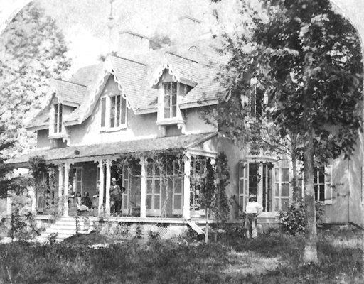
Census counts: 12,265 in 1960, a peak of 24,055 in 1970, 6,835 in 2020. The archive holds 6 old photos and papers going back to 1872 and 3 maps from 1894 on.
Lutherville has less food insecurity than most of Maryland and has commutes shorter than most of Maryland, but it has many renters stretched by housing costs.
Its widest gap with Maryland is food insecurity: 7.4% of its 5,326 adults worry about having enough food, against 15.4% statewide.
Among adults in Lutherville, 31% sleep under 7 hours and 13% report frequent mental distress. Of 32 CDC measures, Lutherville beats the Maryland average on 21 and trails it on 1. In Lutherville, 7.5% of adults smoke cigarettes.
The public schools here belong to the Baltimore County Public Schools. Two of its 3 schools are below, each with the reason it’s listed. The 2 public schools in Lutherville teach 1,444 students between them.
Flood insurance has paid out on 25 claims in Lutherville since 1979. FEMA expects less storm and flood damage in the town than in 98% of U.S. communities. Households locally have drawn federal disaster aid once, in 2003. Of the losses FEMA expects locally, 46% come from inland flooding and 20% from heat waves.
The average commute for its 3,321 working residents takes 24.8 minutes, against 31.1 across Maryland.
Just 2% of Lutherville’s working residents have a job in town. The mean commuting time for Lutherville comes to 25 minutes. The top destinations are Baltimore (28%), Towson (11%) and Cockeysville (7%). The share of residents in Lutherville who live below the poverty line: 4.2%.
Lutherville
Maryland towns
U.S. towns
Work from home
22%
18%
11%
Average trip to work
25 minutes
32 minutes
25 minutes
Below the poverty line
4.2%
7%
9.6%
Median household income
$114,000
$113,000
$80,000
Where working residents work
In Lutherville2%
Baltimore28%
Towson11%
Cockeysville7%
Timonium4%
9 mi
median commute distance
4,056
jobs based in Lutherville
Balanced
jobs vs. working residents
A
Walkability grade: more walkable than 88% of U.S. towns
65.7% of renter households pay 30% or more of their income for housing, against 51.5% across Maryland.
A home in Lutherville typically sold within 30 days of listing. 85% of households are owner-occupiers in the town. Also worth knowing: the typical rent locally is $1,423 a month.
Census-designated place in Maryland, United States
Lutherville is a census-designated place (CDP) in Baltimore County, Maryland, United States. As of the 2020 census it had a population of 6,835. Prior to 2010 the area was part of the Lutherville-Timonium CDP. Within its borders lies the Lutherville Historic District.
By most measures, yes. Lutherville grades B+ overall, better than 73% of U.S. towns and #110 of 259 in Maryland. It grades A for health and C− for schools. Schools is its weak spot, with a C−.
Is Lutherville, MD expensive?
The typical home is worth about $444,000, 4% above the Maryland typical home. Cost of living, which also weighs rents, property taxes and how many households pay 30% or more of their income for housing, grades C.
What is Lutherville, MD known for?
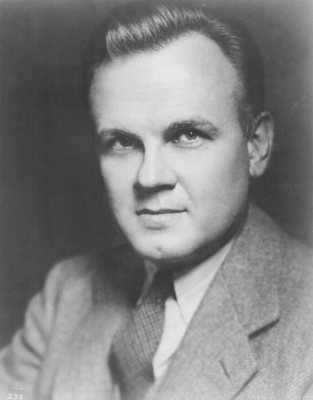
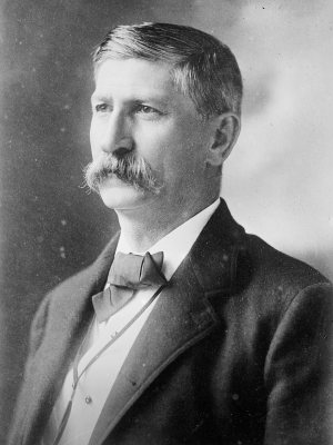
5 notable people were born here, including Bosley Crowther and Joshua Frederick Cockey Talbott.
Lutherville is in here
Say something about Lutherville.
Ask a question, answer one, post a photo or an event. Free, and the parts only a neighbor would know are the parts worth reading.
 10 mi
 10 mi
 12 mi
 11 mi

 9 mi