Emmitsburg dates to 1785, and 19% of its homes were built before 1940
More historic than 92% of U.S. towns · #18 of 261 in Maryland. What drives it
3 places in town are on the National Register, among them two historic districts with 228 buildings between them. Below: 6 old photos and papers, maps from 1911 on, and the census since 1850.
Founding year: Wikidata. First post office: 1800.The full story ↓
History grade
What drives Emmitsburg’s History grade
On its age, its old homes and the National Register, Emmitsburg is more historic than 92% of U.S. towns, #18 of 261 in Maryland. All 3 inputs are above most U.S. towns; its National Register listings ranks highest and its share of homes from before 1940 lowest.
A
HistoryA character grade: shown, never part of Emmitsburg’s overall grade.
Few Maryland towns list much on the Register (a typical Maryland town has 0.9 per 10,000 residents, the U.S. 2.4), so Emmitsburg’s 805 sits above most of its state (95% of Maryland towns have fewer) while its 229 historic buildings outnumber those of 94% of U.S. towns.
NoteThe founding year comes from Wikidata alone; no second source gives 1785.
How sure. Graded on any two of the three inputs instead, the letter would range from A− to A. The pre-1940 share is a Census survey estimate (±8.5 points).
Founding year: Wikidata (other dates in Quick answers). Homes: Census ACS 2020–24. National Register: National Park Service, May 2026 list; each listing counted once (boundary changes and added documentation belong to their listing), and a historic district counts its contributing buildings. How TownRatings grades history →
What stands out about Emmitsburg’s past
Read from the archive, the National Register and the record. The page puts what stands out first.
Emmitsburg was named for its founder, William Emmit, in 1785. However, a settlement (named first "Silver Fancy" and later "Poplar Fields") preceded the town, particularly since British authorities restricted colonists' expansion during and after the French and Indian War.
Passages that mention Emmitsburg, cut from the printed page as they were published.
History of Emmitsburg, Maryland, with a prelude of historical facts of Frederick County, and a romance entitled Disappointed1906 · page 100Read the page →
Read the text
Cooper, the money to purchase ground for this institution was supplied. In deciding the locality Mr. Dubourg was favorable to Baltimore City. Mr. Cooper insisted upon the selection of Emmitsburg, Md„ as a more convenient situation, as its physical and moral advantages were preferable to Baltimore. Then the priest (Dubourg) replied: "Be it Emmitsburg." The vicinity of Emmitsburg having been selected for the location of the sisterhood projected by Mrs.
Text read by machine from the scan; it may contain errors.
History of Emmitsburg, Maryland, with a prelude of historical facts of Frederick County, and a romance entitled Disappointed1906 · page 45Read the page →
Read the text
Samuel Einmit after laying out the town August 12th, 1785, deeded to his son William, 35 acres of land as follows: Samuel Emmit to his son William, part of Carrolsburg, wherein the lots of a new town of Emmitsburg are laid out. Excepting five lots, to wit: No. i to Samuel Emmit'swife; No. 17 to son Josiah; No. 16 to daughter Mary ; No. 4 to son Abraham James; No. 10 to grandchild Wm.
Text read by machine from the scan; it may contain errors.
The history of Graceham, Frederick County, Maryland1913 · page 112Read the page →
Read the text
We went as far as Littlestown (via Hanover) by railroad, and having partaken of a savory meal, we proceeded per stage to Emmitsburg, and were thence transported to Graceham in two private conveyances which were in waiting for us. “During the latter stage of our journey I learned from one of the Graceham brethren that for the last two weeks an unusual degree of interest in the subject of religion had prevailed among the community around Graceham. Greatly encouraged by this
Text read by machine from the scan; it may contain errors.
Scans and text from the Internet Archive. Books published in 1930 or earlier, which are in the public domain.
By decade
Emmitsburg, decade by decade
2 decades in the archive, from the 1860s to the 1870s. Scroll each row; tap a photo for its story.
In 1785, according to Wikidata. Emmitsburg’s post office opened in 1800, and the census of 1850 counted 812 people here.
How does Emmitsburg rank for history?
Emmitsburg is more historic than 92% of U.S. towns, #18 of 261 in Maryland. The History grade combines the town’s founding era, the share of homes built before 1940 and its National Register listings. It’s a character grade, so it isn’t part of the overall grade. How it works.
What is on the National Register in Emmitsburg?
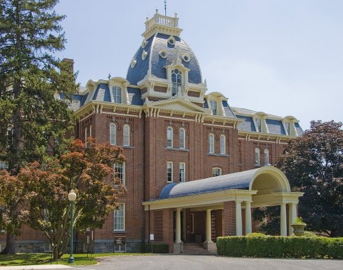
Three places: the St. Joseph's College and Mother Seton Shrine (listed 1976), the St. Euphemia's School and Sisters' House (1984) and the Emmitsburg Historic District (2024).
How old are the homes in Emmitsburg?
19% of Emmitsburg’s homes were built before 1940 (Census estimate, ±8.5 points), against a typical 3.3% for a Maryland town; the median home was built in 1986.
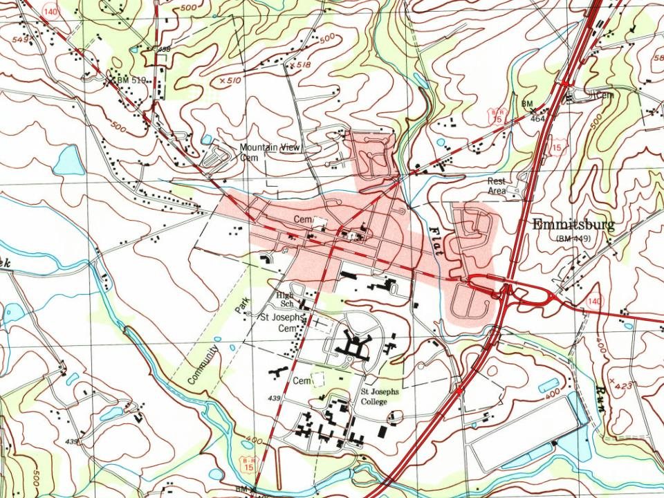
Founding dates: Wikidata, Wikipedia, the U.S. post office records of Blevins & Helbock (CC0) and the Census. Homes by year built: Census ACS 2020–24. National Register of Historic Places: National Park Service (list of May 22, 2026). Old photos, postcards and papers: Wikimedia Commons, the Library of Congress and other public archives, credited on each item’s page. Maps: U.S. Geological Survey historical topographic maps (via Esri) and Sanborn fire-insurance maps (Library of Congress). History text and census tables: Wikipedia (CC BY-SA 4.0). Places that used to be: USGS Geographic Names Information System (2021).
From Wikimedia Commons (1), the Library of Congress (5), the National Register of Historic Places (3), Wikipedia, Wikidata and Wikipedia for famous people, U.S. Geological Survey historical maps, U.S. Census counts (via Wikipedia), the US Post Offices dataset (Blevins & Helbock), the USGS Geographic Names Information System and old county and town histories (Internet Archive). Archive images are copied here with their credits and licenses, shown on each photo’s page. Refreshed monthly.







 1861
 1863
 1863
 1863