More historic than 85% of U.S. towns · #23 of 261 in Maryland. What drives it
4 places in town are on the National Register, among them a historic district with 960 buildings. Below: 6 old photos and papers, maps from 1885 on, and the census since 1850.
On its age, its old homes and the National Register, Easton is more historic than 85% of U.S. towns, #23 of 261 in Maryland. All 2 inputs are above most U.S. towns; its National Register listings ranks highest and its share of homes from before 1940 lowest.
A−
HistoryA character grade: shown, never part of Easton’s overall grade.
Few Maryland towns list much on the Register (a typical Maryland town has 0.9 per 10,000 residents, the U.S. 2.4), so Easton’s 559 sits above most of its state (90% of Maryland towns have fewer) while its 967 historic buildings outnumber those of 99% of U.S. towns.
How sure. Graded on two of the three inputs, so a change in either one moves the letter more than it would with three. The pre-1940 share is a Census survey estimate (±3.2 points).
Founding year: our sources. Homes: Census ACS 2020–24. National Register: National Park Service, May 2026 list; each listing counted once (boundary changes and added documentation belong to their listing), and a historic district counts its contributing buildings. How TownRatings grades history →
What stands out about Easton’s past
Read from the archive, the National Register and the record. The page puts what stands out first.
National Park Service, National Register of Historic Places. Photos from Wikimedia Commons, credited on each place’s page.
Places that used to be
Lost post offices, old corners, places now gone and burying grounds
Easton’s post office has been open since 1777. Another post office, Talbot Court House, opened and closed inside today’s town.
Talbot Court House
1776–1777
Easton
1777–today
17701900today
Hamlets and corners on the map
Ashby ParkBrookwood EstatesCalvert TerraceCarrolls AdditionCarters PlainsCliftonColonial HeightsCooks HopeCrabapple CourtFausleyFrankfordGlenwood HeightsGoltonHyde Park Trailer ParkIdlewildJensen's Hyde ParkLondonderryMecklenburgMount PleasantMulberry HillNorth EastonNorth GlenwoodPennsfieldPoplar Hill
Gone or out of use
Bethel African Methodist Episcopal ChurchchurchEaston Montessori SchoolschoolEaston Public School Number 1schoolEaston Public School Number 2schoolFort Stokesmilitary
4cemeteries and burying grounds inside Easton
DoverbrookRichland Memorial ParkSpring HillThird Haven Meeting
US Post Offices dataset (Blevins & Helbock, CC0). Places and cemeteries from the USGS Geographic Names Information System (2021).
People over time
Easton, census by census
Lost a third of its people between 1920 and 1930, then grew 8-fold.
18 censuses, 1850–2020.
U.S. Census Bureau decennial counts, from the census table on Easton’s Wikipedia page.
The town of Easton received its official beginning from an Act of the Assembly of the Province of Maryland dated November 4, 1710. The act was entitled, "An Act for the Building of a Court House for Talbot County, at Armstrong's Old Field near Pitt's Bridge". Pitt's Bridge crossed a stream forming the headwaters of the Tred Avon or Third Haven River. It was located at a point where North Washington Street crosses this stream, now enclosed in culverts, north of the Talbottown Shopping Center, and passes under the Electric Plant property. Prior to this date, the court had met at York, near the mouth of Skipton Creek. The court decided that this location was not convenient to all sections of the county and, in order to change the location, the above act of the Assembly was passed. As a result of this act, two acres of land were purchased from Philemon Armstrong, at a cost of 15,000 pounds …
Nothing in the archives for these yearsWeddings on Main Street, storms, parades, school pictures, the old store. If it’s in your family album, it belongs here.
Every edition of the U.S. Geological Survey’s map of Easton. Tap a year, or press play to watch the town change.
1904St Michaels sheet · 1:62,500
U.S. Geological Survey historical topographic maps (public domain), via Esri’s collection of the scans. The red ring marks the center of Easton.
Every building
Easton, building by building, 1885–1919
Fire insurance maps drew every building, what it was made of and what it was used for, so insurers could price the risk of fire. Pick a year, then a sheet.
Easton is more historic than 85% of U.S. towns, #23 of 261 in Maryland. The History grade combines the town’s founding era, the share of homes built before 1940 and its National Register listings. It’s a character grade, so it isn’t part of the overall grade. How it works.
What is on the National Register in Easton?
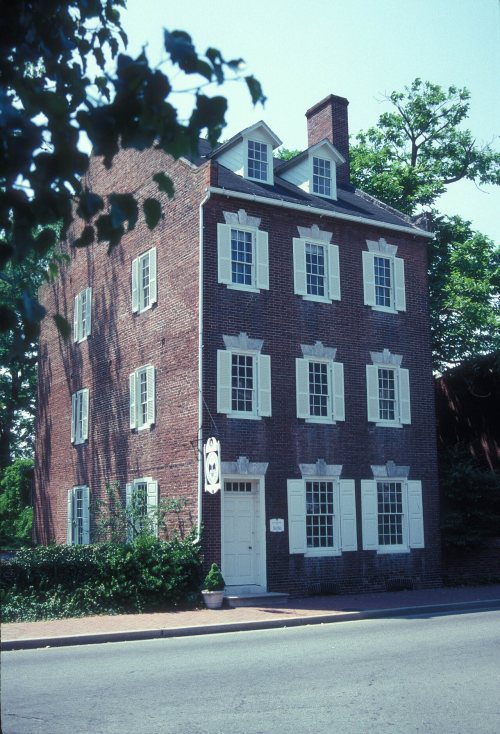
4 listings: 3 buildings and 1 historic district, the Easton Historic District, with 960 contributing buildings. 967 historic buildings in all.
How old are the homes in Easton?
11% of Easton’s homes were built before 1940 (Census estimate, ±3.2 points), against a typical 3.3% for a Maryland town; the median home was built in 1989.
Founding dates: Wikidata, Wikipedia, the U.S. post office records of Blevins & Helbock (CC0) and the Census. Homes by year built: Census ACS 2020–24. National Register of Historic Places: National Park Service (list of May 22, 2026). Old photos, postcards and papers: Wikimedia Commons, the Library of Congress and other public archives, credited on each item’s page. Maps: U.S. Geological Survey historical topographic maps (via Esri) and Sanborn fire-insurance maps (Library of Congress). History text and census tables: Wikipedia (CC BY-SA 4.0). Places that used to be: USGS Geographic Names Information System (2021).
From Wikimedia Commons (3), the Library of Congress (3), the National Register of Historic Places (4), Wikipedia, Wikidata and Wikipedia for famous people, U.S. Geological Survey historical maps, U.S. Census counts (via Wikipedia), the US Post Offices dataset (Blevins & Helbock), the USGS Geographic Names Information System and Sanborn fire insurance maps (Library of Congress). Archive images are copied here with their credits and licenses, shown on each photo’s page. Refreshed monthly.




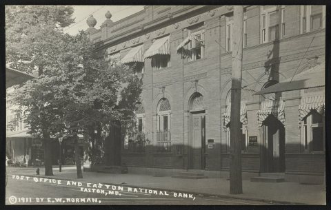 1911
 1911


