Cumberland dates to 1787, and 48% of its homes were built before 1940
More historic than 98% of U.S. towns · #4 of 261 in Maryland. What drives it
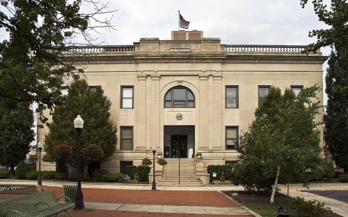
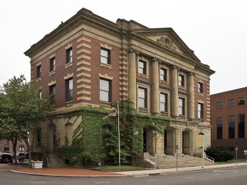
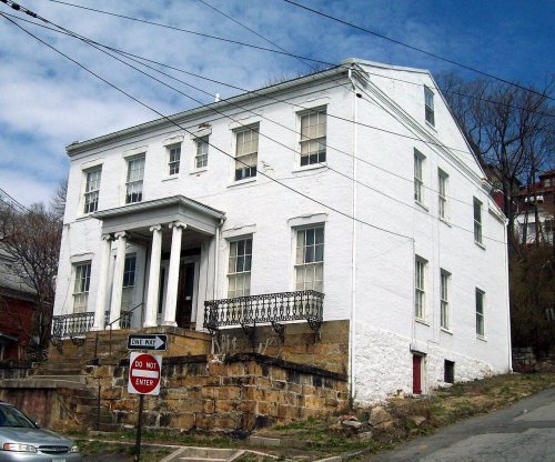
24 places in town are on the National Register, among them six historic districts with 1,562 buildings between them. Below: 9 old photos and papers, maps from 1887 on, and the census since 1840.
Founding year: Wikidata. First post office: 1795.The full story ↓
History grade
What drives Cumberland’s History grade
On its age, its old homes and the National Register, Cumberland is more historic than 98% of U.S. towns, #4 of 261 in Maryland. All 3 inputs are above most U.S. towns; its share of homes from before 1940 ranks highest and its age lowest.
A+
HistoryA character grade: shown, never part of Cumberland’s overall grade.
Few Maryland towns list much on the Register (a typical Maryland town has 0.9 per 10,000 residents, the U.S. 2.4), so Cumberland’s 843 sits above most of its state (95% of Maryland towns have fewer) while its 1,585 historic buildings outnumber those of 99% of U.S. towns.
NoteThe founding year comes from Wikidata alone; no second source gives 1787.
How sure. Graded on any two of the three inputs instead, the letter would still be A+. The pre-1940 share is a Census survey estimate (±3.5 points).
Founding year: Wikidata (other dates in Quick answers). Homes: Census ACS 2020–24. National Register: National Park Service, May 2026 list; each listing counted once (boundary changes and added documentation belong to their listing), and a historic district counts its contributing buildings. How TownRatings grades history →
What stands out about Cumberland’s past
Read from the archive, the National Register and the record. The page puts what stands out first.
National Park Service, National Register of Historic Places. Photos from Wikimedia Commons, credited on each place’s page.
Every building
Cumberland, building by building, 1887–1921
Fire insurance maps drew every building, what it was made of and what it was used for, so insurers could price the risk of fire. Pick a year, then a sheet.
Cumberland was named by English colonists after the son of King George II, Prince William, the Duke of Cumberland. It is built on the site of the mid-18th century Fort Cumberland, the starting point for British General Edward Braddock's ill-fated attack on the French stronghold of Fort Duquesne (present-day Pittsburgh) during the French and Indian War, the North American front of the Seven Years' War between the French and the British. (See Braddock expedition.) This area had been settled for thousands of years by indigenous peoples. The fort was developed along the Great Indian Warpath which tribes used to travel the backcountry.
Passages that mention Cumberland, cut from the printed page as they were published.
History of Cumberland (Maryland) [microform]1878 · page 309Read the page →
Read the text
The town was incorporated in January, 1815, at which time the Legislature passed an ‘‘ Act to provide lor the appointment of Commissioners, for the regulation and improvement of the Town of Cumberland,
Text read by machine from the scan; it may contain errors.
Scans and text from the Internet Archive. Books published in 1930 or earlier, which are in the public domain.
Timeline
Cumberland, 1787 to 1983
Woven from the archive, old maps, post office records, the National Register and the people born here.
Nothing in the archives for these yearsWeddings on Main Street, storms, parades, school pictures, the old store. If it’s in your family album, it belongs here.
Cumberland’s post office has been open since 1795.
Hamlets and corners on the map
Cumberland HeightsShanty TownSouth Cumberland
Gone or out of use
Allegany County InfirmaryhospitalCentral Methodist Episcopal ChurchchurchCentre Street Public SchoolschoolColumbia Street SchoolschoolDingle SchoolschoolEast Side SchoolschoolFort CumberlandmilitaryJohnson Heights Public SchoolschoolSacred Heart HospitalhospitalVirginia Avenue Public SchoolschoolWestern Maryland Health Systemhospital
3cemeteries and burying grounds inside Cumberland
Rose HillSaint PatricksSaints Peter and Paul
US Post Offices dataset (Blevins & Helbock, CC0). Places and cemeteries from the USGS Geographic Names Information System (2021).
Help out
Finish Cumberland’s story
Most archives stop around 1920. The photos from after that are in family albums, not libraries.
Decades since 1900 with photos
00s10s20s30s40s50s60s70s80s90s
1 of 10 decades. The empty ones are waiting for someone’s album.
In 1787, according to Wikidata. Cumberland’s post office opened in 1795, and the census of 1840 counted 2,428 people here.
How does Cumberland rank for history?
Cumberland is more historic than 98% of U.S. towns, #4 of 261 in Maryland. The History grade combines the town’s founding era, the share of homes built before 1940 and its National Register listings. It’s a character grade, so it isn’t part of the overall grade. How it works.
What is on the National Register in Cumberland?
24 listings: 18 buildings and 6 historic districts with 1,562 contributing buildings. 1,585 historic buildings in all.
How old are the homes in Cumberland?
48% of Cumberland’s homes were built before 1940 (Census estimate, ±3.5 points), against a typical 3.3% for a Maryland town; the median home was built in 1943.
Founding dates: Wikidata, Wikipedia, the U.S. post office records of Blevins & Helbock (CC0) and the Census. Homes by year built: Census ACS 2020–24. National Register of Historic Places: National Park Service (list of May 22, 2026). Old photos, postcards and papers: Wikimedia Commons, the Library of Congress and other public archives, credited on each item’s page. Maps: U.S. Geological Survey historical topographic maps (via Esri) and Sanborn fire-insurance maps (Library of Congress). History text and census tables: Wikipedia (CC BY-SA 4.0). Places that used to be: USGS Geographic Names Information System (2021).
From Wikimedia Commons (4), the Library of Congress (5), Wikidata (3), the National Register of Historic Places (24), Wikipedia, Wikidata and Wikipedia for famous people, U.S. Geological Survey historical maps, U.S. Census counts (via Wikipedia), the US Post Offices dataset (Blevins & Helbock), the USGS Geographic Names Information System, Sanborn fire insurance maps (Library of Congress) and old county and town histories (Internet Archive). Archive images are copied here with their credits and licenses, shown on each photo’s page. Refreshed monthly.





 1862
 1888
 1899
 1900


