Beaver Creek’s post office opened in 1836, and 1 of its places is on the National Register
Most of Beaver Creek was built recently: 9% of its homes predate 1940 and the median home dates from 1993. 1 place in town is on the National Register, among them a historic district with 11 buildings.
Wikipedia doesn’t have a history of Beaver Creek yet. The photos, dates and memories neighbors add here are how it gets written.
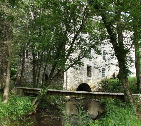
Beaver Creek is an unincorporated community in eastern Washington County, Maryland, United States. Its population was 251 as of the 2010 census. It is located southeast of Hagerstown and north of Boonsboro near U.S. Route 40 and Maryland Route 66. The community is officially included in the Hagerstown Metropolitan Area (Hagerstown-Martinsburg, MD-WV Metropolitan Statistical Area). This town was founded in 1766. Although Beaver Creek is home to several historic landmarks such as Beaver Creek School and the Doub's Mill Historic District, most of the community's development has occurred since the 1990s, with new and upscale housing for professionals from Hagerstown and from the Washington, D.C…
Its first post office opened in 1836. Between the 2010 and 2020 censuses its population grew from 251 to 461 (+84%).
Intro from Wikipedia. Population: U.S. Census Bureau.
Founding dates: Wikidata, Wikipedia, the U.S. post office records of Blevins & Helbock (CC0) and the Census. Homes by year built: Census ACS 2020–24. National Register of Historic Places: National Park Service (list of May 22, 2026). Old photos, postcards and papers: Wikimedia Commons, the Library of Congress and other public archives, credited on each item’s page. Maps: U.S. Geological Survey historical topographic maps (via Esri) and Sanborn fire-insurance maps (Library of Congress). History text and census tables: Wikipedia (CC BY-SA 4.0). Places that used to be: USGS Geographic Names Information System (2021). How TownRatings grades history →
From Wikimedia Commons (6), the National Register of Historic Places (1), the US Post Offices dataset (Blevins & Helbock) and the USGS Geographic Names Information System. Archive images are copied here with their credits and licenses, shown on each photo’s page. Refreshed monthly.

 2018
 2016
 2011
 2008
 2007
 2007
