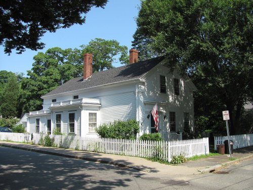
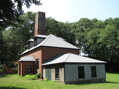
Tisbury dates to 1660, and 28% of its homes were built before 1940
More historic than 96% of U.S. towns · #64 of 283 in Massachusetts. What drives it
6 places in town are on the National Register, among them two historic districts with 61 buildings between them. Below: 6 old photos and papers, maps from 1889 on, and the census since 1790.
Founding year: Wikidata. First post office: 1797.The full story ↓
History grade
What drives Tisbury’s History grade
On its age, its old homes and the National Register, Tisbury is more historic than 96% of U.S. towns, #64 of 283 in Massachusetts. All 3 inputs are above most U.S. towns; its age ranks highest and its National Register listings lowest.
A+
HistoryA character grade: shown, never part of Tisbury’s overall grade.
Massachusetts towns list more on the Register than most of the country (a typical Massachusetts town has 46.0 per 10,000 residents, the U.S. 2.4), so Tisbury’s 139 sits above most of its state (70% of Massachusetts towns have fewer) while its 68 historic buildings outnumber those of 87% of U.S. towns.
How sure. Graded on any two of the three inputs instead, the letter would range from A to A+. The pre-1940 share is a Census survey estimate (±6.9 points). Two sources give 1660.
Founding year: Wikidata (other dates in Quick answers). Homes: Census ACS 2020–24. National Register: National Park Service, May 2026 list; each listing counted once (boundary changes and added documentation belong to their listing), and a historic district counts its contributing buildings. How TownRatings grades history →
What stands out about Tisbury’s past
Read from the archive, the National Register and the record. The page puts what stands out first.
The Wampanoag have lived on Martha's Vineyard, which they called Noepe, continuously for approximately 5,000-15,000 years. The first English maritime explorer, Bartholomew Gosnold, came in 1602. Six decades later, in 1660, Tisbury was first settled by James Allen, William Peabody and Lt. Josiah Standish, a son of Captain Myles Standish. It was officially incorporated in 1671 by Francis Lovelace, Governor General of New York. The town, which originally included the lands of West Tisbury, was named for Tisbury, Wiltshire, England, the hometown of Martha's Vineyard Governor Mayhew. Citizens of the island, unhappy with the leadership of Governor Mayhew, petitioned William III and Mary II in 1673 for a change of leadership, and the entire island, including the town, became a part of Massachusetts.
Passages that mention Tisbury, cut from the printed page as they were published.
The history of Martha's Vineyard, Dukes County, Massachusetts1911Read the page →
Read the text
The town of Tisbury, incorporated July 8, 167 1, included the present town of West Tisbury, the region originally settled by the early proprietors, — and the limits of the town remained intact, territorially, until May i, 1892, when as a result of a long continued agitation, the old town was divided. The portion formerly known as Homes Hole Neck retained the corporate name and ancient records of Tisbury, and the settlement at West Tisbury, where the town had its first
Text read by machine from the scan; it may contain errors.
The history of Martha's Vineyard, Dukes County, Massachusetts1911Read the page →
Read the text
r In 1803, John Davis and seventy-five others addressed a petition to the General Court, praying for incorporation as the Baptist Society of Tisbury. The town of Tisbury at its April meeting instructed the selectmen [Ezekiel Luce, William Athearn and Rufus Spalding] and Benjamin Allen "to consult and draw a remonstrance to a petition Sent by a number of the Inhabatants of Tisbury, Chillmark & Edgartown praying to be incorporated into a religious baptiss Society," but a year
Text read by machine from the scan; it may contain errors.
Scans and text from the Internet Archive. Books published in 1930 or earlier, which are in the public domain.
By decade
Tisbury, decade by decade
5 decades in the archive, from the 1780s to the 1920s. Scroll each row; tap a photo for its story.
Nothing in the archives for these yearsWeddings on Main Street, storms, parades, school pictures, the old store. If it’s in your family album, it belongs here.
In 1660, according to Wikidata. Tisbury’s post office opened in 1797, and the first U.S. census counted 1,142 people here in 1790.
How does Tisbury rank for history?
Tisbury is more historic than 96% of U.S. towns, #64 of 283 in Massachusetts. The History grade combines the town’s founding era, the share of homes built before 1940 and its National Register listings. It’s a character grade, so it isn’t part of the overall grade. How it works.
What is on the National Register in Tisbury?
6 listings: 3 buildings, among them the Ritter House (listed 1977, the first), 2 historic districts, the William Street Historic District and the West Chop Club Historic District, with 61 contributing buildings, and 1 structure. 68 historic buildings in all.
How old are the homes in Tisbury?
28% of Tisbury’s homes were built before 1940 (Census estimate, ±6.9 points), against a typical 21% for a Massachusetts town; the median home was built in 1979.
Founding dates: Wikidata, Wikipedia, the U.S. post office records of Blevins & Helbock (CC0) and the Census. Homes by year built: Census ACS 2020–24. National Register of Historic Places: National Park Service (list of May 22, 2026). Old photos, postcards and papers: Wikimedia Commons, the Library of Congress and other public archives, credited on each item’s page. Maps: U.S. Geological Survey historical topographic maps (via Esri) and Sanborn fire-insurance maps (Library of Congress). History text and census tables: Wikipedia (CC BY-SA 4.0). Places that used to be: USGS Geographic Names Information System (2021).
From Wikimedia Commons (10), Wikidata (2), the National Register of Historic Places (6), Wikipedia, Wikidata and Wikipedia for famous people, U.S. Geological Survey historical maps, U.S. Census counts (via Wikipedia), the US Post Offices dataset (Blevins & Helbock), the USGS Geographic Names Information System and old county and town histories (Internet Archive). Archive images are copied here with their credits and licenses, shown on each photo’s page. Refreshed monthly.


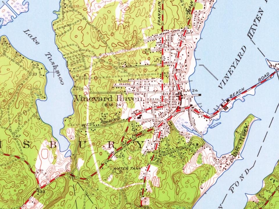


 1919
 2014
 2014
 2010
 2008