196 years in pictures
The archive holds 6 old photos and papers going back to 1865 and 4 maps from 1890 on.
- 1830Shelburne Falls is settled
Each edition grades its towns against each other only.

17% of residents live below the poverty line in Shelburne Falls, against 6% in Massachusetts’ towns and 9.6% across U.S. towns. Only 10 of the 284 Massachusetts towns we compare have a lower January low than Shelburne Falls. Shelburne Falls’ trail network density is 0.9 miles per square mile, below Massachusetts’ towns (1.8) but above U.S. towns (0.4). We don’t grade Shelburne Falls yet; the figures below are still real.
Where Shelburne Falls beats most towns.
Where Shelburne Falls’s working residents go each day. Line width shows the share.
Census LEHD 2023

The archive holds 6 old photos and papers going back to 1865 and 4 maps from 1890 on.
Museums, parks, gardens and other places to visit around Shelburne Falls. Close and well known come first.
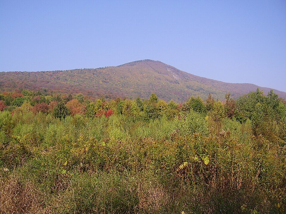
21 mi MountainMount Greylock
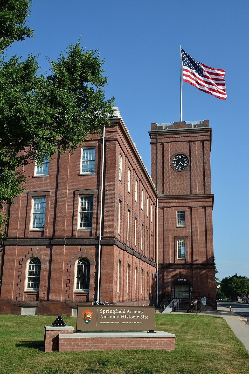
35 mi National Historic SiteSpringfield Armory National Historic Site14K visitors a year
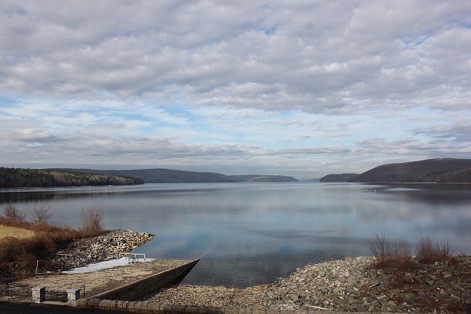
29 mi LakeQuabbin Reservoir
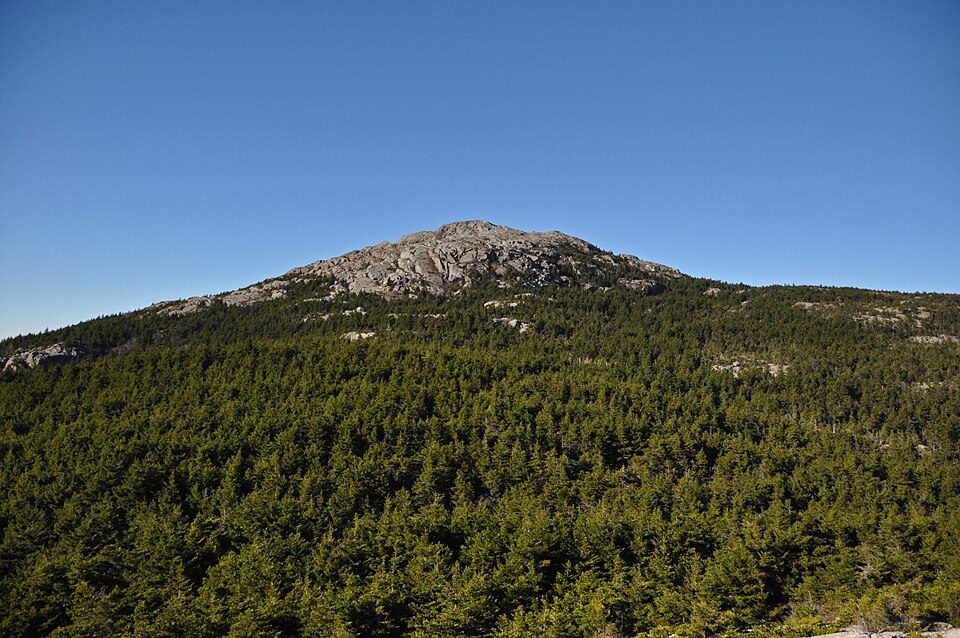
37 mi MountainMount Monadnock
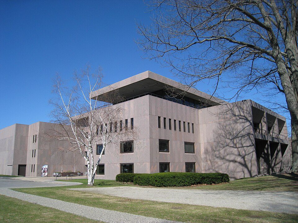
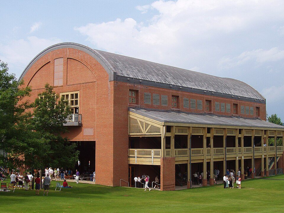
25 mi MuseumClark Art Institute
34 mi TheatreTanglewoodMount Greylock: Jstergis, CC BY 3.0 · Springfield Armory National Historic Site: National Park Service, Public domain · Quabbin Reservoir: engineerchange, CC BY 2.0 · Mount Monadnock: Jonwmcinenrey, CC BY-SA 4.0 · Clark Art Institute: Daderot, Public domain · Tanglewood: Daderot., CC BY-SA 3.0
Shelburne Falls is unincorporated, so Franklin County and regional agencies provide most services.
EPA SDWIS (Oct 9, 2026) · HIFLD + EIA-861 2025 · Census 2020 ZCTAs · NCES 2024–25 · registration: vote.gov, updated Nov 18, 2024.
Ordered by what stands out in Shelburne Falls.
For half of commuters, work is under 19 miles away. The mean commuting time in Shelburne Falls is 32 minutes. Only a tenth of working residents stay in Shelburne Falls for work; the rest commute out. In Shelburne Falls, a fifth of workers work from home.
| Shelburne Falls | Massachusetts towns | U.S. towns | |
|---|---|---|---|
| Average trip to work | 32 minutes | 30 minutes | 25 minutes |
| Median household income | $77,000 | $120,000 | $80,000 |
| Work from home | 20% | 18% | 11% |
Census LEHD 2023 · ACS
Adults 18 to 34 are 13% of residents (24% statewide); people 65 and older are 25% of residents (18% statewide). In Shelburne Falls, the median age is 49.4 years. Here, 43% of adults 25 and older have a bachelor’s degree, against 47% in Massachusetts as a whole.
| Shelburne Falls | Massachusetts towns | U.S. towns | |
|---|---|---|---|
| Median age | 49.4 years | 43.4 years | 40.5 years |
| Aged 65 or older | 24% | 19% | 18% |
| Under 18 | 18% | 20% | 22% |
| Bachelor’s degree or more, 25+ | 43% | 47% | 29% |
54% women, 46% men
That’s an even split within the survey’s margin of ±4.5 points. Across Massachusetts, 51.1% of residents are women.
| Shelburne Falls | MA | U.S. | |
|---|---|---|---|
| Under 10 | 8.2% | 10.2% | 11.6% |
| 10 to 17 | 9.2% | 9.2% | 10.3% |
| 18 to 24 | 6.5% | 9.8% | 9.1% |
| 25 to 34 | 6.1% | 14% | 13.7% |
| 35 to 44 | 12.8% | 13% | 13.2% |
| 45 to 54 | 17.2% | 12.3% | 12.2% |
| 55 to 64 | 15.4% | 13.6% | 12.7% |
| 65 to 74 | 15.7% | 10.5% | 10.2% |
| 75 and older | 8.8% | 7.4% | 7% |
| No diploma | 5.8% | 8.6% | 10.4% |
| High school | 27.2% | 22.6% | 26% |
| Some college | 15.8% | 14.1% | 19.1% |
| Associate’s | 8.6% | 7.5% | 8.8% |
| Bachelor’s | 17.5% | 25.5% | 21.6% |
| Graduate | 25.2% | 21.8% | 14.1% |
U.S. Census Bureau · ACS 2020-2024 5-year estimates · in a town of 1,800, single groups can be off by several points
Expected damage from storms and floods is higher here than in 68% of U.S. communities. FEMA puts 76% of Shelburne Falls’s expected hazard losses down to inland flooding, and 8% to cold waves.
FEMA National Risk Index · OpenFEMA
In Shelburne Falls, the July high is 83°F.
NOAA U.S. Climate Normals, 1991–2020
2.3 miles of trail wind through 2 parks and preserves.
| Biggest places to walk | Trails | Acres |
|---|---|---|
| 1. High Ledges Wildlife Sanctuary | — | 13 |
| 2. Veterans Memorial Field | — | 4 |
Trails & parks © OpenStreetMap contributors · Conserved land: USGS PAD-US
For adults in Shelburne Falls, the share who had a checkup this year is 84%. This Massachusetts town beats the Massachusetts average on 9 of 32 CDC measures and trails it on 6. In Shelburne Falls, 26% of adults have obesity, and 38% have high blood pressure.
| Shelburne Falls | Massachusetts towns | U.S. towns | |
|---|---|---|---|
| Yearly checkup (CDC PLACES) | 84% | 82% | 79% |
| Obesity (CDC PLACES) | 26% | 28% | 35% |
| High blood pressure (CDC PLACES) | 38% | 32% | 35% |
| Binge drink (CDC PLACES) | 15% | 17% | 16% |
| What stands out | Shelburne Falls | MA |
|---|---|---|
| Fewer uninsured adults | 3.7% | 5.2% |
| Fewer adults facing housing insecurity | 8.1% | 11.1% |
| More adults who have had cancer | 12.2% | 8.5% |
CDC PLACES 2025 · modeled estimates for adults · CMS · HRSA
Among households in Shelburne Falls, 60% live in a home they own. Shelburne Falls’ rent at the middle of the market comes in at $1,107 a month.
| Shelburne Falls | Massachusetts towns | U.S. towns | |
|---|---|---|---|
| Households that own their home | 60% | 79% | 73% |
| Median rent | $1,107 a month | $1,683 a month | $1,185 a month |
Census ACS, 2020–24 · Zillow Home Value Index · Redfin Data Center
1 within 15 miles of the center of Shelburne Falls
About 3 of every 100 Shelburne Falls residents are enrolled in college, against 8 across Massachusetts.
6 notable people were born in Shelburne Falls.


Census-designated place in Massachusetts, United States
Shelburne Falls is a historic village in the towns of Shelburne and Buckland in Franklin County, Massachusetts, United States. The village is a census-designated place (CDP); as of the 2020 census, Shelburne Falls had a population of 1,719. It is part of the Springfield, Massachusetts, Metropolitan Statistical Area.
From Wikipedia, licensed CC BY-SA 4.0 · facts via Wikidata (CC0)
3 towns share a border with Shelburne Falls.
| Town | MA rank | Overall | Cost | Safety | Schools | Health |
|---|---|---|---|---|---|---|
| Shelburne Falls | — | — | — | — | — | — |
| Buckland | — | — | C− | — | C− | A− |
| Shelburne | — | — | C− | A− | C− | A− |
| Charlemont | — | — | C | — | D− | A− |
Buckland, Shelburne and Charlemont have fewer than 2,500 residents, so they get subject grades but no overall grade. Buckland and Charlemont report no FBI crime data of their own. Shelburne Falls isn’t graded (fewer than 1,000 residents, or not enough data). Compare Shelburne Falls with a neighbor →
Short answers, built from the data on this page.
We don’t grade Shelburne Falls yet; the figures below are still real.
6 notable people were born here, including Scott Lively and Epaphroditus Ransom.