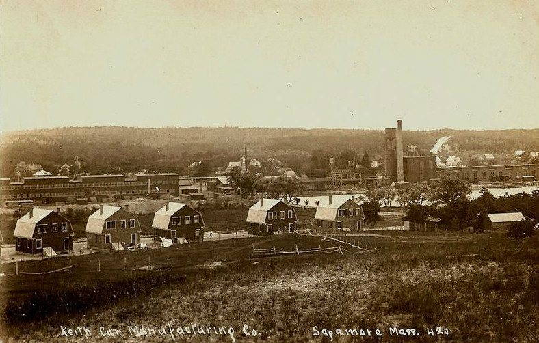
Keith Car Manufacturing Company, c. 1915
Sagamore’s story
142 years in pictures
The archive holds 6 old photos and papers going back to 1915.
- 1884Sagamore is settled
Each edition grades its towns against each other only.
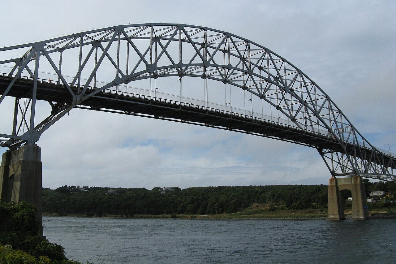
A town of 4,072, settled in 1884.
Sagamore’s median rent is $2,123 a month, against $1,683 a month in Massachusetts’ towns and $1,185 a month across U.S. towns. Sagamore’s trail density is 3.4 miles per square mile, above both Massachusetts’ towns (1.8) and U.S. towns (0.4). We don’t grade Sagamore yet; the figures below are still real.
The archive holds 6 old photos and papers going back to 1915.
Museums, parks, gardens and other places to visit around Sagamore. Close and well known come first.
 33 mi MuseumUSS Massachusetts
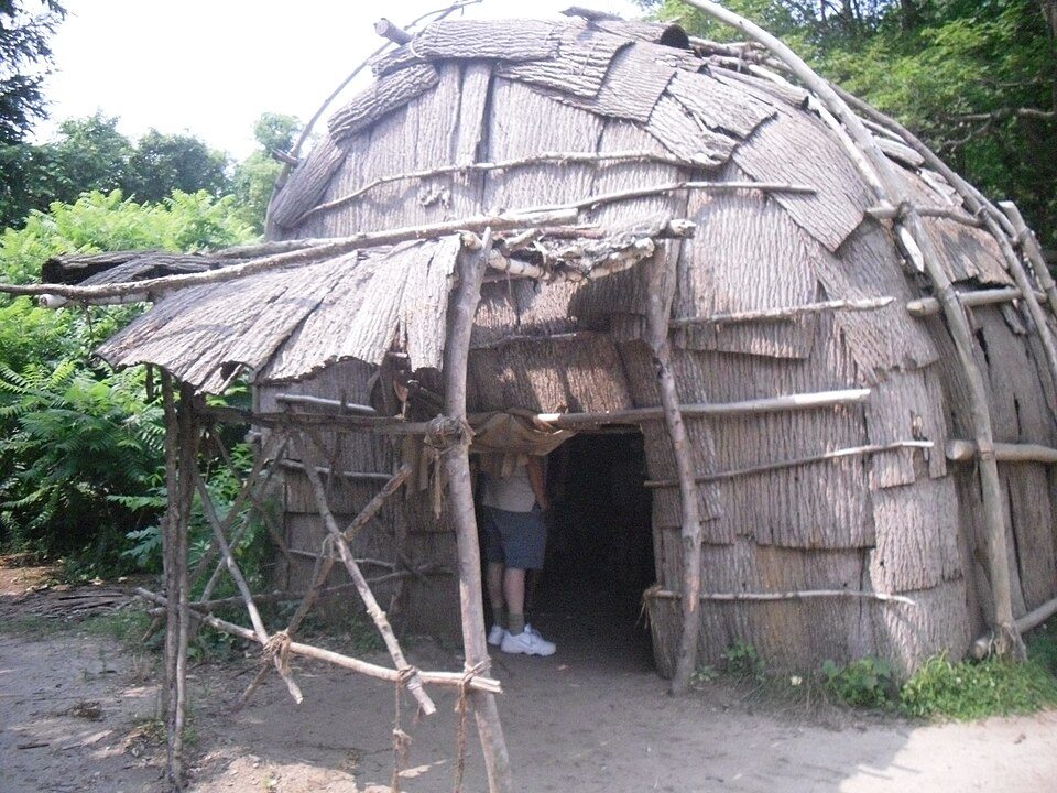 12 mi MuseumPlimoth Patuxet
 32 mi Ancient siteSS Pendleton
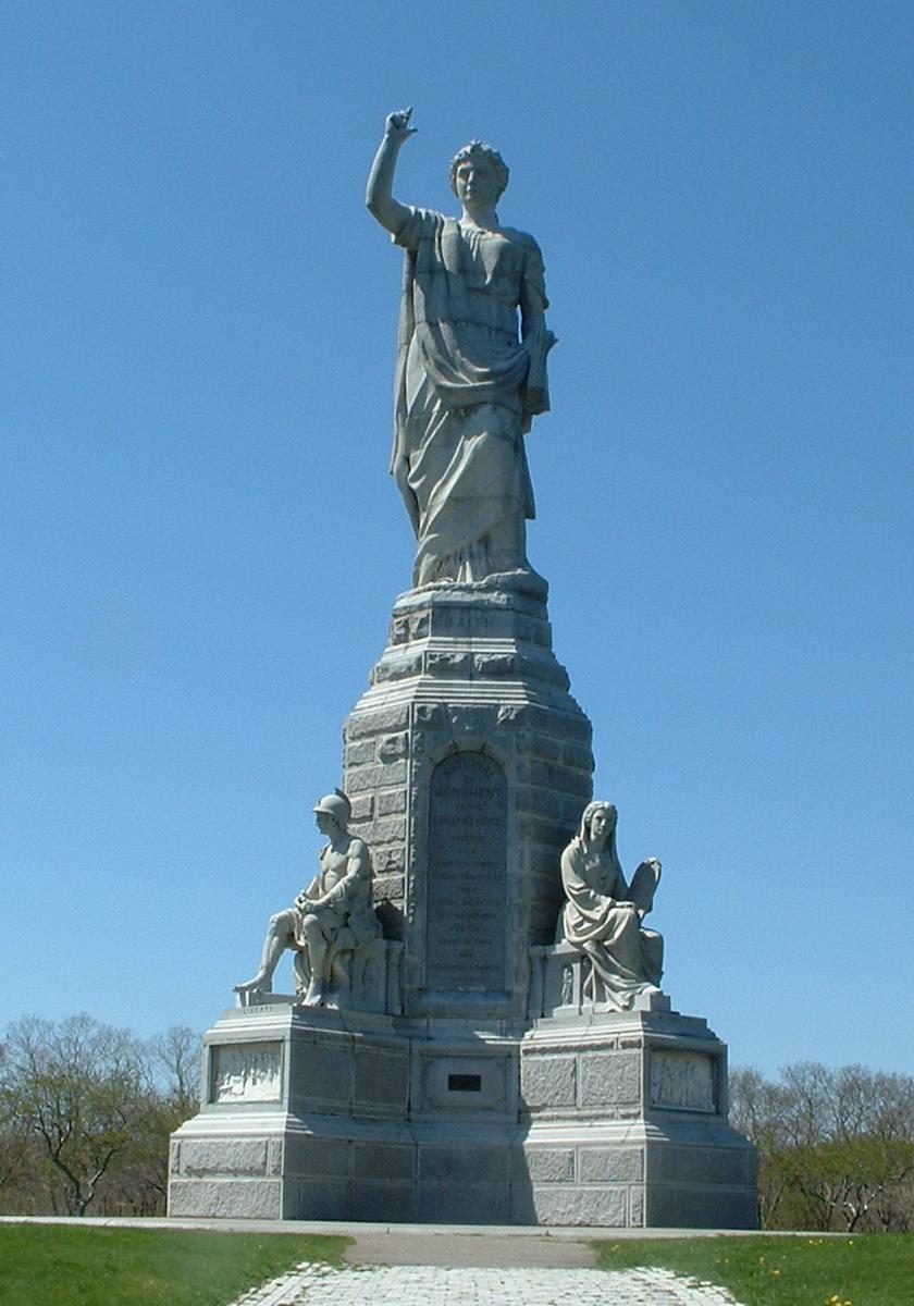 14 mi LandmarkNational Monument to the Forefathers
 33 mi MuseumBattleship Cove
 13 mi Theme parkEdaville Railroad
USS Massachusetts: USN, Public domain · Plimoth Patuxet: Tr!sie, CC BY-SA 3.0 · SS Pendleton: United States Coast Guard, Richard C. Kelsey, Public domain · National Monument to the Forefathers: T.S. Custadio aka ToddC4176 at en.wikipedia, Public domain · Battleship Cove: Electroengie at English Wikipedia, Public domain · Edaville Railroad: Dan Crow, CC BY-SA 3.0
Sagamore is unincorporated, so Barnstable County and regional agencies provide most services.
EPA SDWIS (Oct 9, 2026) · HIFLD + EIA-861 2025 · Census 2020 ZCTAs · NCES 2024–25 · registration: vote.gov, updated Nov 18, 2024.
Ordered by what stands out in Sagamore.
Expected storm and flood damage is lower than in 78% of U.S. communities. Since 2005, 4 flood insurance claims have been paid out in Sagamore.
FEMA flood insurance claims · FEMA National Risk Index · OpenFEMA
| Biggest places to walk | Trails | Acres |
|---|---|---|
| 1. Marsh | — | 16 |
| 2. North Sagamore Playground | — | 16 |
| 3. Marsh On Pilgram Rd | — | 10 |
Trails & parks © OpenStreetMap contributors · Conserved land: USGS PAD-US
Sagamore has chilly, snowy winters and pleasant summers, with plenty of rain. Sagamore’s July high is 81°F.
NOAA U.S. Climate Normals, 1991–2020
Most working residents leave Sagamore for work: only 6% work in town. 2.5% of residents live below the poverty line in Sagamore. The top destinations are Bourne (15%), Plymouth (12%) and Barnstable Town (9%).
| Sagamore | Massachusetts towns | U.S. towns | |
|---|---|---|---|
| Below the poverty line | 2.5% | 6% | 9.6% |
| Median household income | $108,000 | $120,000 | $80,000 |
| Average trip to work | 26 minutes | 30 minutes | 25 minutes |
| Working residents who work in town | 5.7% | 9.8% | 8% |
Census LEHD 2023 · ACS
Adults 18 to 34 are 18% of residents (24% statewide). The median age in Sagamore is 47.9 years. 49% of adults 25 and older have a bachelor’s degree or more, vs 47% across Massachusetts.
| Sagamore | Massachusetts towns | U.S. towns | |
|---|---|---|---|
| Median age | 47.9 years | 43.4 years | 40.5 years |
| Bachelor’s degree or more, 25+ | 49% | 47% | 29% |
| Aged 65 or older | 21% | 19% | 18% |
| Under 18 | 20% | 20% | 22% |
51% women, 49% men
That’s an even split within the survey’s margin of ±5.4 points. Across Massachusetts, 51.1% of residents are women.
| Sagamore | MA | U.S. | |
|---|---|---|---|
| Under 10 | 10.7% | 10.2% | 11.6% |
| 10 to 17 | 9.3% | 9.2% | 10.3% |
| 18 to 24 | 7.3% | 9.8% | 9.1% |
| 25 to 34 | 10.4% | 14% | 13.7% |
| 35 to 44 | 8.9% | 13% | 13.2% |
| 45 to 54 | 13.1% | 12.3% | 12.2% |
| 55 to 64 | 19.2% | 13.6% | 12.7% |
| 65 to 74 | 12.6% | 10.5% | 10.2% |
| 75 and older | 8.5% | 7.4% | 7% |
| No diploma | 2.5% | 8.6% | 10.4% |
| High school | 19.4% | 22.6% | 26% |
| Some college | 24.2% | 14.1% | 19.1% |
| Associate’s | 5% | 7.5% | 8.8% |
| Bachelor’s | 30.5% | 25.5% | 21.6% |
| Graduate | 18.4% | 21.8% | 14.1% |
U.S. Census Bureau · ACS 2020-2024 5-year estimates · in a town of 4,100, single groups can be off by several points
Sagamore beats the Massachusetts average on 13 of 32 CDC measures and trails it on 2. 29% of Sagamore adults sleep under 7 hours.
| Sagamore | Massachusetts towns | U.S. towns | |
|---|---|---|---|
| Sleep under 7 hours (CDC PLACES) | 29% | 33% | 36% |
| Obesity (CDC PLACES) | 26% | 28% | 35% |
| Yearly checkup (CDC PLACES) | 84% | 82% | 79% |
| Frequent mental distress (CDC PLACES) | 14% | 16% | 17% |
| What stands out | Sagamore | MA |
|---|---|---|
| Fewer adults facing food insecurity | 7.2% | 12.4% |
| Fewer uninsured adults | 3.1% | 5.2% |
| More adults who have had cancer | 11.8% | 8.5% |
CDC PLACES 2025 · modeled estimates for adults · CMS · HRSA
Zillow Home Value Index · Redfin Data Center
2 within 15 miles of the center of Sagamore
About 5 of every 100 Sagamore residents are enrolled in college, against 8 across Massachusetts.
Census-designated place in Massachusetts, United States
Sagamore is a census-designated place (CDP) in the town of Bourne in Barnstable County, Massachusetts, United States. As of the 2020 census, Sagamore had a population of 3,851. "Sagamore" was one of the words used by northeastern Native Americans to designate an elected chief or leader.
From Wikipedia, licensed CC BY-SA 4.0 · facts via Wikidata (CC0)
3 towns share a border with Sagamore.
| Town | MA rank | Overall | Cost | Safety | Schools | Health |
|---|---|---|---|---|---|---|
| Sagamore | — | — | — | — | — | — |
| Bourne | #222 | C+ | C− | B− | C | A |
| Sandwich | #100 | A− | D | A− | B+ | A |
| Plymouth | #180 | B | D | B− | B− | A− |
Sagamore isn’t graded (fewer than 1,000 residents, or not enough data). Compare Sagamore with a neighbor →
Short answers, built from the data on this page.
We don’t grade Sagamore yet; the figures below are still real.


