Marblehead dates to 1629, and 47% of its homes were built before 1940
Among the most historic 1% of U.S. towns · #3 of 283 in Massachusetts. What drives it
11 places in town are on the National Register, among them 2 National Historic Landmarks and a historic district with 988 buildings. Below: 22 old photos and papers, maps from 1885 on, and the census since 1790.
Founding year: Wikidata. First post office: 1773.The full story ↓
History grade
What drives Marblehead’s History grade
On its age, its old homes and the National Register, Marblehead is among the most historic 1% of U.S. towns, #3 of 283 in Massachusetts. All 3 inputs put Marblehead near the top nationally; its share of homes from before 1940 ranks highest.
A+
HistoryA character grade: shown, never part of Marblehead’s overall grade.
Massachusetts towns list more on the Register than most of the country (a typical Massachusetts town has 46.0 per 10,000 residents, the U.S. 2.4), so Marblehead’s 488 sits above most of its state (91% of Massachusetts towns have fewer) while its 996 historic buildings outnumber those of 99% of U.S. towns.
NoteThe founding year comes from Wikidata alone; no second source gives 1629.
How sure. Graded on any two of the three inputs instead, the letter would still be A+. The pre-1940 share is a Census survey estimate (±3.3 points).
Founding year: Wikidata (other dates in Quick answers). Homes: Census ACS 2020–24. National Register: National Park Service, May 2026 list; each listing counted once (boundary changes and added documentation belong to their listing), and a historic district counts its contributing buildings. How TownRatings grades history →
What stands out about Marblehead’s past
Read from the archive, the National Register and the record. The page puts what stands out first.
Marblehead was originally called Massebequash after the river which ran between it and Salem. The land was inhabited by the Naumkeag tribe of the Pawtucket confederation under the overall sachem Nanepashemet. Epidemics in 1615–1619 and 1633, believed to be smallpox, devastated the tribe. Numerous shell mounds and burial sites have been found throughout the town's history, along with foundations of multiple villages and forts. On September 16, 1684, heirs of Nanepashemet sold their 3,700 acres (15 km2); the deed is preserved today at Abbot Hall in the town.
Passages that mention Marblehead, cut from the printed page as they were published.
History of Essex County, Massachusetts, with biographical sketches of many of its pioneers and prominent men1888 · page 160Read the page →
Read the text
In the spring of 1884 a line was projected to the town of Marblehead, whose transportation facilities by railroad were very meagre. The line was completed in August, 1884, the first car being run August 18th, and being received with great enthusiasm by the Marbleheaders. The line has met with good sticcess, although it was prophesied that it would prove unprofitable during cold weather ; the use of stoves in
Text read by machine from the scan; it may contain errors.
History of Essex County, Massachusetts, with biographical sketches of many of its pioneers and prominent men1888 · page 41Read the page →
Read the text
Marblehead, taken from Salem, was incorporated in 1649, but no church was gathered there till 1684; meantime such of its people as had had or desired church fellowship continued to find it in connection with the church in Salem. On the other side of Bass River, in what is now Beverly, public worship was established in 1657, and Rev. John Hale was settled as the first minister in 1667. In 1713 a second church
Text read by machine from the scan; it may contain errors.
Scans and text from the Internet Archive. Books published in 1930 or earlier, which are in the public domain.
By decade
Marblehead, decade by decade
4 decades in the archive, from the 1790s to the 1890s. Scroll each row; tap a photo for its story.
Nothing in the archives for these yearsWeddings on Main Street, storms, parades, school pictures, the old store. If it’s in your family album, it belongs here.
Every edition of the U.S. Geological Survey’s map of Marblehead. Tap a year, or press play to watch the town change.
1948Boston sheet · 1:250,000
U.S. Geological Survey historical topographic maps (public domain), via Esri’s collection of the scans. The red ring marks the center of Marblehead.
Every building
Marblehead, building by building, 1885–1915
Fire insurance maps drew every building, what it was made of and what it was used for, so insurers could price the risk of fire. Pick a year, then a sheet.
In 1629, according to Wikidata. Marblehead’s post office opened in 1773, and the first U.S. census counted 5,661 people here in 1790.
How does Marblehead rank for history?
Marblehead is among the most historic 1% of U.S. towns, #3 of 283 in Massachusetts. The History grade combines the town’s founding era, the share of homes built before 1940 and its National Register listings. It’s a character grade, so it isn’t part of the overall grade. How it works.
What is on the National Register in Marblehead?
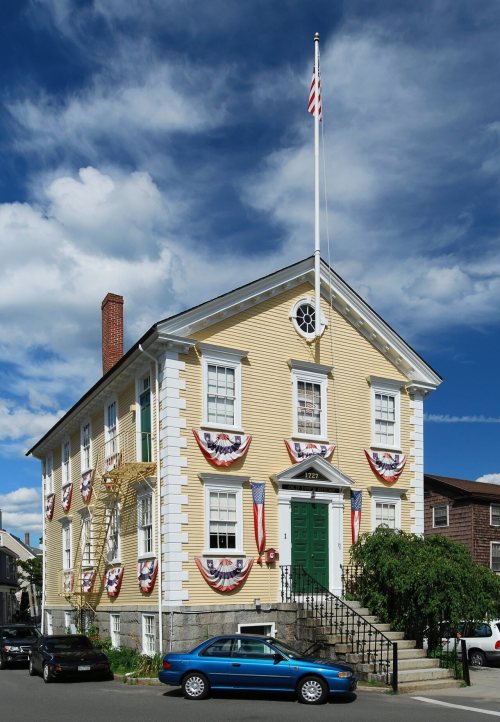
11 listings, 2 of them National Historic Landmarks: 8 buildings, among them the Jeremiah Lee House (a National Historic Landmark since 1960), 1 historic district, the Marblehead Historic District, with 988 contributing buildings, 1 site, and 1 structure. 996 historic buildings in all.
How old are the homes in Marblehead?
47% of Marblehead’s homes were built before 1940 (Census estimate, ±3.3 points), against a typical 21% for a Massachusetts town; the median home was built in 1944.
Founding dates: Wikidata, Wikipedia, the U.S. post office records of Blevins & Helbock (CC0) and the Census. Homes by year built: Census ACS 2020–24. National Register of Historic Places: National Park Service (list of May 22, 2026). Old photos, postcards and papers: Wikimedia Commons, the Library of Congress and other public archives, credited on each item’s page. Maps: U.S. Geological Survey historical topographic maps (via Esri) and Sanborn fire-insurance maps (Library of Congress). History text and census tables: Wikipedia (CC BY-SA 4.0). Places that used to be: USGS Geographic Names Information System (2021).
From Wikimedia Commons (15), the Library of Congress (7), Wikidata (2), the National Register of Historic Places (11), Wikipedia, Wikidata and Wikipedia for famous people, U.S. Geological Survey historical maps, U.S. Census counts (via Wikipedia), the US Post Offices dataset (Blevins & Helbock), the USGS Geographic Names Information System, Sanborn fire insurance maps (Library of Congress) and old county and town histories (Internet Archive). Archive images are copied here with their credits and licenses, shown on each photo’s page. Refreshed monthly.


 ★ Landmark
 ★ Landmark





 c. 1865
 1888
 1890
 1890
 1896
 1896
 1898
 1898
 1898
 1898
 1898
 1898
 1898
 1898
 1898
 1898
 1898
 1899


