Fall River has 108 places on the National Register, 5 of them National Historic Landmarks
Among the most historic 1% of U.S. towns · #20 of 283 in Massachusetts. What drives it
Dated to 1670 (Wikidata), with 46% of its homes built before 1940 and 6 historic districts holding 1,105 contributing buildings. Below: 6 old photos and papers, maps from 1888 on, the census since 1810, and every listing on the Register.
Founding year: Wikidata. First post office: 1811.The full story ↓
History grade
What drives Fall River’s History grade
On its age, its old homes and the National Register, Fall River is among the most historic 1% of U.S. towns, #20 of 283 in Massachusetts. All 3 inputs are above most U.S. towns; its share of homes from before 1940 ranks highest and its National Register listings lowest.
A+
HistoryA character grade: shown, never part of Fall River’s overall grade.
Massachusetts towns list more on the Register than most of the country (a typical Massachusetts town has 46.0 per 10,000 residents, the U.S. 2.4), so Fall River’s 117 sits above most of its state (66% of Massachusetts towns have fewer) while its 1,105 historic buildings outnumber those of 99% of U.S. towns.
NoteThe founding year comes from Wikidata alone; no second source gives 1670.
How sure. Graded on any two of the three inputs instead, the letter would still be A+. The pre-1940 share (±2.0 points) is firm at this size.
Founding year: Wikidata (other dates in Quick answers). Homes: Census ACS 2020–24. National Register: National Park Service, May 2026 list; each listing counted once (boundary changes and added documentation belong to their listing), and a historic district counts its contributing buildings. How TownRatings grades history →
What stands out about Fall River’s past
Read from the archive, the National Register and the record. The page puts what stands out first.
At the time of the establishment of the Plymouth Colony in 1620, the area that would one day become Troy City was inhabited by the Pocasset Wampanoag tribe, affiliated with the Pokanoket Confederacy headquartered at Mount Hope in what is now Bristol, Rhode Island. The "falling" river that the city's name refers to is the Quequechan River (pronounced "quick-a-shan" by locals) a 2.5 mi (4.0 km) river which flows through the city before draining into the bay. Quequechan is a Wampanoag word believed to mean "falling river" or "leaping/falling waters." During the 1960s, Interstate 195 was constructed through the city along the length of the Quequechan River. The portion west of Plymouth Avenue was routed underground through a series of box culverts, while much of the eastern section "mill pond" was filled in for the highway embankment.
Passages that mention Fall River, cut from the printed page as they were published.
A centennial history of Fall River, Mass.1877 · page 237Read the page →
Read the text
Section II. Be it further enacted, that the said town of Fall River shall pay all the arrears of taxes, which have been assessed upon them, together with their proportion of all debts owed by said town of Freetown prior to the date of this Act, and that all questions relative to property already existing, shall be adjusted and settled in the same manner as if this Act had not been made ; and that all property rights and credits of said town of Freetown be received and enjoyed by the said town of Fall River, according to their proportion of the taxes of said Freetown, as assessed in the last tax-bills.
Text read by machine from the scan; it may contain errors.
A centennial history of Fall River, Mass.1877 · page 238Read the page →
Read the text
In a warrant for the assembling of the legal voters of the town of Fall River, dated March 2ist, 1804, a portion of article 5th reads — " Also to know the minds of the town respecting altering the name of the town, and if altered, by what name they would wish it called." At a meeting held May 8th, 1804, it was voted "that the present town of Fall River shall be called Troy." Tradition reports that this action was induced by a prominent citizen who had recently visited Troy, New York, and who became so enamored of its name, that, upon his return he induced his fellow-townsmen to give up the suggestive and appropriate name received from the red man, and assume that derived from the ancient and mythical Homeric city.
Text read by machine from the scan; it may contain errors.
I will speak now of the more recent history, and of the present condition of Fall River ; particularly of this village. This village stands at the head of Mount Hope Bay, on both sides of the river of Fall River ; and is in the South-west corner of the town of Fall River, Mass., and in the North-west corner of the town of Tiverton, R. I. ; about seven-eighths of the population, and the whole of the water-power being in Mass. The River of Fall River is less than one rod in width, and about two miles in length. The Indian name of
Text read by machine from the scan; it may contain errors.
About two-thix*ds of the amount of business in the District, is done in the town of Fall River. About 90 men and boys are employed in the whaling vessels belonging to this town. About 100 men belonging to this town are employed in other vessels sailing from this port, and about 200 sailing from other ports ; making 390 seamen belonging to the town of Fall River. Of these, 24 are masters of vessels. In 1840, a female Bethel Society Avas formed for the purpose of promoting the temporal and spiritual interests of Seamen.
Text read by machine from the scan; it may contain errors.
Scans and text from the Internet Archive. Books published in 1930 or earlier, which are in the public domain.
Timeline
Fall River, 1670 to 1986
Woven from the archive, old maps, post office records, the National Register and the people born here.
Nothing in the archives for these yearsWeddings on Main Street, storms, parades, school pictures, the old store. If it’s in your family album, it belongs here.
Every edition of the U.S. Geological Survey’s map of Fall River. Tap a year, or press play to watch the town change.
1888Fall River sheet · 1:62,500
U.S. Geological Survey historical topographic maps (public domain), via Esri’s collection of the scans. The red ring marks the center of Fall River.
Every building
Fall River, building by building, 1888–1905
Fire insurance maps drew every building, what it was made of and what it was used for, so insurers could price the risk of fire. Pick a year, then a sheet.
In 1670, according to Wikidata. Fall River’s post office opened in 1811, and the census of 1810 counted 1,296 people here.
How does Fall River rank for history?
Fall River is among the most historic 1% of U.S. towns, #20 of 283 in Massachusetts. The History grade combines the town’s founding era, the share of homes built before 1940 and its National Register listings. It’s a character grade, so it isn’t part of the overall grade. How it works.
What is on the National Register in Fall River?
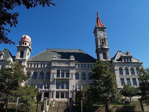
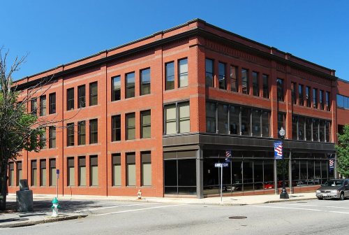
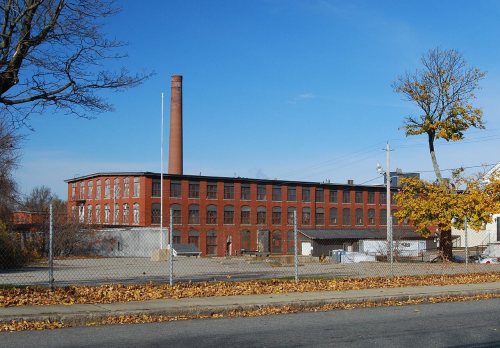
108 listings, 5 of them National Historic Landmarks: 92 buildings, among them the Academy Building (listed 1973, the first), 6 historic districts with 839 contributing buildings, 4 sites, and 7 structures. 1,105 historic buildings in all.
How old are the homes in Fall River?
46% of Fall River’s homes were built before 1940 (Census estimate, ±2.0 points), against a typical 21% for a Massachusetts town; the median home was built in 1945.
Founding dates: Wikidata, Wikipedia, the U.S. post office records of Blevins & Helbock (CC0) and the Census. Homes by year built: Census ACS 2020–24. National Register of Historic Places: National Park Service (list of May 22, 2026). Old photos, postcards and papers: Wikimedia Commons, the Library of Congress and other public archives, credited on each item’s page. Maps: U.S. Geological Survey historical topographic maps (via Esri) and Sanborn fire-insurance maps (Library of Congress). History text and census tables: Wikipedia (CC BY-SA 4.0). Places that used to be: USGS Geographic Names Information System (2021).
From Wikimedia Commons (6), Wikidata (12), the National Register of Historic Places (109), Wikipedia, U.S. Geological Survey historical maps, U.S. Census counts (via Wikipedia), the US Post Offices dataset (Blevins & Helbock), the USGS Geographic Names Information System, Sanborn fire insurance maps (Library of Congress) and old county and town histories (Internet Archive). Archive images are copied here with their credits and licenses, shown on each photo’s page. Refreshed monthly.


 ★ Landmark
 ★ Landmark
 ★ Landmark
 ★ Landmark
 ★ Landmark




 1848
 1878


