Eastham dates to 1644, and 11 of its places are on the National Register
More historic than 86% of U.S. towns · #175 of 283 in Massachusetts. What drives it
Most of Eastham was built recently: 9% of its homes predate 1940 and the median home dates from 1975. 11 places in town are on the National Register, among them four historic districts with 83 buildings between them. Below: 13 old photos and papers, maps from 1887 on, and the census since 1790.
Founding year: Wikidata. First post office: 1797.The full story ↓
History grade
What drives Eastham’s History grade
On its age, its old homes and the National Register, Eastham is more historic than 86% of U.S. towns, #175 of 283 in Massachusetts. Its age holds the grade up; its share of homes from before 1940 pulls it down.
A
HistoryA character grade: shown, never part of Eastham’s overall grade.
Massachusetts towns list more on the Register than most of the country (a typical Massachusetts town has 46.0 per 10,000 residents, the U.S. 2.4), so Eastham’s 151 sits above most of its state (71% of Massachusetts towns have fewer) while its 88 historic buildings outnumber those of 89% of U.S. towns.
NoteThe founding year comes from Wikidata alone; no second source gives 1644.
How sure. Graded on any two of the three inputs instead, the letter would range from B+ to A+. The pre-1940 share (±2.7 points) is firm at this size.
Founding year: Wikidata (other dates in Quick answers). Homes: Census ACS 2020–24. National Register: National Park Service, May 2026 list; each listing counted once (boundary changes and added documentation belong to their listing), and a historic district counts its contributing buildings. How TownRatings grades history →
What stands out about Eastham’s past
Read from the archive, the National Register and the record. The page puts what stands out first.
Originally inhabited by the Nauset tribe, Eastham was the site of the 1620 landing of a hunting party from the sailing vessel Mayflower, which had stopped in Provincetown harbor on Cape Cod Bay after a rough crossing of the Atlantic Ocean. This led to the first encounter of the Pilgrims with the local Nauset people at what became known as First Encounter Beach. The area would not be settled by Europeans, however, until 1644. The original lands included what are now the towns of Truro, Wellfleet, Eastham, Orleans and a small portion of Chatham. Eastham town was officially incorporated in 1651.
act of the district, at the very first meeting warned after the organization, was, Aug. 29, the raising of money u for the support of the ministry and schbols," £121.13.4 or who shall dwell thereon which are to remain to the town of Eastham and to the South Precinct in said town, said Snow paying his just proportion of all past taxes in said north precinct that remain unpaid : — And that the said district be, and hereby is, invested with all the privileges, powers, and immunities that towns in this Province do or may enjoy, excepting the
Text read by machine from the scan; it may contain errors.
History of Barnstable County, Massachusetts, 1620-1637-1686-18901890 · page 790Read the page →
Read the text
sent a petition to the proper oflBcers of Eastham, who, after properlyobtaining the wishes of the people, consented that " the precinct be set off as a district as far as Blackfish creek." This condition not being satisfactory to the petitioners, on the first of November, 1762, another meeting was held in this precinct, at which another committee of seven men — in part the same as at first — was appointed to assist Captain Doane, the agent, in petitioning the general court for an act of incorporation. Order of notice was served on the town of
Text read by machine from the scan; it may contain errors.
History of Barnstable County, Massachusetts, 1620-1637-1686-18901890 · page 735Read the page →
Read the text
Villages. — This town does not contain the compact villages that are seen in sister towns, but the store, post office, mill, railroad station, town house and churches in the south part of the town form the nucleus of the village of Eastham. It is the largest centre of the town and embraces the territory upon which the pioneers erected their first dwellings in 1644. That the village is scattered across the southern portion of the town is due to the fact that the excellent quality of the soil has rendered rural pursuits the leading industry, in the absence
Text read by machine from the scan; it may contain errors.
mill on the hill near his house." A com., app. to settle the bounds between this town and the town of Harwich, reported that an agreement had been made with the town and proprietors of Harwich "that the jurisdiction of Eastham shall remain as formerly ; but that all lands lying between the bounds of said towns 1 shall forever be improved in common by the said two towns, — in consideration of which the town of Eastham shall annually pay to the proprietors of Harwich, £'2 10s."
Text read by machine from the scan; it may contain errors.
Scans and text from the Internet Archive. Books published in 1930 or earlier, which are in the public domain.
By decade
Eastham, decade by decade
5 decades in the archive, from the 1600s to the 1930s. Scroll each row; tap a photo for its story.
Nothing in the archives for these yearsWeddings on Main Street, storms, parades, school pictures, the old store. If it’s in your family album, it belongs here.
In 1644, according to Wikidata. Eastham’s post office opened in 1797, and the first U.S. census counted 1,834 people here in 1790.
How does Eastham rank for history?
Eastham is more historic than 86% of U.S. towns, #175 of 283 in Massachusetts. The History grade combines the town’s founding era, the share of homes built before 1940 and its National Register listings. It’s a character grade, so it isn’t part of the overall grade. How it works.
What is on the National Register in Eastham?
11 listings: 2 buildings, among them the French Cable Hut (listed 1976, the first), 4 historic districts with 83 contributing buildings, 2 sites, and 3 structures. 88 historic buildings in all.
How old are the homes in Eastham?
9% of Eastham’s homes were built before 1940 (Census estimate, ±2.7 points), against a typical 21% for a Massachusetts town; the median home was built in 1975.
Founding dates: Wikidata, Wikipedia, the U.S. post office records of Blevins & Helbock (CC0) and the Census. Homes by year built: Census ACS 2020–24. National Register of Historic Places: National Park Service (list of May 22, 2026). Old photos, postcards and papers: Wikimedia Commons, the Library of Congress and other public archives, credited on each item’s page. Maps: U.S. Geological Survey historical topographic maps (via Esri) and Sanborn fire-insurance maps (Library of Congress). History text and census tables: Wikipedia (CC BY-SA 4.0). Places that used to be: USGS Geographic Names Information System (2021).
From Wikimedia Commons (13), Wikidata (5), the National Register of Historic Places (11), Wikipedia, Wikidata and Wikipedia for famous people, U.S. Geological Survey historical maps, U.S. Census counts (via Wikipedia), the US Post Offices dataset (Blevins & Helbock), the USGS Geographic Names Information System and old county and town histories (Internet Archive). Archive images are copied here with their credits and licenses, shown on each photo’s page. Refreshed monthly.
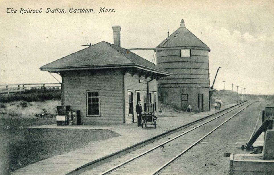


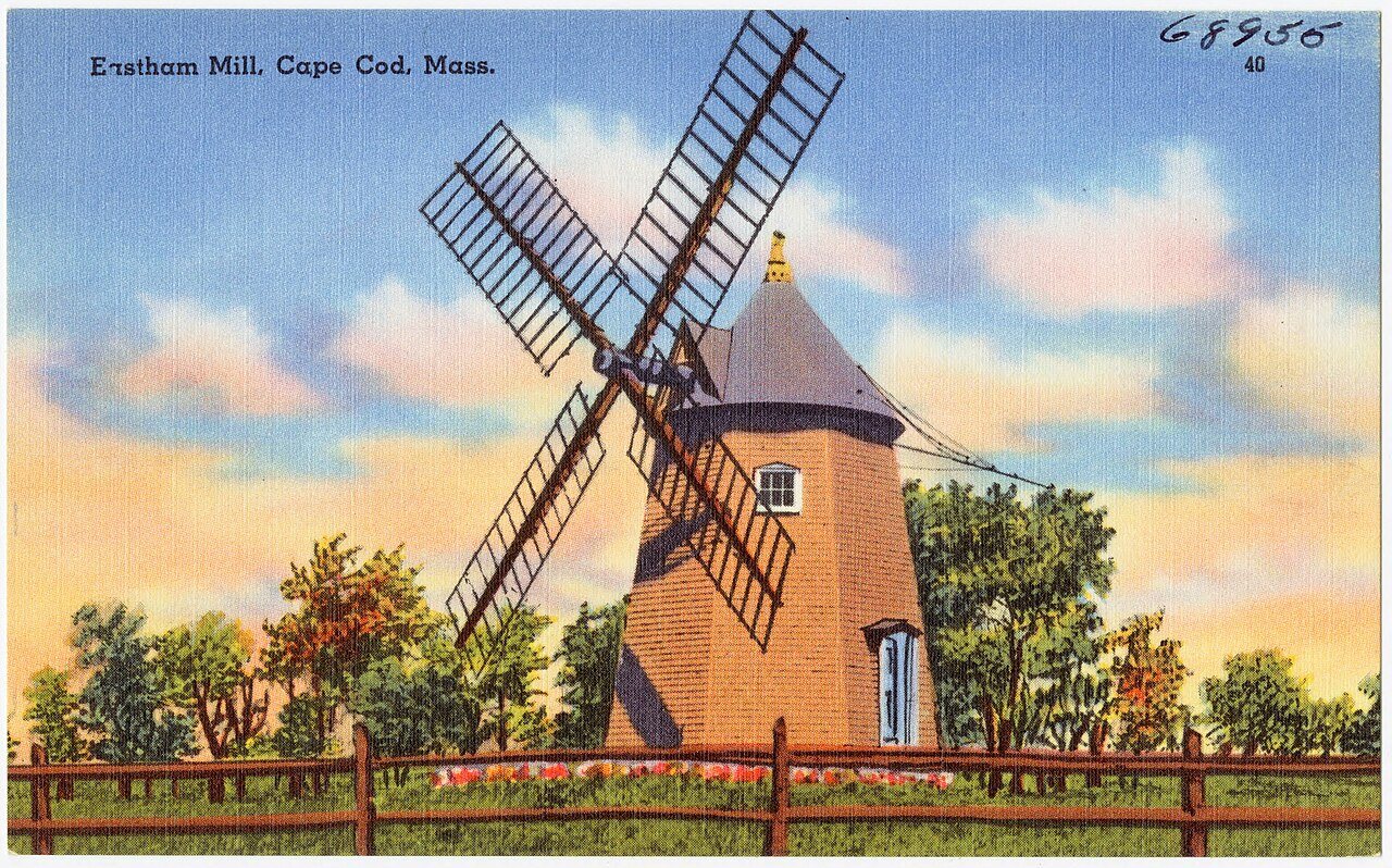






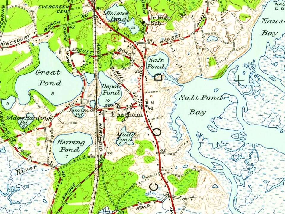

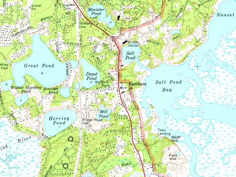


 c. 1915
 c. 1930
 c. 1930
 c. 1930
 c. 1930
 1930s
 1930–1945
 1933


